
MyTopo
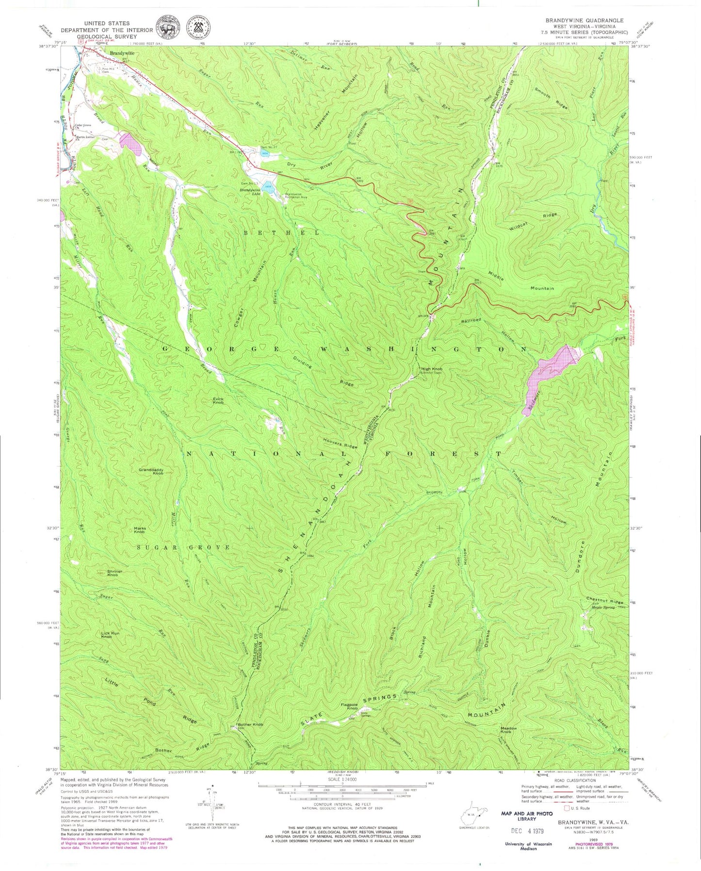
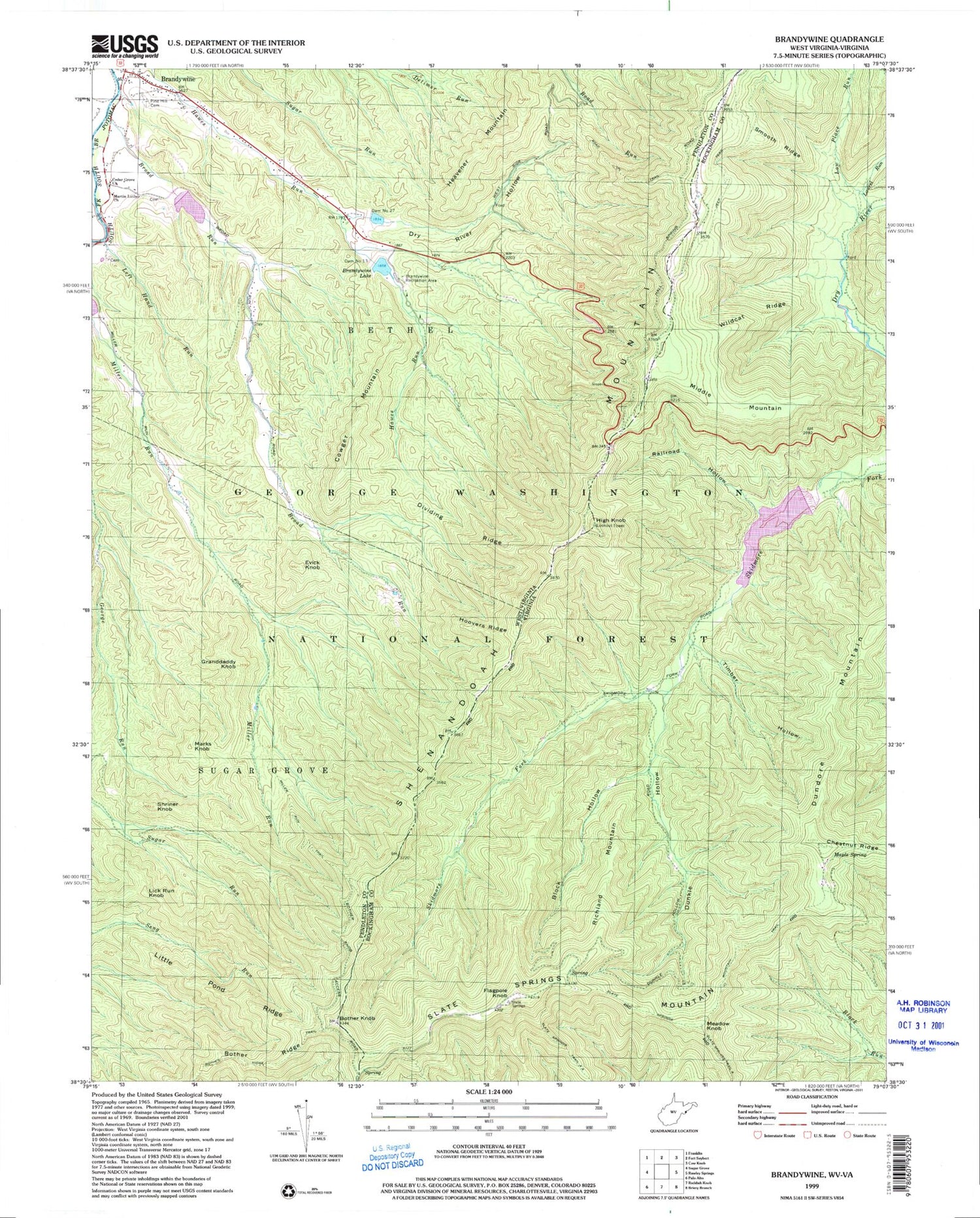
Classic USGS Brandywine West Virginia 7.5'x7.5' Topo Map
Couldn't load pickup availability
Historical USGS topographic quad map of Brandywine in the states of West Virginia, Virginia. Typical map scale is 1:24,000, but may vary for certain years, if available. Print size: 24" x 27"
This quadrangle is in the following counties: Pendleton, Rockingham.
The map contains contour lines, roads, rivers, towns, and lakes. Printed on high-quality waterproof paper with UV fade-resistant inks, and shipped rolled.
Contains the following named places: Bother Knob, Bother Ridge, Bother Ridge Trail, Brandywine, Brandywine Lake, Brandywine Recreation Area, Brandywine Run, Broad Run, Cedar Grove Church, Dividing Ridge, Dry River Hollow, Evick Knob, Granddaddy Knob, Heavener Mountain, Hoovers Ridge, Left Hand Run, Little Pond Ridge, Martin Luther Church, Miller Run Trail, Pine Hill Cemetery, Road Run Trail, Shriner Knob, Bandywine Lake Campground, Cowger Mountain, Lick Run Knob, Marks Knob, Dam Number 13, Dam Number 27, South Fork Structure Number 13 Dam, South Fork Structure Number 14 Dam, South Fork Structure Number 27 Dam, Shenandoah Wildlife Management Area, Brandywine Census Designated Place, South Fork Volunteer Fire Department, Block Hollow, Dundore Mountain, Dunkle Hollow, Laurel Run, Low Place Run, Maple Spring, Railroad Hollow, Chestnut Ridge, Slate Springs Mountain Trail, Smooth Ridge, Timber Hollow, Wildcat Ridge, Skidmore Fork Scenic Area, Switzer Dam, Switzer Lake, Lower North River Number 81c Dam, Skidmore Fork Lake, Flagpole Knob, High Knob, Meadow Knob, Middle Mountain, Richland Mountain, Slate Springs Mountain, Skidmore Fork Scenic Area