MyTopo
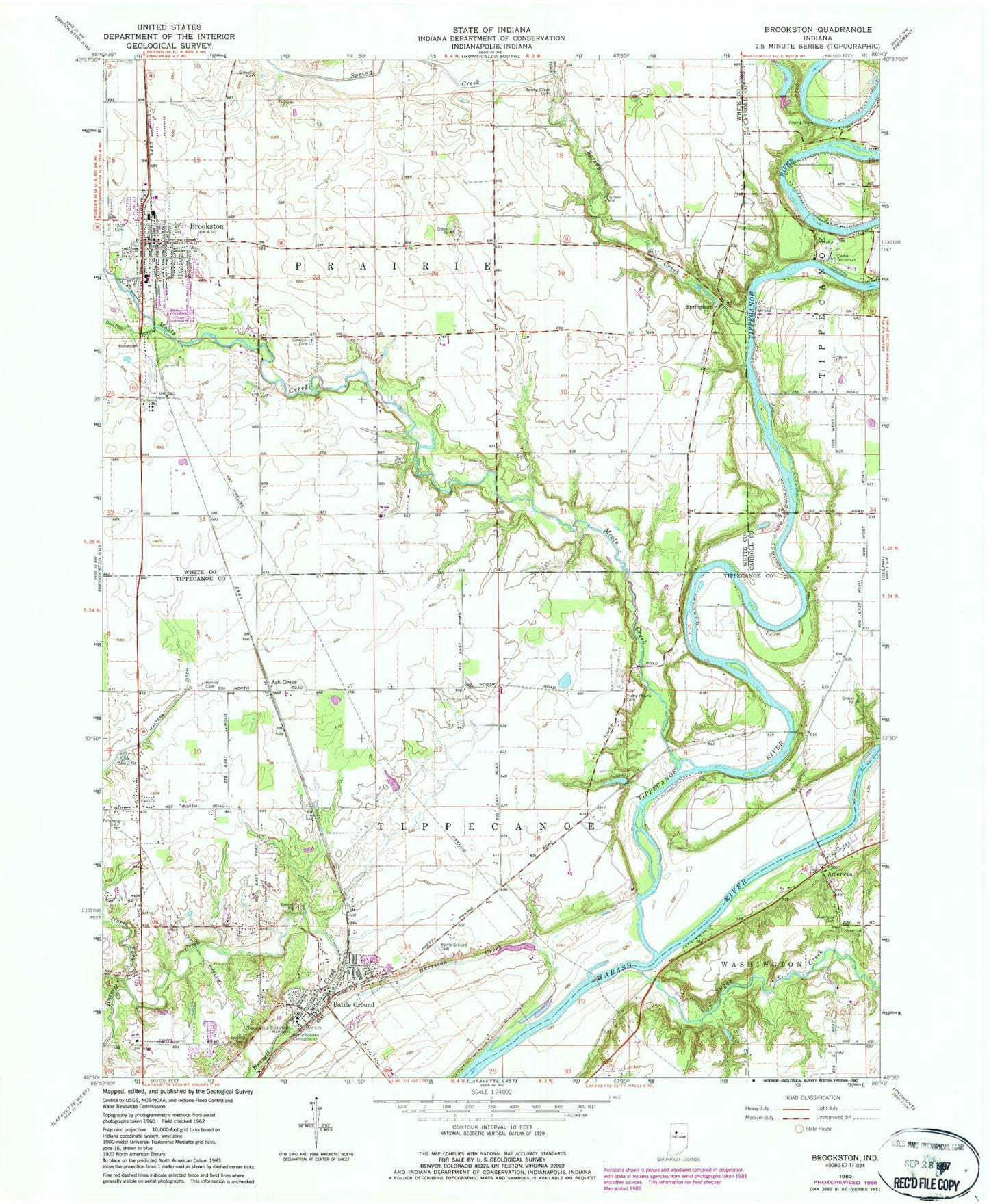
Classic USGS Brookston Indiana 7.5'x7.5' Topo Map
Couldn't load pickup availability
Historical USGS topographic quad map of Brookston in the state of Indiana. Typical map scale is 1:24,000, but may vary for certain years, if available. Print size: 24" x 27"
This quadrangle is in the following counties: Carroll, Tippecanoe, White.
The map contains contour lines, roads, rivers, towns, and lakes. Printed on high-quality waterproof paper with UV fade-resistant inks, and shipped rolled.
Contains the following named places: Americus, Americus Cemetery, Battle Ground, Battle Ground Campground, Battle Ground Cemetery, Brookston, Buck Creek, Camp Tecumseh, Harrison Creek, Harvey Cemetery, Independent Order of Odd Fellows Cemetery, Moots Creek, North Fork Burnett Creek, Pretty Prairie Cemetery, Prophet Rock, Smelcer Cemetery, Spring Creek, Spring Creek Cemetery, Springboro, Tippecanoe Battlefield Memorial, Walters Ditch, Frontier Middle School, Frontier Elementary School, Battle Ground Junior High School, Battle Ground Elementary School, Wallys Woods Lake Dam, Wallys Woods Lake, Bartlett Airport (historical), Ash Grove, Tippecanoe River, Township of Tippecanoe, Town of Battle Ground, Town of Brookston, Tippecanoe Township Volunteer Fire Department, Brookston Prairie Township Volunteer Fire Department, Chalmers - Brookston First Response, Brookston Police Department, Battle Ground Police Department, Indiana State Police Department District 14, Battle Ground Post Office, Brookston Post Office