MyTopo
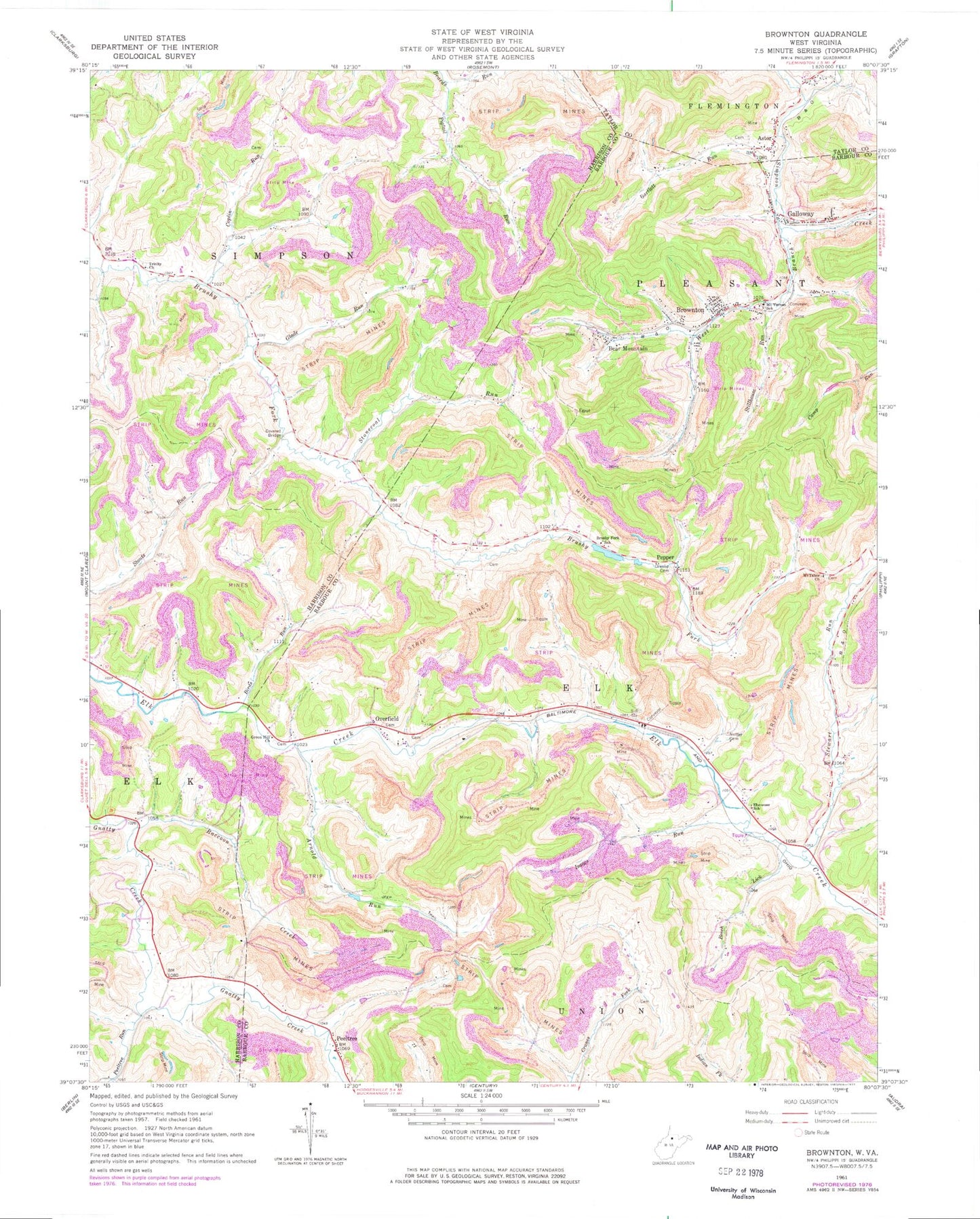
Classic USGS Brownton West Virginia 7.5'x7.5' Topo Map
Couldn't load pickup availability
Historical USGS topographic quad map of Brownton in the state of West Virginia. Map scale may vary for some years, but is generally around 1:24,000. Print size is approximately 24" x 27"
This quadrangle is in the following counties: Barbour, Harrison, Taylor.
The map contains contour lines, roads, rivers, towns, and lakes. Printed on high-quality waterproof paper with UV fade-resistant inks, and shipped rolled.
Contains the following named places: Arnold Run, Astor, Astor Cemetery, Astor United Methodist Church, Bamgardner School, Bartlett Run, Bean Cemetery, Bear Mountain, Beech Lick, Birds Run, Birds Run School, Brownton, Brownton Census Designated Place, Brushy Fork School, Chrislip Cemetery, Coplin Run, Ebenezer Church, Ebenezer School, Galloway Census Designated Place, Glade Run, Goodwin School, Green Hill Cemetery, Green Hill United Methodist Church, Isaacs Run, Lower Brushy Fork School, Mount Tabor Cemetery, Mount Tabor Church, Mount Vernon Baptist Church, Mount Vernon Elementary School, Mudlick School, Nutter Cemetery, Nutters Place Spring, Oreslip Cemetery, Overfield, Overfield Community Church, Overfield School, Peeltree, Peeltree Run, Peeltree Run School, Pepper, Pigtail Run, Pigtail School, Raccoon Creek, Raccoon School, Rexroad Airport, Stewart Run, Stewart Run School, Stillhouse Run, Stonecoal Run, Trinity Church, West Branch Simpson Creek, ZIP Code: 26349