MyTopo
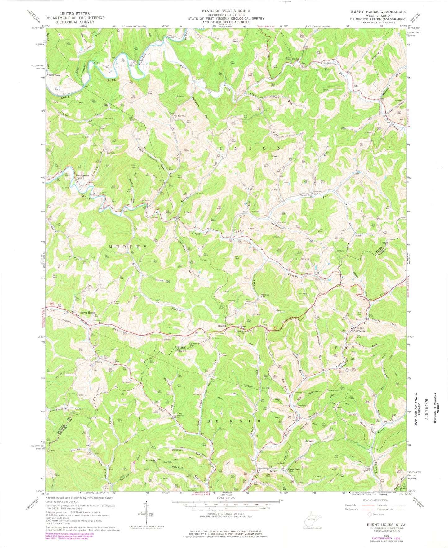
Classic USGS Burnt House West Virginia 7.5'x7.5' Topo Map
Couldn't load pickup availability
Historical USGS topographic quad map of Burnt House in the state of West Virginia. Typical map scale is 1:24,000, but may vary for certain years, if available. Print size: 24" x 27"
This quadrangle is in the following counties: Gilmer, Ritchie.
The map contains contour lines, roads, rivers, towns, and lakes. Printed on high-quality waterproof paper with UV fade-resistant inks, and shipped rolled.
Contains the following named places: Alum Fork, Bearpen Run, Beech Fork, Bone Creek, Brushy Fork, Brushy Run, Bush Cemetery, Bushcamp Run, Cherry Fork, Coal Run, Coburn Run, Conrad Run, Cooper Chapel, Dungeon Run, Ellis Fork, Fairview Church, Garfield Run, Hall, Hardmans Fork, Holt Run, Jessie Run, Jones Cabin Run, Laurel Fork, Laurel Lick, Law Run, Leatherbark Run, Left Fork Spruce Creek, Mitchell Run, Mound Run, Mount Liberty Church, Mount Olive Cemetery, New Mount Olive Church, Panther Run, Pennsylvania Run, Pine Low Gap Church, Right Fork Spruce Creek, Roseville Church, Seng Run, Shanty Run, Slab Creek, Smith Chapel, Spring Run, Spruce Creek Church, Straight Fork, Tarkiln Run, Taylor Summers Run, Turkey Run, Two Run, Racket, Burnt House, Hazelgreen, Lawford, Newberne, William Spring, Burnt House Post Office, Lawford Post Office (historical), Alum Fork School (historical), Bartlett School (historical), Cain Run School (historical), Hall School (historical), Pine Low Gap, Pleasant Valley School (historical), Smith Run School (historical), Straight Fork School (historical), Cherry Grove School (historical), Cooper School (historical), Ellis Fork Church (historical), Hall School (historical), Lower Newberne School (historical), Mound Run School (historical), Newberne Post Office, Upper Laurel School (historical), Upper Newberne School (historical)