


MyTopo
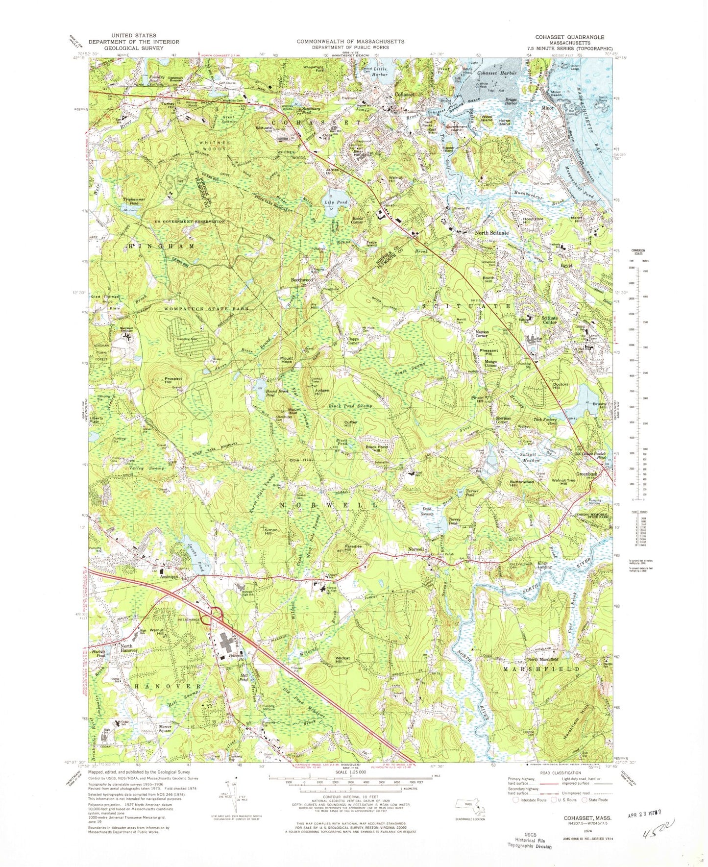
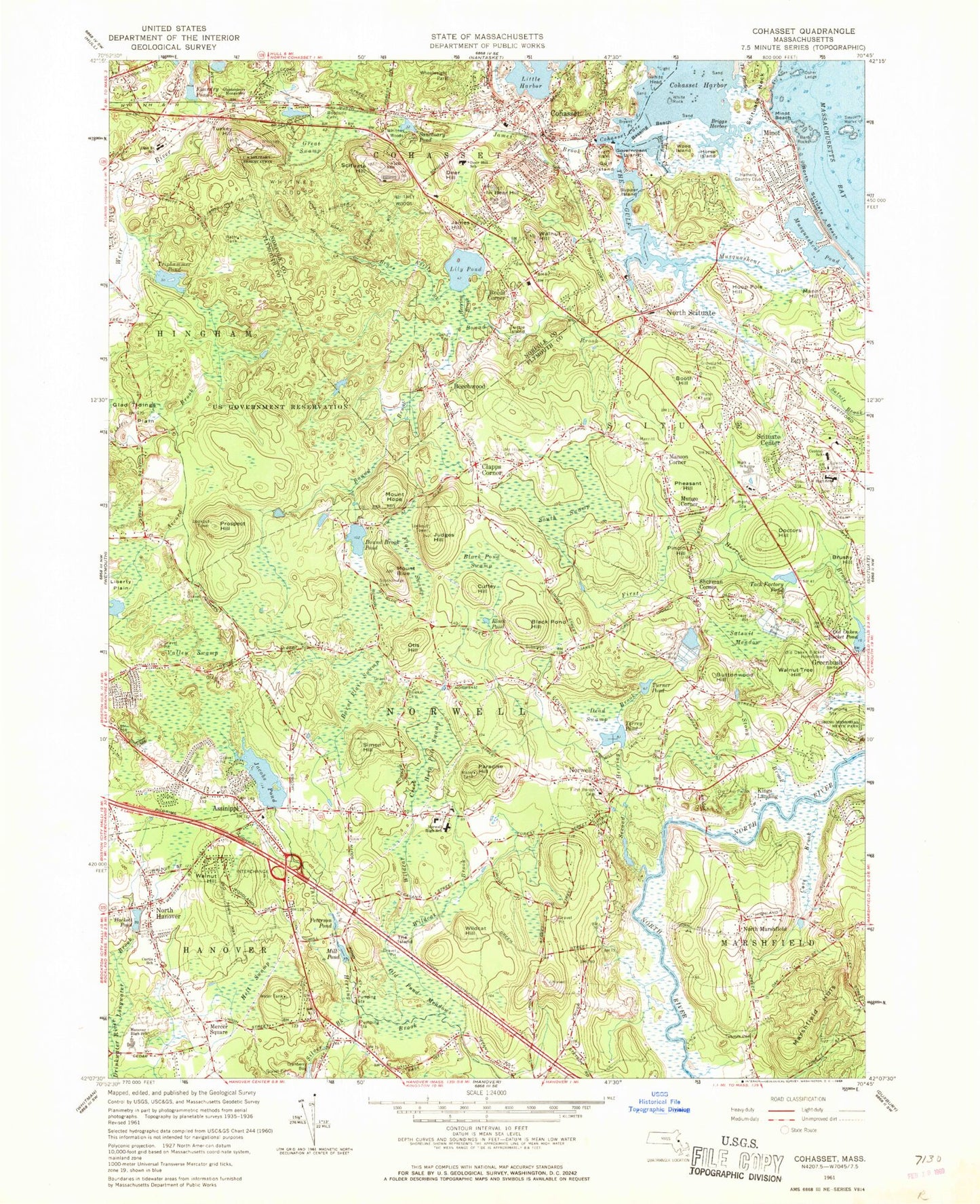
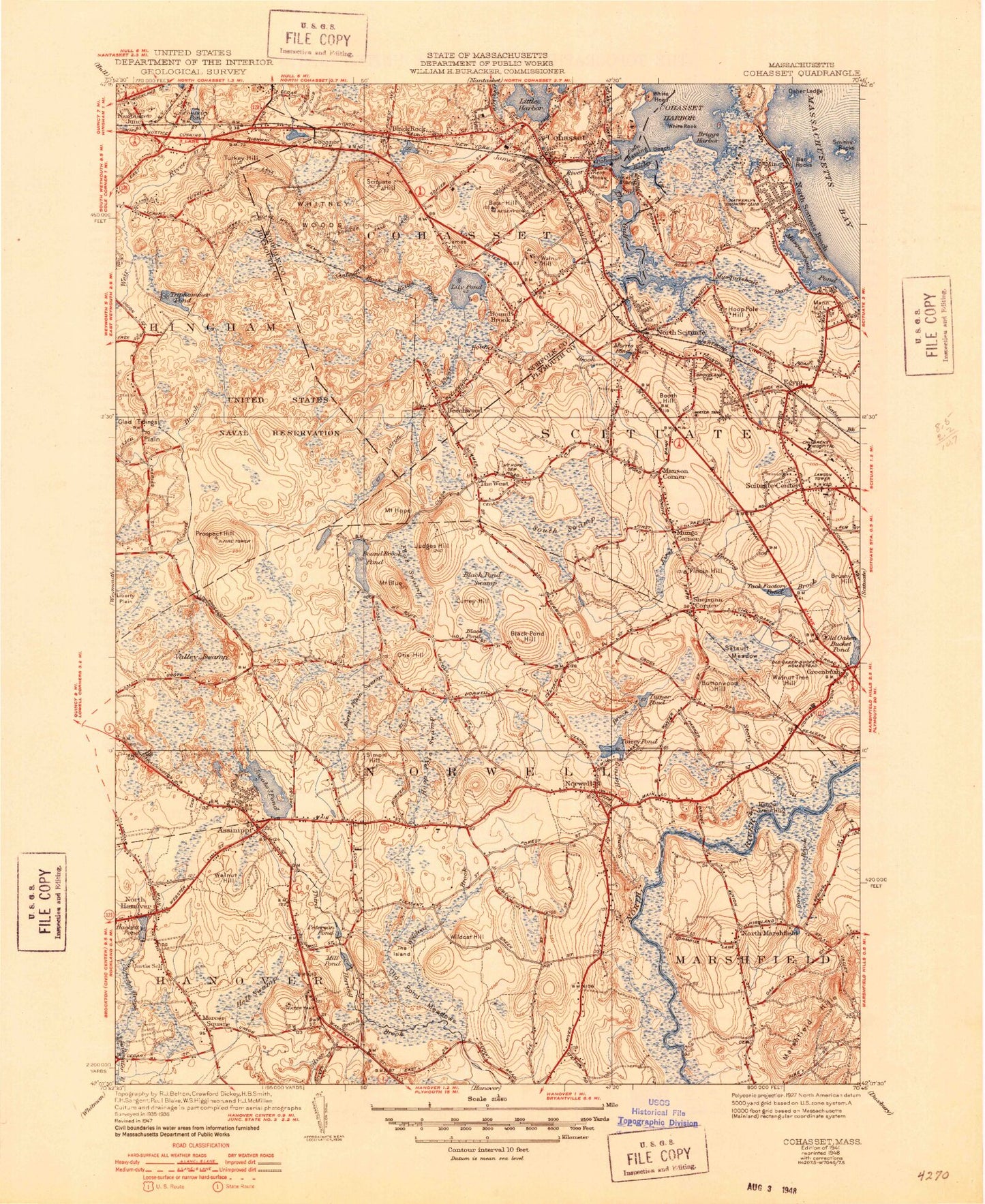
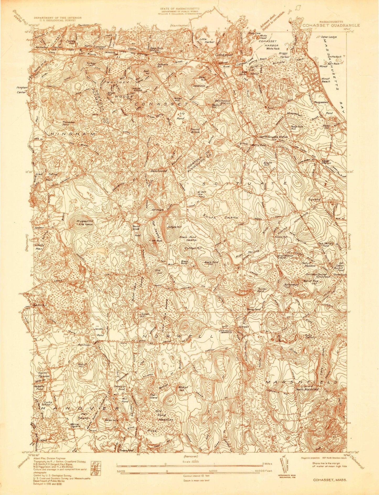
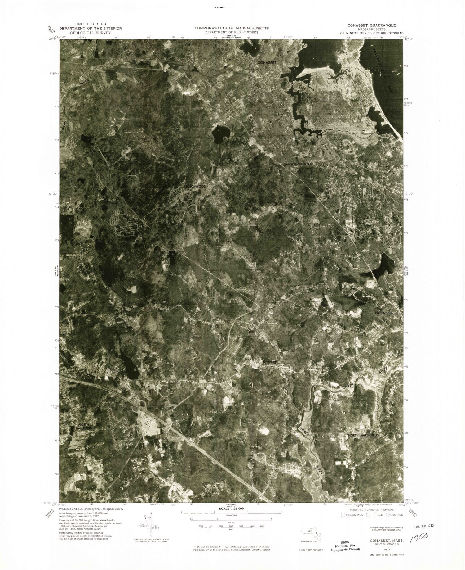
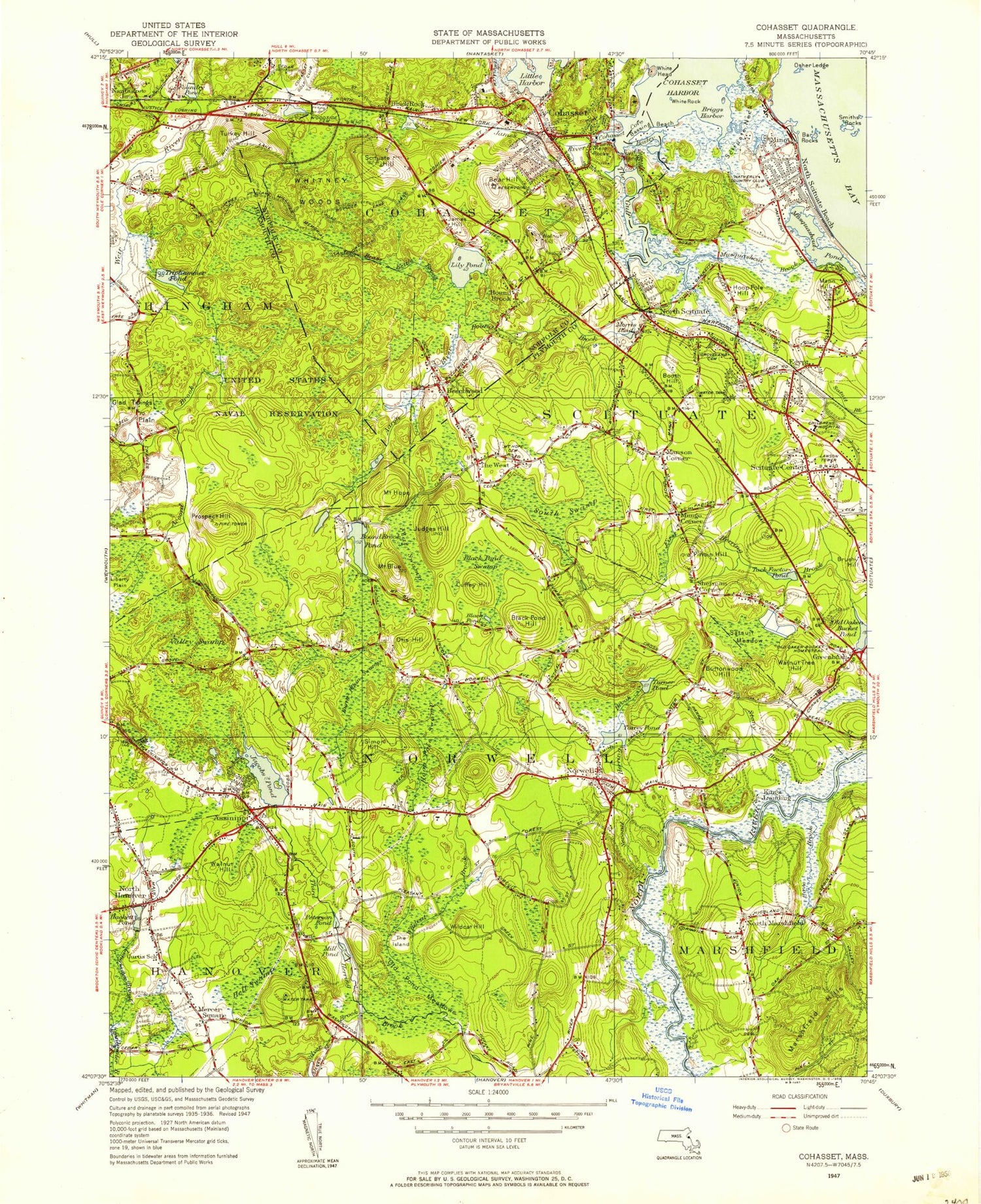
Classic USGS Cohasset Massachusetts 7.5'x7.5' Topo Map
Couldn't load pickup availability
Historical USGS topographic quad map of Cohasset in the state of Massachusetts. Typical map scale is 1:24,000, but may vary for certain years, if available. Print size: 24" x 27"
This quadrangle is in the following counties: Norfolk, Plymouth.
The map contains contour lines, roads, rivers, towns, and lakes. Printed on high-quality waterproof paper with UV fade-resistant inks, and shipped rolled.
Contains the following named places: Wompatuck State Park, Merritt Cemetery, Glastonbury Monastery, East School, Maryknoll Seminary, Wheelwright Park, White Head Light, Long Basin Light, Bryant Point Light, Lawson Tower, Donald Ross School, Bear Hill High School, Hatherly Elementary School, Norwell High School, Second Parish Cemetery, William G Vinal School, First Parish Cemetery, Curtis School, Cushing Elementary School, Two Mile Cemetery, Gaffield Park, Bowker Family Cemetery, Mount Hope Cemetery, Cohasset Central Cemetery, Stockbridge Family Cemetery, Groveland Cemetery, Woodside Cemetery, Deer Hill School, Joseph Osgood School, Scituate Center Central School, Scituate Center High School, Scituate Center Junior High School, North Hanover High School, Cedar Elementary School, Hanover High School, Osborn School, Norwell Junior High School, Steeple School, Old Colony House Station (historical), North Cohasset Station (historical), Old Oaken Bucket Homestead (historical), Egypt Station (historical), North Scituate Station (historical), Cushing, Tedeschi Shopping Center, Jacobs Pond Dam, Torrey Pond Dam, First Herring Brook Reservoir, First Herring Brook Reservoir Dam, Turner Pond Dam, Cranberry Bog Reservoir, Bog Dam, Bound Brook Pond Dam, Aaron River Dam, Triphammer Pond Dam, Maritime Museum, Jacobs Farm Museum, Cohasset Yacht Club, Assinippi, Bailey Creek, Bar Rock, Bassing Beach, Beechwood, Black Pond, Black Pond Hill, Black Pond Swamp, Black Rock, Mount Blue, Booth Hill, Bound Brook Pond, Brass Kettle Brook, Bryant Point, Burnt Plain Swamp, Buttonwood Hill, Clapps Corner, Cohasset, Cove Brook, Cuffey Hill, Dead Swamp, Deer Hill, Doctors Hill, Egypt, Flat Swamp, Foundry Pond, The Glades, Glad Tidings Plain, Great Swamp, The Gulf, Gulf Island, Hackett Pond, The Hazards, Hell Swamp, Herring Brook, Hoop Pole Hill, Hoop Pole Swamp, Mount Hope, Horse Island, The Island, Jacobs Pond, James Brook, James Hill, Judges Hill, Kent Rocks, Kings Landing, Liberty Plain, Lily Pond, Longwater Brook, Mann Hill, Manson Corner, Marshfield Hills, Mercer Square, Mill Pond, Minot, Minot Beach, Mungo Corner, Musquashcut Brook, Musquashcut Pond, North Hanover, North Marshfield, North Scituate, North Scituate Beach, Norwell, Old Oaken Bucket Homestead, Old Oaken Bucket Pond, Old Pond Meadows, Osher Ledge, Otis Hill, Paradise Hill, Peterson Pond, Pheasant Hill, Pincin Hill, Prospect Hill, Reeds Corner, Sanctuary Pond, Satsuit Meadow, Scituate Center, Second Herring Brook, Sherman Corner, Shinglemill Brook, Silver Brook, Simon Hill, Smith Rocks, South Entering Rock, South Swamp, Stony Brook, Supper Island, Tack Factory Pond, Torrey Pond, Triphammer Pond, Turkey Hill, Turner Pond, Turtle Island, The Twins, Valley Swamp, Walnut Hill, Walnut Hill, Walnut Tree Hill, Well Rock, White Head, White Rock, Wildcat Brook, Wildcat Creek, Wildcat Hill, Wood Island, Accord Brook, Whitney Woods, Gannett Corners, Nantasket Junction, Little White Head, South Hingham, Aaron River, Treat Pond, Town of Norwell, Briggs Harbor, Cohasset Cove, North Hanover Post Office (historical), West Scituate Post Office (historical), Mount Blue Post Office (historical), North Marshfield Post Office (historical), Norwell Post Office (historical), North Scituate Post Office (historical), Simmons Heliport, Bear Hill, Bound Brook, Government Island, Scituate Hill, WHRC-TV (Norwell), Burtram J Pratt Memorial Library and Archives, Cohasset Historical Society Building, Cohasset Junior Senior High School, Cohasset Plaza Shopping Center, Cohasset Post Office, Paul Pratt Memorial Library, Beechwood Congregational Church, First Parish in Cohasset Church, Saint Anthonys Parish Church, Saint Stephens Parish Church, Second Congregational Church, Albert Norris Conservation Area, Assinippi Universalist Church, Brantwood Manor, First Baptist Church of Hanover, First Parish of Norwell Church, Fogg Park, Garfield Park, Gates Intermediate School, Hanover Mall Shopping Center, Jacobs Lake Shores, Merchants Row Shopping Center, Minot Post Office, Morris Pond, North Marshfield Post Office, North Scituate Post Office, Norwell Homes, Norwell Post Office, Norwell Town Hall, Norwell Village Area Historic District, Saint Francis Church, Salt Marsh Conservation Area, Scituate High School, Scituate Town Hall, Sparrell Elementary School, Cushing Plaza Shopping Center, Manns Corner, Norwell High School Library, Norwell Public Library, Norwell Fire Department Station 1, South Shore Vocational Technical High School, William Ripley Junior Library, North Scituate Census Designated Place, Norwell Fire Department, Cohasset Fire Department, Scituate Fire Department Station 3, Hanover Fire Department Station 1, Norwell Fire Department Station 3, Scituate Police Department