
MyTopo
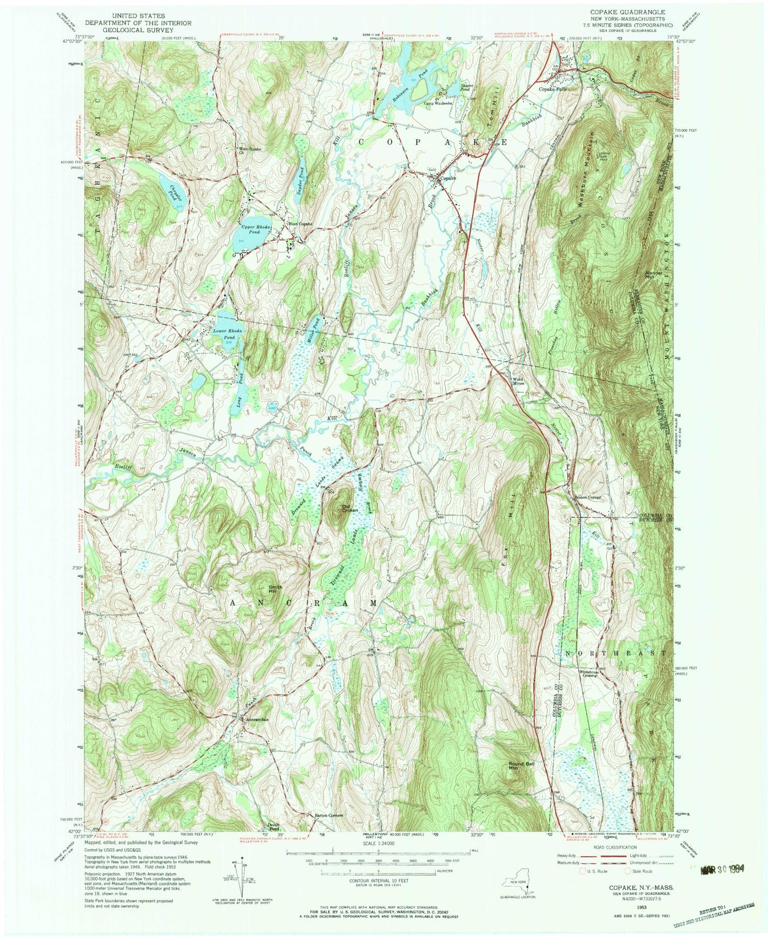
Classic USGS Copake New York 7.5'x7.5' Topo Map
Couldn't load pickup availability
Historical USGS topographic quad map of Copake in the states of New York, Massachusetts. Typical map scale is 1:24,000, but may vary for certain years, if available. Print size: 24" x 27"
This quadrangle is in the following counties: Berkshire, Columbia, Dutchess.
The map contains contour lines, roads, rivers, towns, and lakes. Printed on high-quality waterproof paper with UV fade-resistant inks, and shipped rolled.
Contains the following named places: Ancramdale, Barton Corners, Boston Corner, Camp Waubeeka, Chrysler Pond, Copake, Copake Falls, Drowned Lands Swamp, Fox Hill, Long Pond, Lower Rhoda Pond, Miller Pond, Noster Kill, Old Croken, Preechey Hollow Brook, Punch Brook, Robinson Pond, Round Ball Mountain, Shaver Pond, Smith Hill, Snyder Pond, Tom Hill, Upper Rhoda Pond, Washburn Mountain, West Copake, West Copake Church, Taconic State Park, Whitehouse Crossing, Weed Mines, Town of Ancram, Bash Bish Brook, Thompson-Finch Farm, Millerhurst Farm, West Copake Cemetery, Copake Cemetery, Old Saint Bridget's Cemetery, Undermountain Golf Course, Camp Waubeeka Family Campground, Oleana Family Campground, Ancramdale Presbyterian Church, Copake United Methodist Church, Saint Bridget's Church, Copake Town Hall, Clausson Raught Community Rescue Squad, Copake Fire District, Copake Census Designated Place, Taconic Shores Census Designated Place, Copake Falls Census Designated Place, Taconic Shores, Ancramdale Post Office, Copake Falls Post Office, Copake Post Office, Alander Mountain, Cedar Brook


