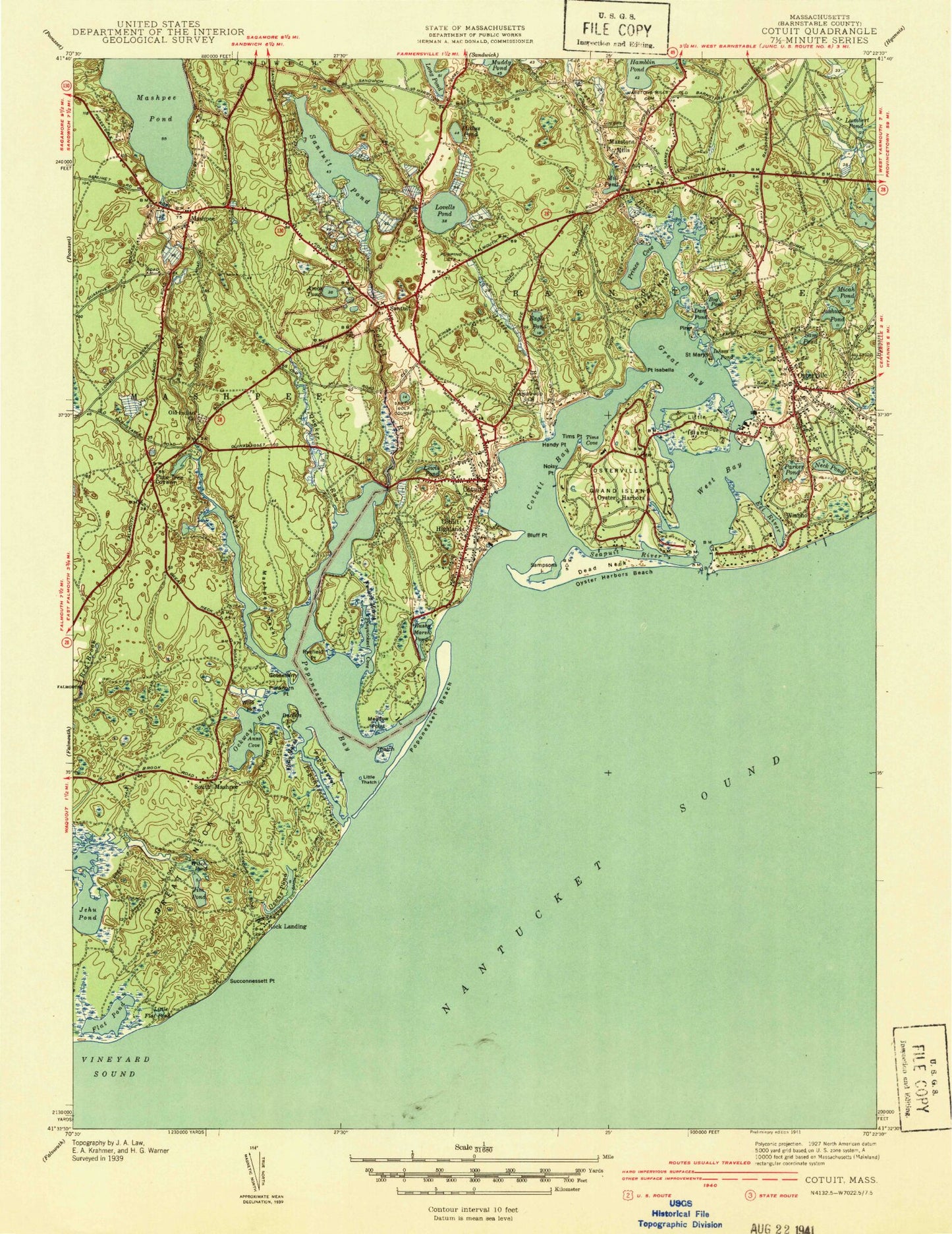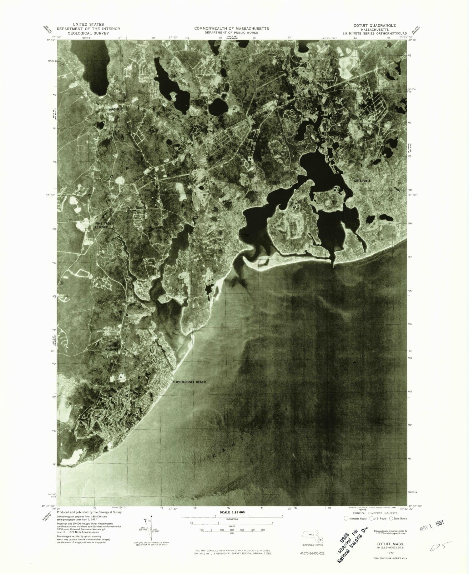
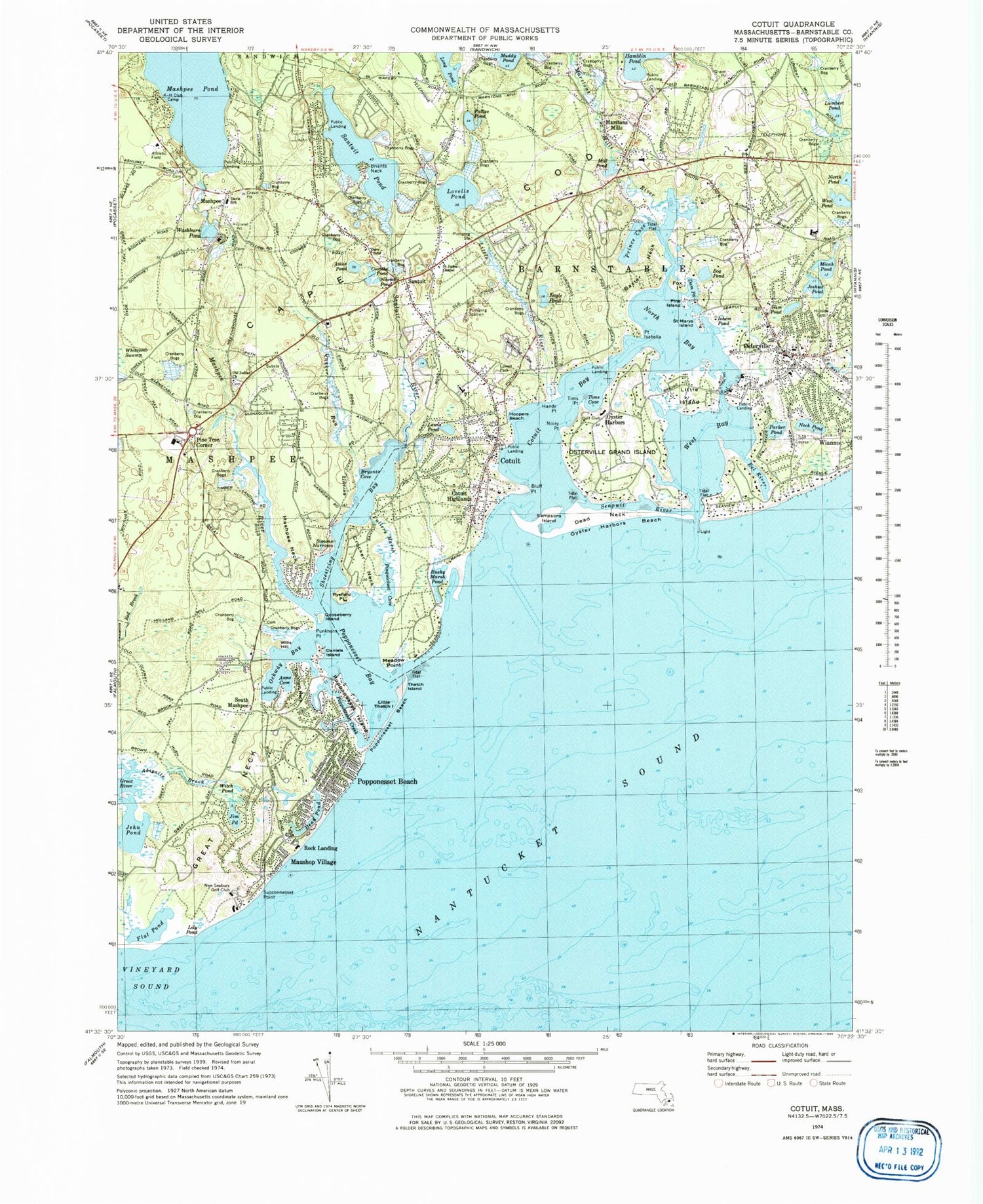
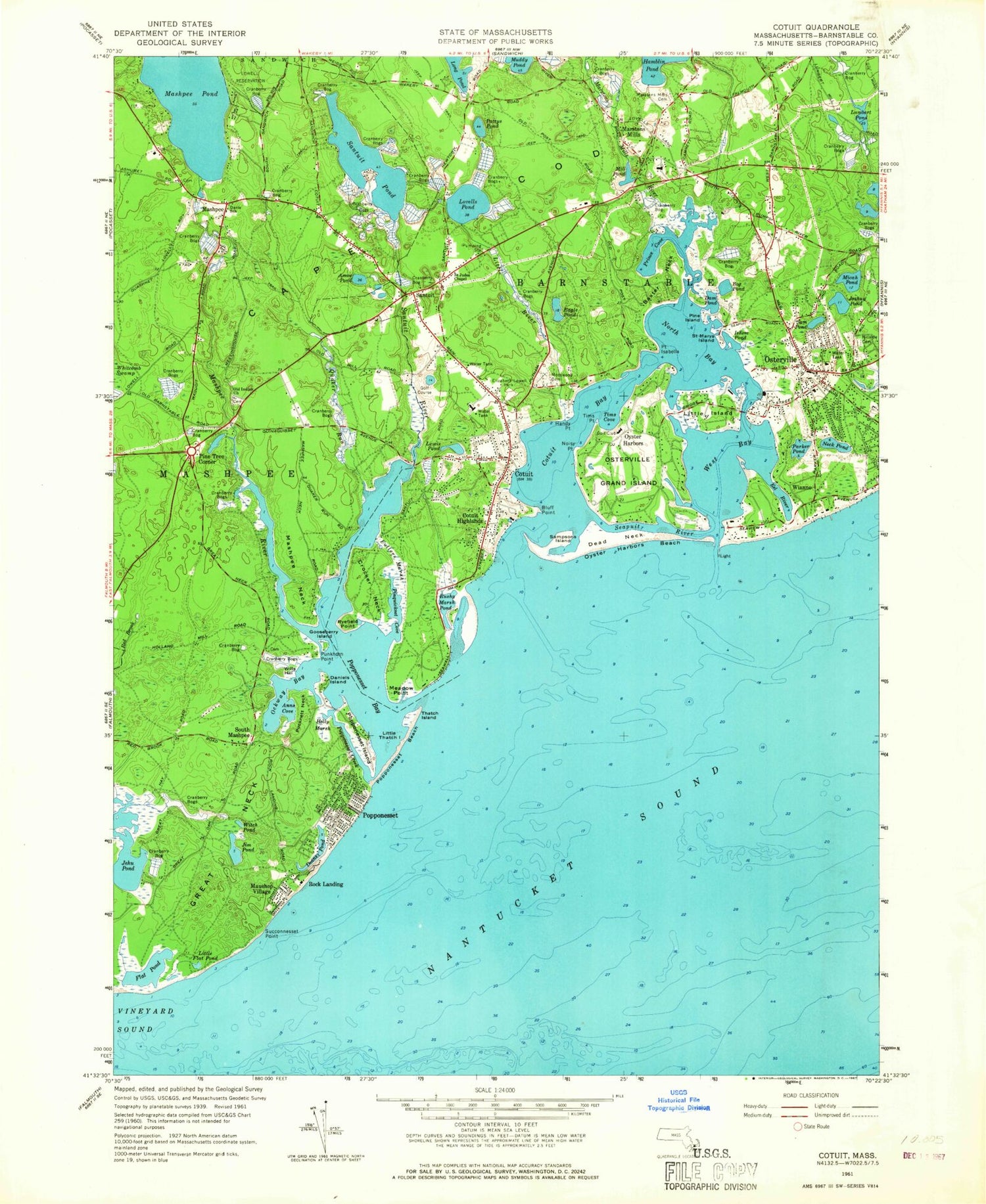

MyTopo
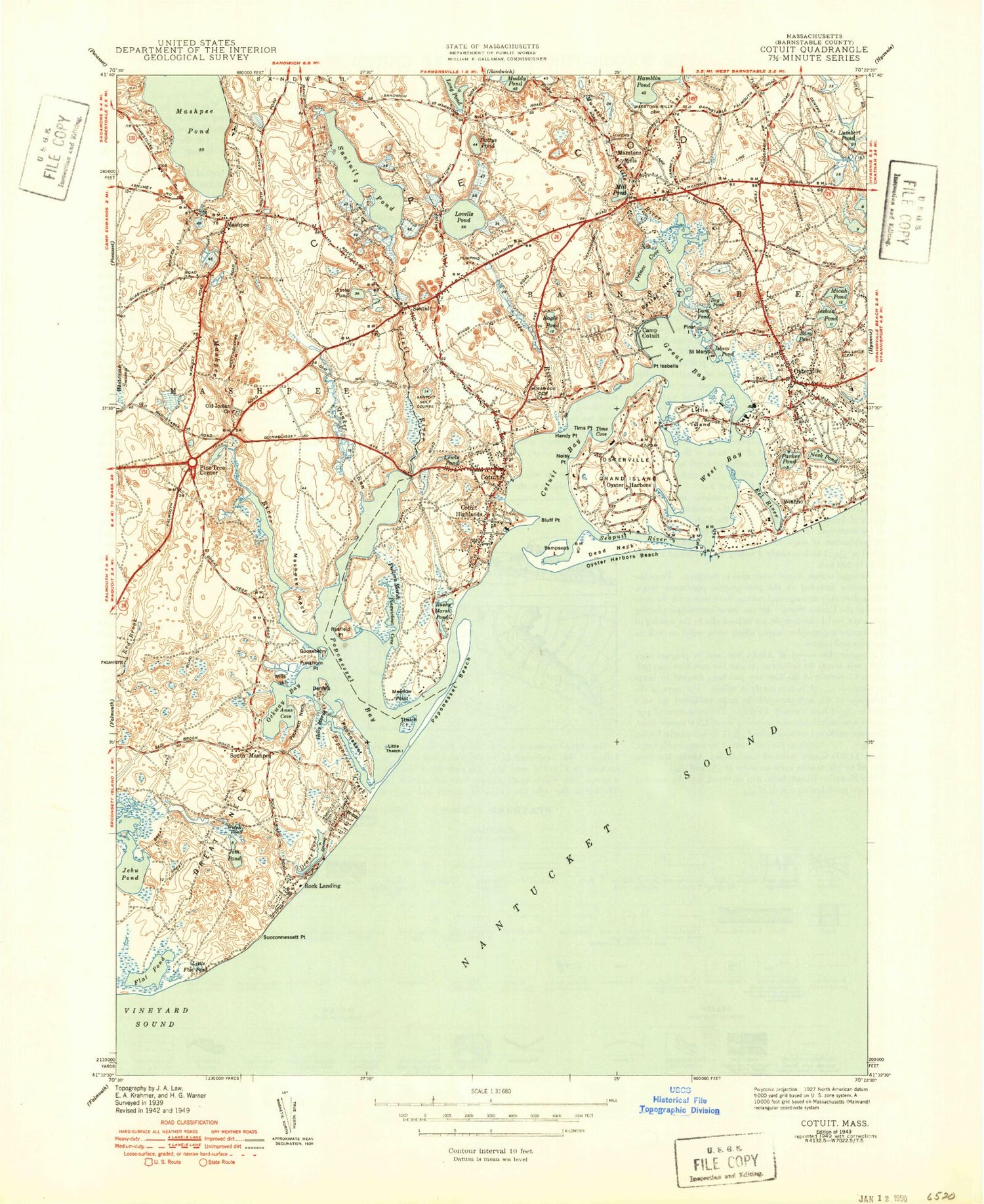
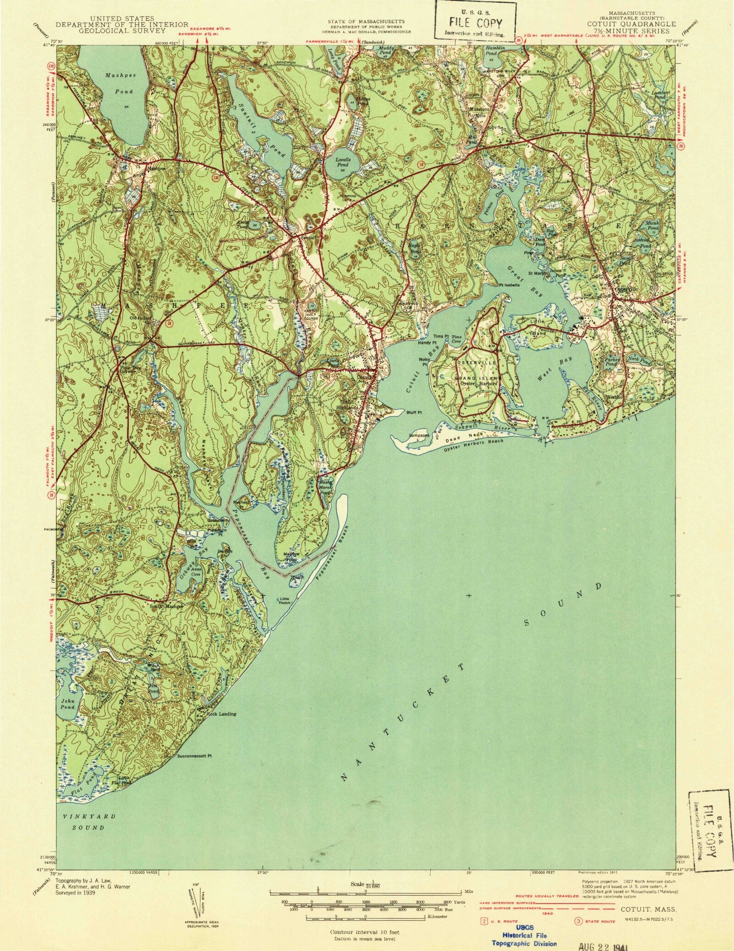
Classic USGS Cotuit Massachusetts 7.5'x7.5' Topo Map
Couldn't load pickup availability
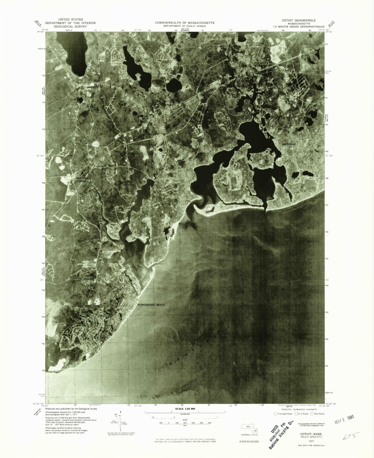
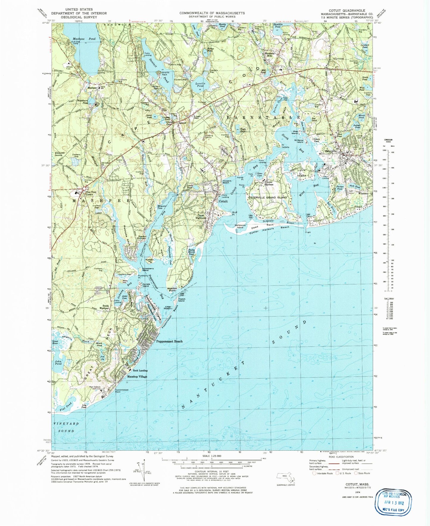
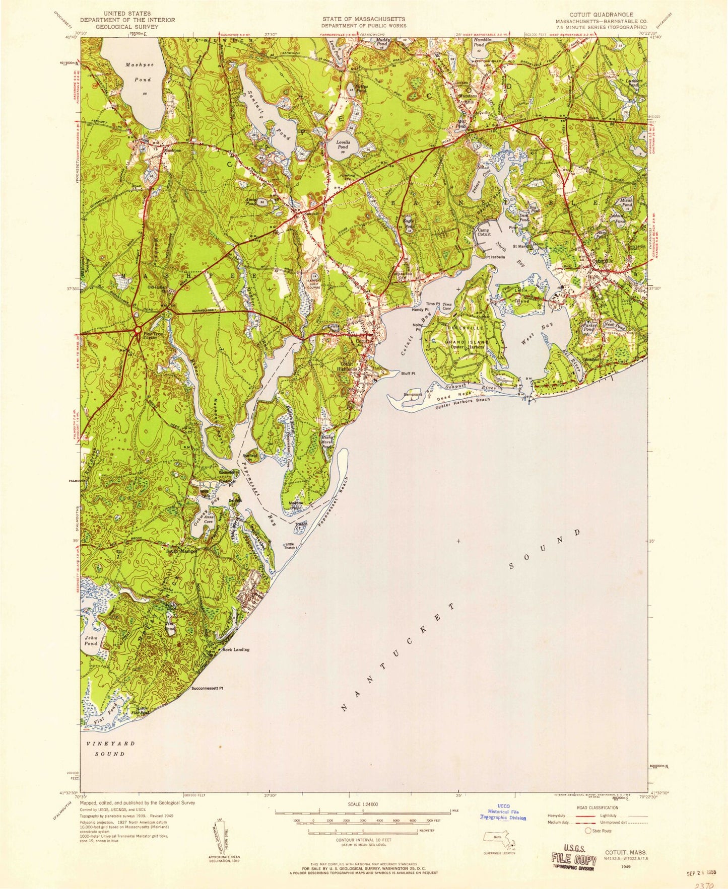
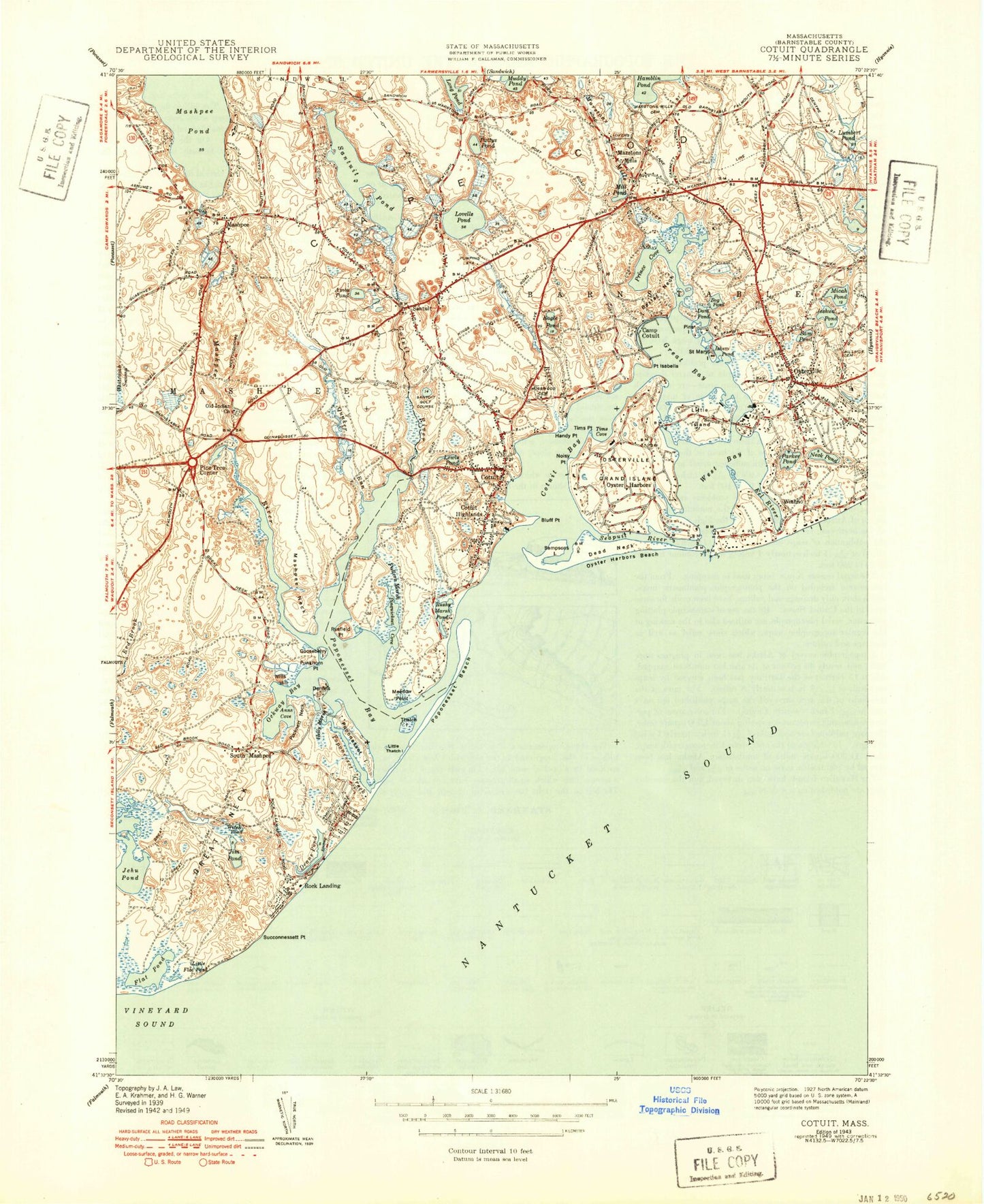
Historical USGS topographic quad map of Cotuit in the state of Massachusetts. Typical map scale is 1:24,000, but may vary for certain years, if available. Print size: 24" x 27"
This quadrangle is in the following counties: Barnstable.
The map contains contour lines, roads, rivers, towns, and lakes. Printed on high-quality waterproof paper with UV fade-resistant inks, and shipped rolled.
Contains the following named places: Wreck Shoal, West Bay Entrance Light, Mosswood Cemetery, Lowell Park, 4-H Club Camp, Dare School, New Seabury Golf Club, Old Indian Church, Davis Elementary School, Saint Judes Chapel, Hillside Cemetery, Great River Marshes, Flat Pond Marshes, Poppenesset Bird Sanctuary, Sampsons Island Sanctuary, Benjamin Marstons Mill Site, Mashpee River Dam, Anns Cove, Abigails Brook, Simons Narrows, Washburn pond, Combs Pond, Naomi Pond, Shoestring Bay, West Pond, Mill Pond, Amos Pond, Baxter Neck, Bluff Point, Bog Pond, Cotuit, Cotuit Anchorage, Cotuit Bay, Cotuit Highlands, Crocker Neck, Dam Pond, Daniels Island, Dead Neck, Dean Pond, Eagle Pond, Flat Pond, Fullers Marsh, Gooseberry Island, Great Neck, Handy Point, Holly Marsh, Point Isabella, Jehu Pond, Jim Pond, Joshua Pond, Lewis Pond, Lily Pond, Little Island, Little River, Little Thatch Island, Lone Rock, Lovells Pond, Lumbert Pond, Marstons Mills, Mashpee, Mashpee Neck, Mashpee River, Maushop Village, Meadow Point, Micah Pond, Neck Pond, Noisy Point, North Bay, Ockway Bay, Osterville, Osterville Grand Island, Oyster Harbors, Oyster Harbors Beach, Parker Pond, Pattys Pond, Pine Island, Pine Tree Corner, Pocknett Neck, Popponesset Bay, Popponesset Beach, Popponesset Beach, Popponesset Creek, Popponesset Island, Punkhorn Point, Quaker Run, Rock Landing, Rushy Marsh Pond, Ryefield Point, Saint Marys Island, Sam Pond, Sampsons Island, Santuit, Santuit Pond, Santuit River, Seapuit River, South Mashpee, Succonnesset Point, Succonnesset Shoal, Thatch Island, Tims Point, West Bay, Wills Hill, Witch Pond, Wianno, Mashpee Pond, Muddy Pond, Marstons Mill River, Wianno Head, Town of Mashpee, Eleanors Cove, Sams Cove, Briants Neck, Uncle Georges Cove, Eel River, Ishem Pond, Pinquickset Cove, Prince Cove, Tims Cove, Seapuit Heliport, Cotuit Heliport, Marston Mills Heliport, North Bay Heliport, Mashpee Neck, New Seabury, Popponesset, Popponesset Island, Seabrook, Osterville Baptist Church, Osterville Free Library, Bayberry Christian School, Cape Cod Academy, Mashpee Neck Census Designated Place, New Seabury Census Designated Place, Popponesset Census Designated Place, Popponesset Island Census Designated Place, Seabrook Census Designated Place, Cotuit Fire District, Centerville - Osterville - Marstons Mills Fire District Station 2, Mashpee Fire and Rescue Department, Centerville - Osterville - Marstons Mills Fire District Station 3, Mashpee Police Department, Mashpee National Wildlife Refuge, Cotuit Post Office, Marstons Mills Post Office, Osterville Post Office, Mashpee Post Office, Wreck Shoal, West Bay Entrance Light, Mosswood Cemetery, Lowell Park, 4-H Club Camp, Dare School, New Seabury Golf Club, Old Indian Church, Davis Elementary School, Saint Judes Chapel, Hillside Cemetery, Great River Marshes, Flat Pond Marshes, Poppenesset Bird Sanctuary, Sampsons Island Sanctuary, Benjamin Marstons Mill Site, Mashpee River Dam, Anns Cove, Abigails Brook, Simons Narrows, Washburn pond, Combs Pond, Naomi Pond, Shoestring Bay, West Pond, Mill Pond, Amos Pond, Baxter Neck, Bluff Point, Bog Pond, Cotuit, Cotuit Anchorage, Cotuit Bay, Cotuit Highlands, Crocker Neck, Dam Pond, Daniels Island, Dead Neck, Dean Pond, Eagle Pond, Flat Pond, Fullers Marsh, Gooseberry Island, Great Neck, Handy Point, Holly Marsh, Point Isabella, Jehu Pond, Jim Pond, Joshua Pond, Lewis Pond, Lily Pond, Little Island, Little River, Little Thatch Island, Lone Rock, Lovells Pond, Lumbert Pond, Marstons Mills, Mashpee, Mashpee Neck, Mashpee River, Maushop Village, Meadow Point, Micah Pond, Neck Pond, Noisy Point, North Bay, Ockway Bay, Osterville, Osterville Grand Island, Oyster Harbors, Oyster Harbors Beach, Parker Pond, Pattys Pond, Pine Island, Pine Tree Corner, Pocknett Neck, Popponesset Bay, Popponesset Beach, Popponesset Beach, Popponesset Creek, Popponesset Island, Punkhorn Point, Quaker Run, Rock Landing, Rushy Marsh Pond, Ryefield Point, Saint Marys Island, Sam Pond