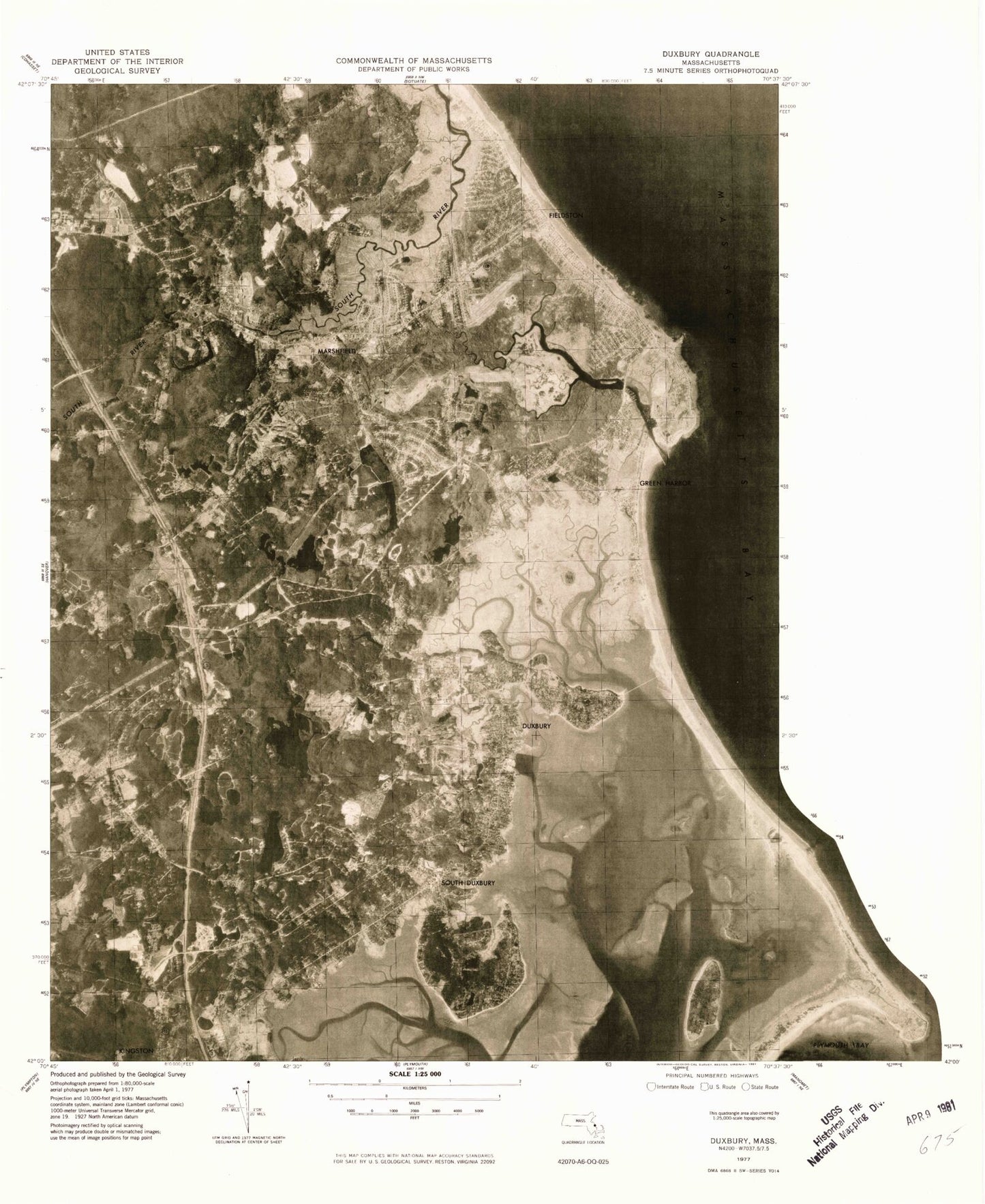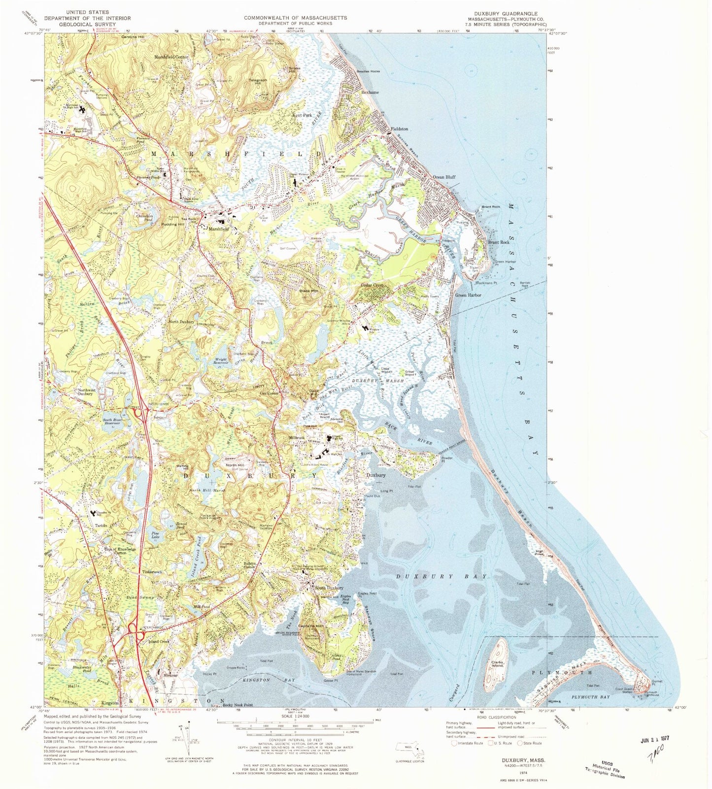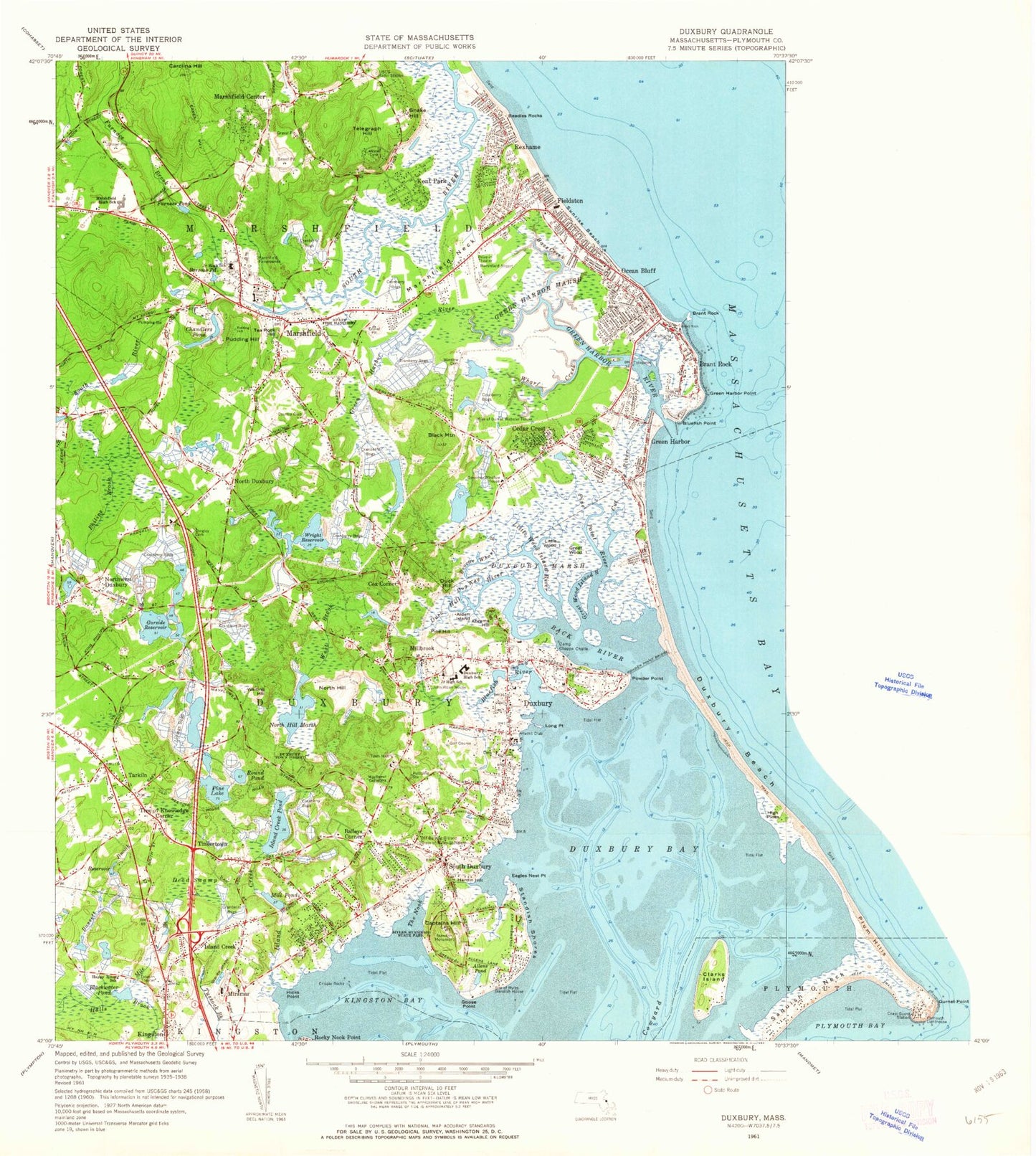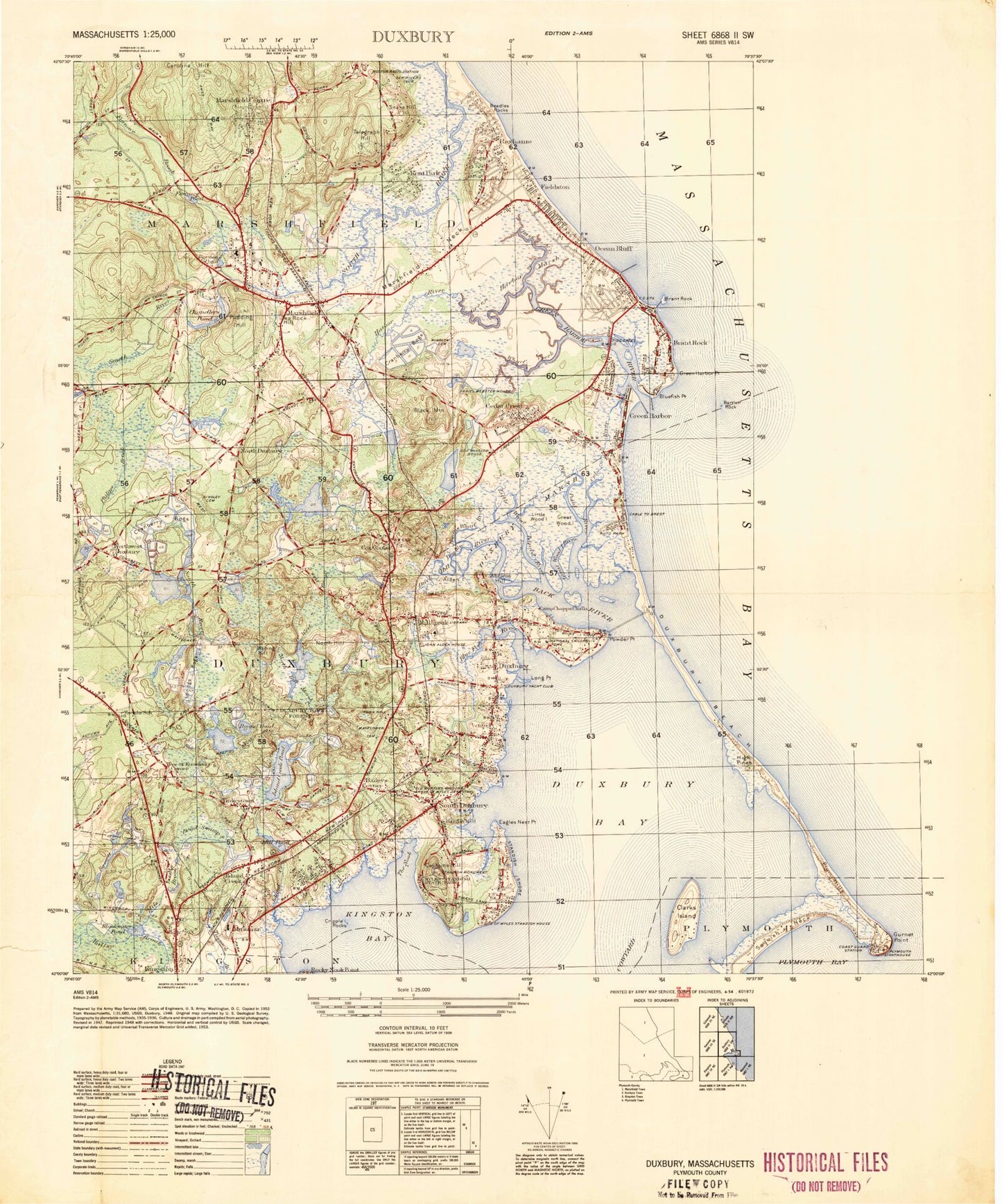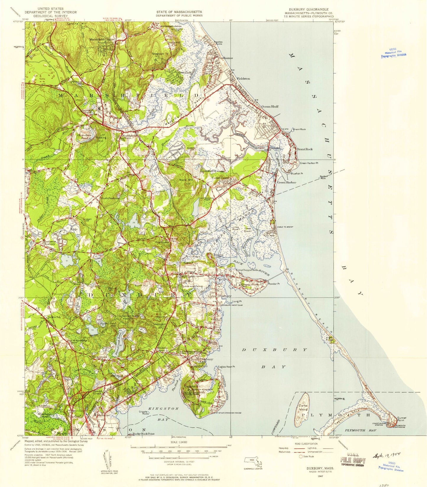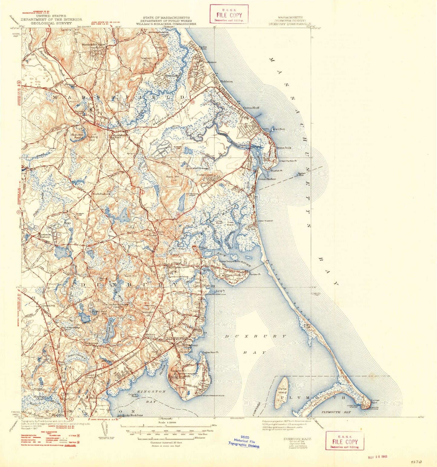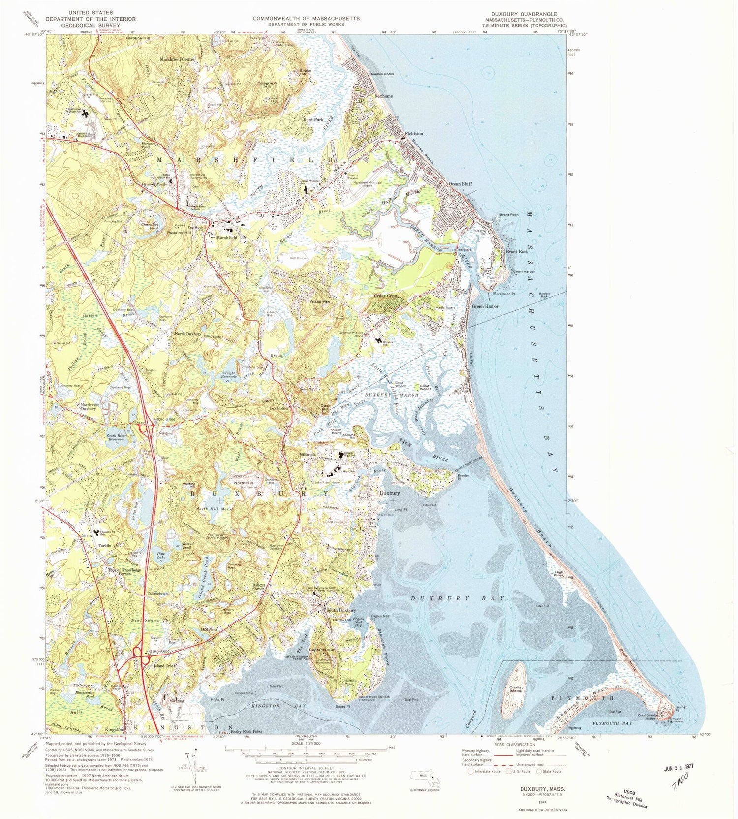

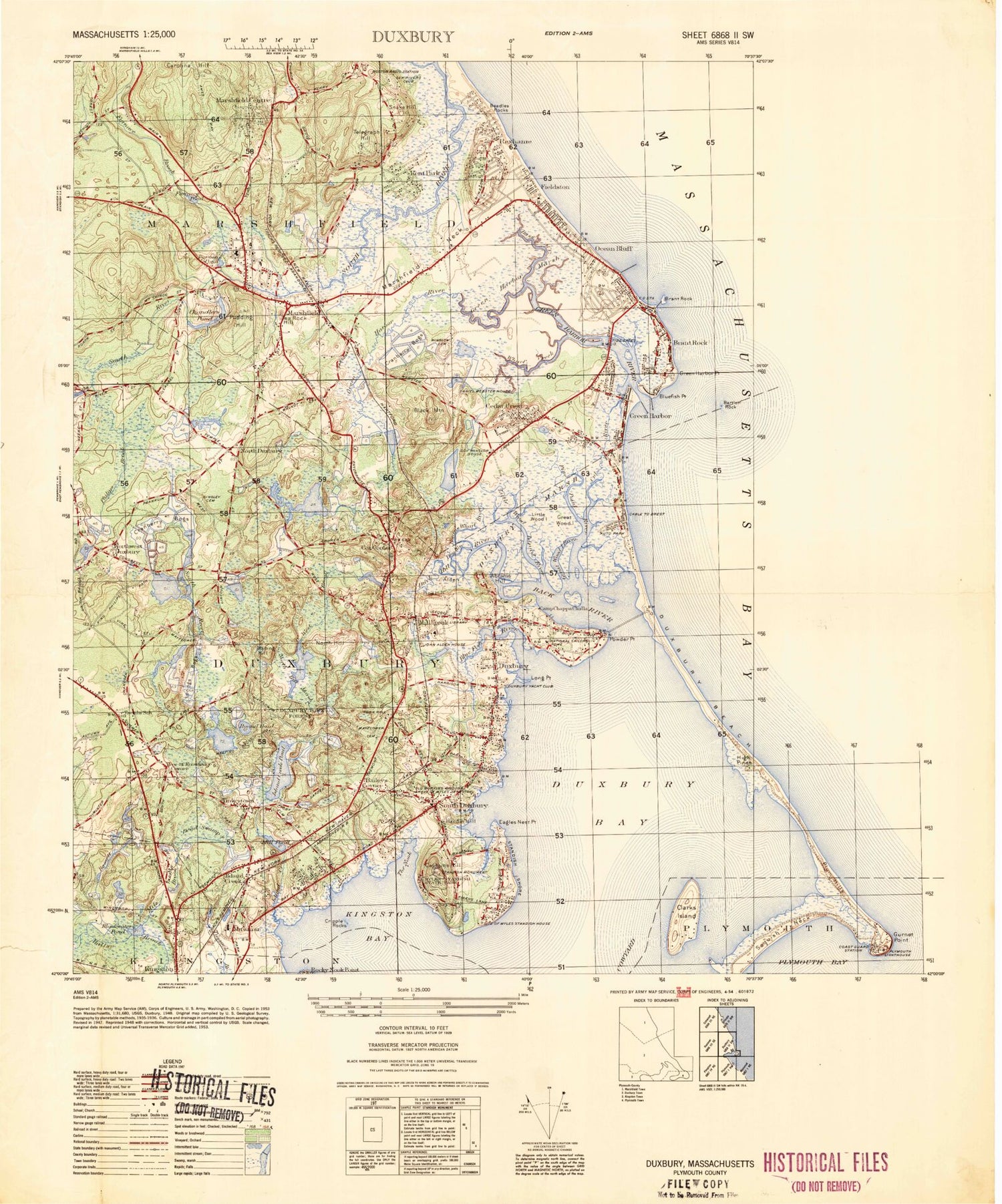


MyTopo
Classic USGS Duxbury Massachusetts 7.5'x7.5' Topo Map
Couldn't load pickup availability
Historical USGS topographic quad map of Duxbury in the state of Massachusetts. Typical map scale is 1:24,000, but may vary for certain years, if available. Print size: 24" x 27"
This quadrangle is in the following counties: Plymouth.
The map contains contour lines, roads, rivers, towns, and lakes. Printed on high-quality waterproof paper with UV fade-resistant inks, and shipped rolled.
Contains the following named places: Marshfield Fairgrounds, Daniel Webster School, Mayflower Cemetery, Chandler Elementary School, Ryder Middle School, Marshfield High School, Martinson Middle School, Winslow Cemetery, Ellison High School, Duxbury Junior High School, Winslow School, Indian Head School, Island Creek Station (historical), Marshfield Station (historical), Marshfield Centre Station (historical), Webster Point Station (historical), Millbrook Station (historical), South Dunbury Station (historical), South River Marshes, Wharf Creek Marshes, Green Harbor River Harshes, Bluefish River Marshes, High Pines Marshes, Kingston Bay Marshes, Marshfield Plaza, Marshfield Plaza East, Duxbury Plaza, Dingley Cemetery, John Alden House, Myles Standish Burying Ground, Governor Winslow House, Stadish Monument, Lorings Bogs, Duxbury Town Forest, Myles Standish State Park, Mill Pond Dam, Pine Lake Dam, Pit Pond Dam, Pit Pond, Round Pond Dam, Golden Reservoir Dam, Bluefish River Reservoir, Bluefish River Dam, North Hill Marsh Dam, South River Reservoir Dam, Reed Bog Reservoir, Reed Number 1 Dam, Petersons Saw Mill Pond Dam, Wright Reservoir Dam, Merry Bog Reservoir, Merry Reservoir Dam, Mount Skirgo Pond Dam, Philips Brook Reservoir, King Caesar House, Cranberry Pond (historical), South River School, Myles Standish Homestead, Howland Ledge, The Gurnet, Abrams Hill, Baileys Corner, Alden Island, Allens Pond, Back River, Bartlett Rock, Bass Creek, Bassett Brook, Beadles Rocks, Blackmans Point, Black Mountain, Blackwater Pond, Bluefish River, Blue Fish Rock, Bourne Wharf River, Brant Rock, Brant Rock, Camp Chappa Challa, Captains Hill, Cedar Crest, Chandlers Pond, Clarks Island, Cowyard, Cox Corner, Cripple Rocks, Cut River, Dead Swamp, Duck Hill, Duck Hill River, Dug Way, Duxbury, Duxbury Bay, Duxbury Beach, Duxbury Marsh, Eagles Nest Point, Fieldston, Furnace Brook, Furnace Pond, South River Reservoir, Goose Point, Great Wood Island, Great Wood Island River, Green Harbor, Green Harbor Marsh, Green Harbor Point, Green Harbor River, Hardin Hill, Hicks Point, High Pines, Island Creek, Island Creek, Island Creek Pond, Jones River, Kent Park, Kingston Bay, Little Wood Island, Little Wood Island River, Long Point, Marshfield, Marshfield Center, Marshfield Neck, Mile Brook, Millbrook, Mill Pond, Miramar, North Duxbury, North Hill, North Hill Marsh, Northwest Duxbury, Ocean Bluff, Parsons Pond, Pine Hill, Pine Lake, Pine Point River, Powder Point, Pudding Hill, Rexhame, Rocky Nook Point, Round Pond, Snake Hill, South Duxbury, Standish Shore, Sunrise Beach, Tarkiln, Tea Rock Hill, Telegraph Hill, Tinkertown, Tree of Knowledge Corner, Waiting Hill, West Brook, Wharf Creek, Wright Reservoir, Keene Brook, Phillips Brook, Sampson Brook, Harlow Brook, Green Harbor Brook, Eagles Nest Bay, Town of Duxbury, Blue Fish Cove, The Nook, Green Harbor Village Post Office (historical), Brant Rock Village Post Office (historical), Marshfield Centre Post Office (historical), Marshfield Post Office (historical), North Dunbury Post Office (historical), Dunbury Post Office (historical), Millbrook Post Office (historical), South Dunbury Post Office (historical), WATD-FM (Marshfield), Marshfield Municipal Airport - George Harlow Field, Town of Marshfield, Alden Upper School, Carl A Weyerhaeuser Library, Common Island, Cranberry Factory Pond, Daniel Webster Law Office Museum, Duxbury Art Complex, Duxbury Elementary School, Duxbury Free Library, Duxbury Junior-Senior High School, Duxbury Post Office, Duxbury Town Hall, Duxbury Yacht Club, First Baptist Church of Duxbury, First Church of Christ Scientist, First Church of Christ Scientist, First Congregational Church, First Parish Church, First Parish Unitarian Church, Great Harry Foot, Green Harbor Golf Course, Green Harbor Marina, Green Harbor Post Office, Hammer Island, Kingdom Hall of Jehovahs Witnesses of Marshfield, Little Harry Foot, Long Island, Marshfield Country Club, Marshfield Plaza East Shopping Center, Marshfield Post Office, Marshfield Town Hall, Massachusetts State Fish Hatchery, Miles Standish Park, Myles Standish Burying Ground, North Hill Country Club, North Hill Pond, Ocean Bluff Post Office, Old Shipbuilders Historic District, Petersons Saw Mill Pond, Pilgrim Church of Duxbury, Saint John the Evangelist Church, Saint John the Evangelist Church, Scat Island, Shipyard Lane Beach, Soules Island, Taylor Marina, Victory Baptist Church, Webster Square Shops Shopping Center, Windsor House Museum, Martinson Elementary School, Bay Farm Montessori Academy, Chandler Elementary School Library, Duxbury High School Media Center, Duxbury Middle School Media Center, Furnace Brook Middle School, Ventress Memorial Library, Duxbury Census Designated Place, Green Harbor-Cedar Crest Census Designated Place (historical), Marshfield Census Designated Place, Ocean Bluff-Brant Rock Census Designated Place, South Duxbury Census Designated Place, Cedar Crest, Saint John's Episcopal Church Cemetery, Duxbury Fire Department Station 1 Headquarters, Marshfield Fire Department Station 3 Headquarters, Marshfield Fire Department Station 1