

MyTopo
Classic USGS East Lee Massachusetts 7.5'x7.5' Topo Map
Couldn't load pickup availability
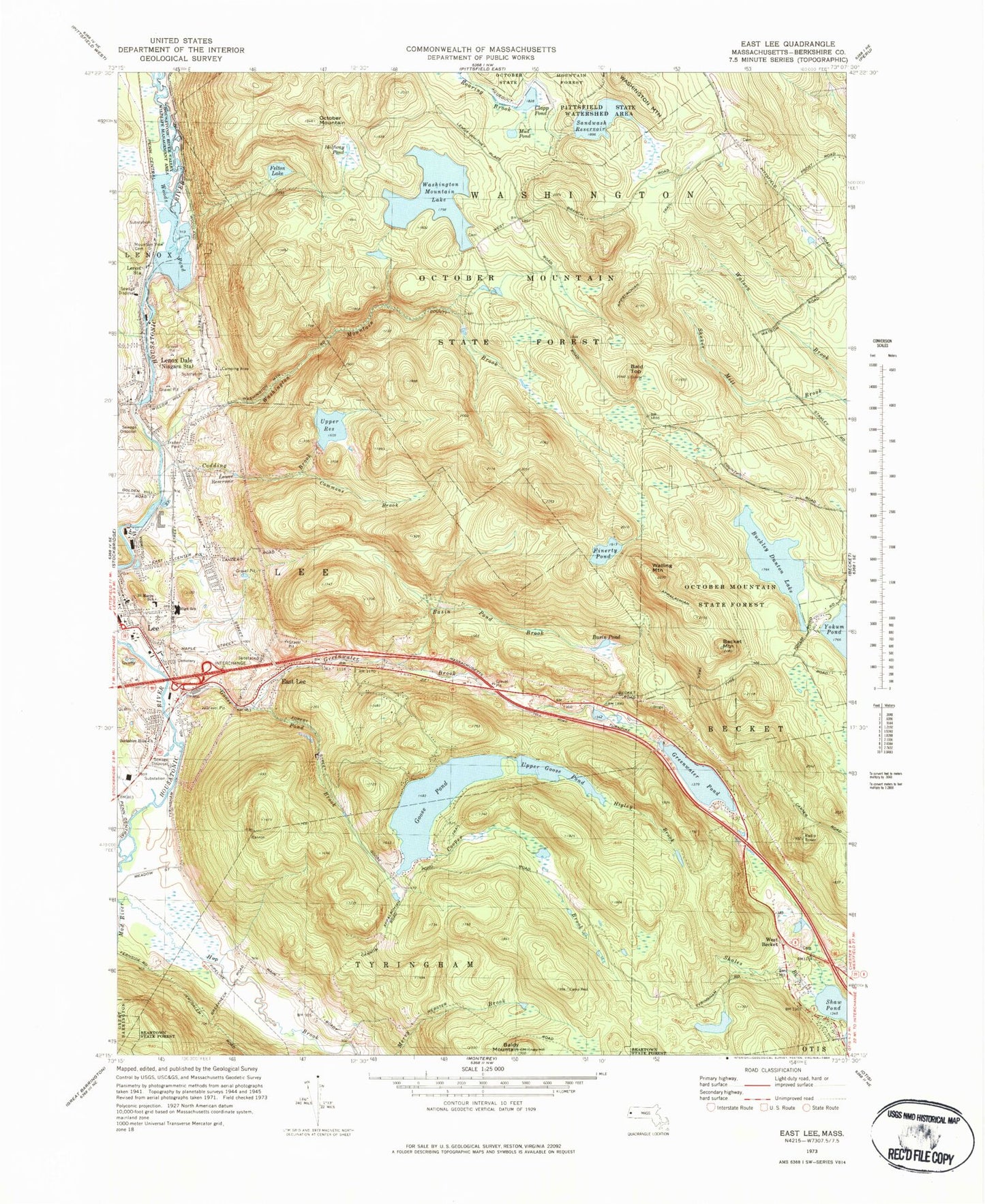
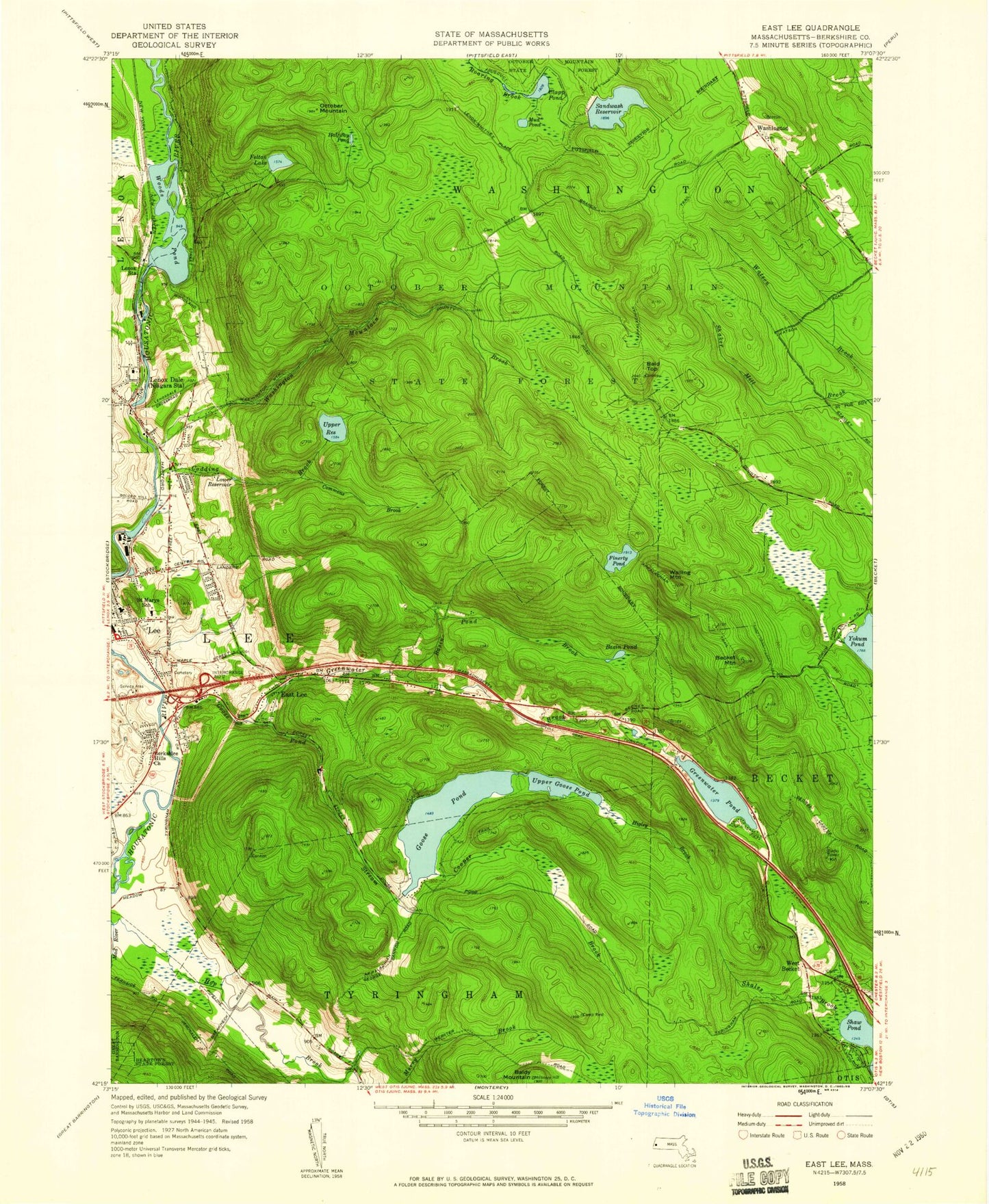
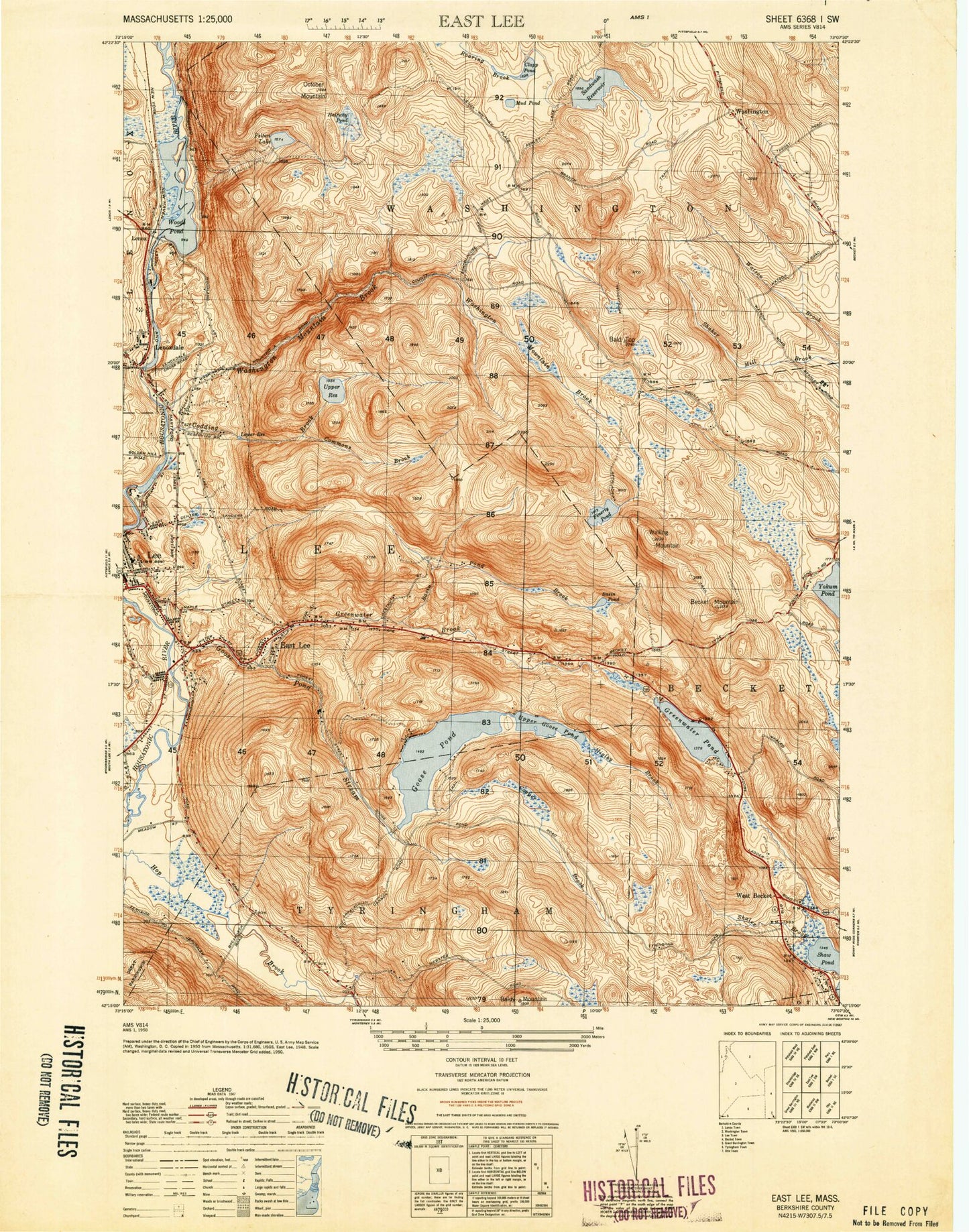
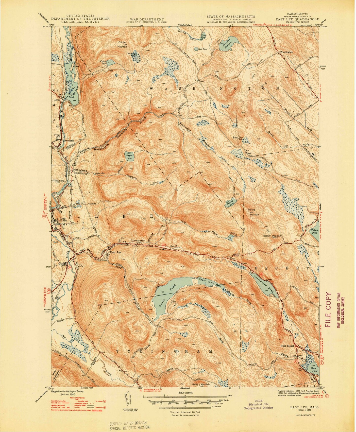
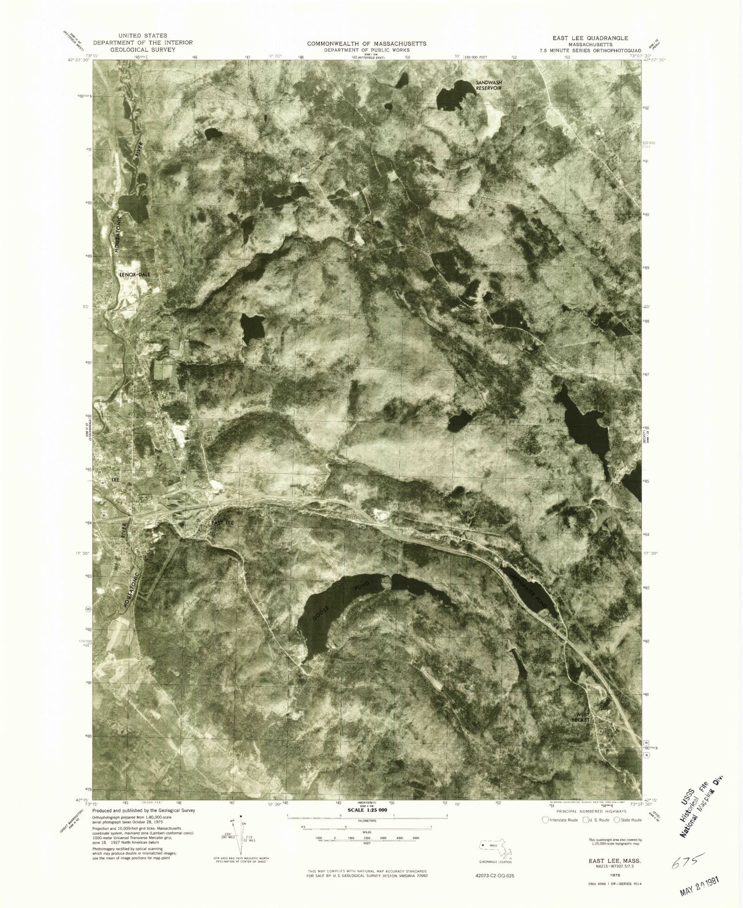
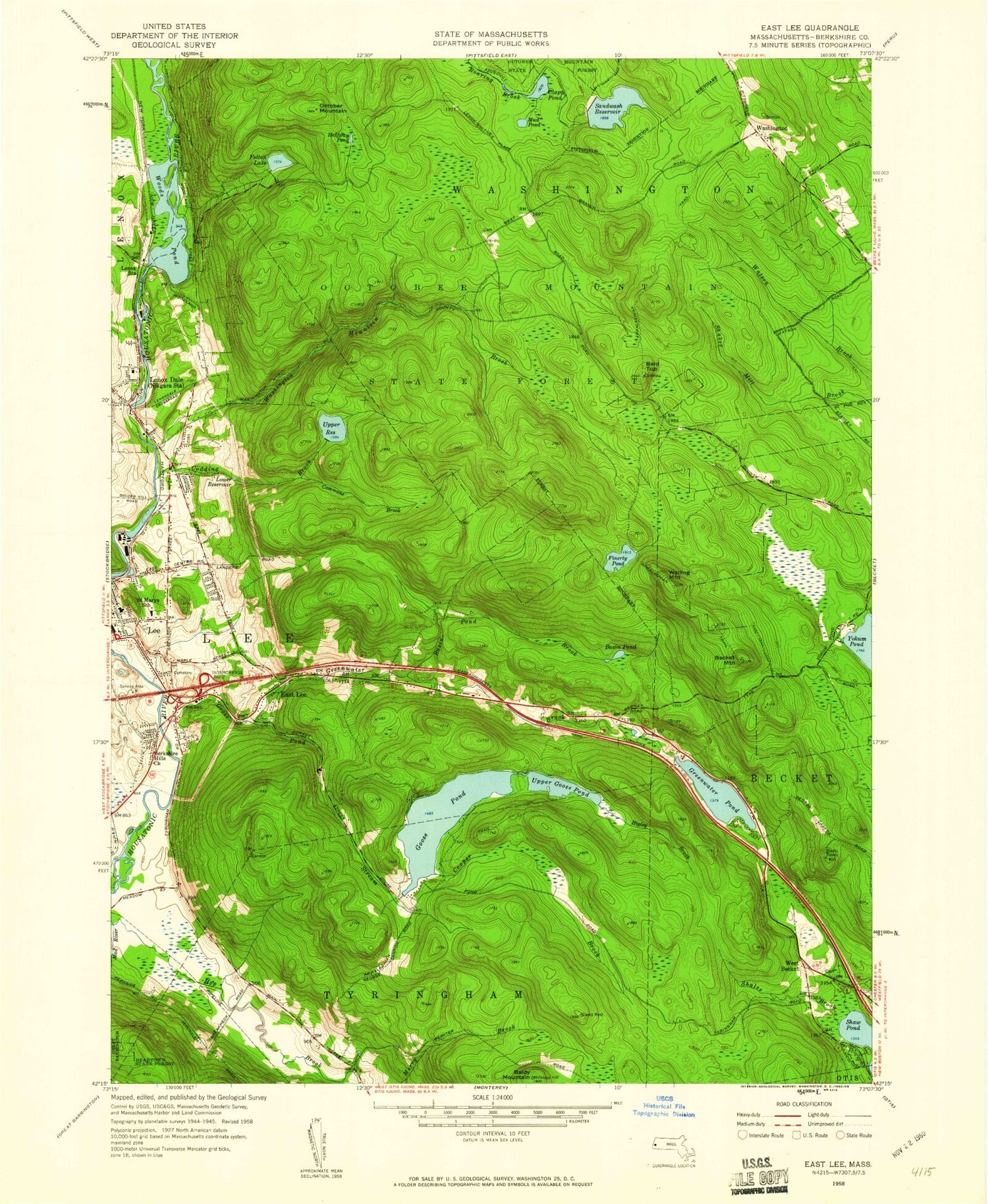
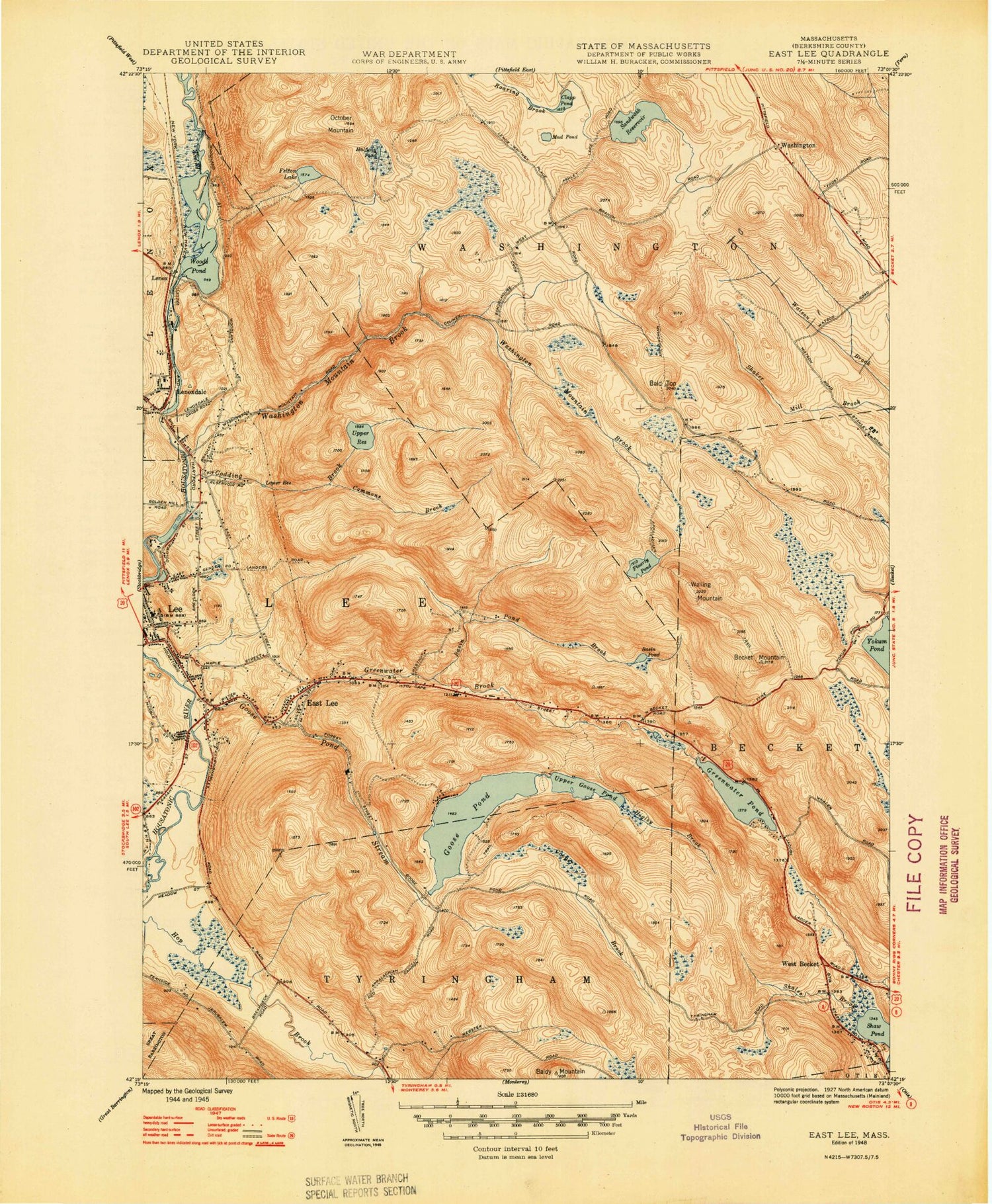
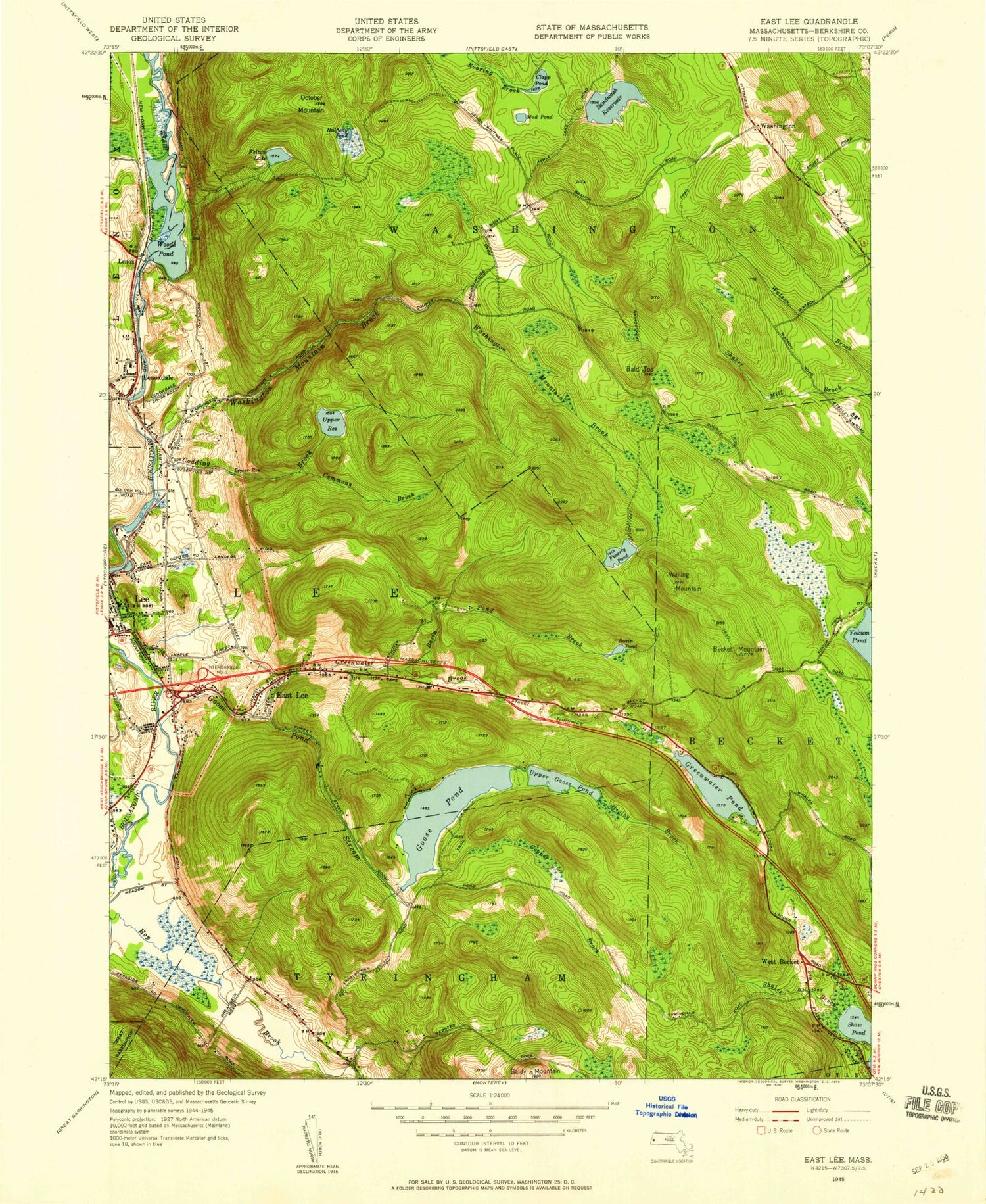
Historical USGS topographic quad map of East Lee in the state of Massachusetts. Typical map scale is 1:24,000, but may vary for certain years, if available. Print size: 24" x 27"
This quadrangle is in the following counties: Berkshire.
The map contains contour lines, roads, rivers, towns, and lakes. Printed on high-quality waterproof paper with UV fade-resistant inks, and shipped rolled.
Contains the following named places: October Mountain State Forest, Goose Pond Dam, Higley Brook Dam, Greenwater Pond Dam, Buckley Dunton Lake Dam, Finerty Pond Dam, Columbia Mill Dam, Housatonic River Reservoir, Leahy Upper Reservoir Dam, Gingerbread House, Riverside (historical), Berkshire County, Felton Lake Brook, Bald Top, Baldy Mountain, Basin Pond, Basin Pond Brook, Becket Mountain, Clapp Pond, Codding Brook, Commons Brook, Cooper Brook, East Lee, Felton Lake, Finerty Pond, Goose Pond, Goose Pond Brook, Greenwater Brook, Greenwater Pond, Halfway Pond, Higley Brook, Lee, Lenox Dale, Lenox Station, Lower Reservoir, Mad River, Mud Pond, October Mountain, Sandwash Reservoir, Shales Brook, Upper Goose Pond, Upper Reservoir, Walling Mountain, West Becket, Willow Brook, Woods Crossing Brook, Woods Pond, Tyne Swamp, Sawmill Brook, Washington Mountain Brook, Buckley Dunton Lake, Washington Mountain Lake, Lee High School, Saint Marys School, Mountain View Cemetery, Town of Lee, Town of Washington, Blueberry Hill Airport, Berkshire Hills Baptist Church, Bucksteep Cross-Country Ski Area, Greater Grace Church, Greenover Country Club, Lee Elementary School, Lee Library Association, Lee Town Hall, Leisure Lee, Lenox Dale Post Office, Saint Andrews Chapel, Saint Georges Episcopal Church, Golden Hill Nursery, Lenox Fire Department Lenox Dale Station, Lee Police Department, Lenox Dale Census Designated Place, October Mountain State Forest, Goose Pond Dam, Higley Brook Dam, Greenwater Pond Dam, Buckley Dunton Lake Dam, Finerty Pond Dam, Columbia Mill Dam, Housatonic River Reservoir, Leahy Upper Reservoir Dam, Gingerbread House, Riverside (historical), Berkshire County, Felton Lake Brook, Bald Top, Baldy Mountain, Basin Pond, Basin Pond Brook, Becket Mountain, Clapp Pond, Codding Brook, Commons Brook, Cooper Brook, East Lee, Felton Lake, Finerty Pond, Goose Pond, Goose Pond Brook, Greenwater Brook, Greenwater Pond, Halfway Pond, Higley Brook, Lee, Lenox Dale, Lenox Station, Lower Reservoir, Mad River, Mud Pond, October Mountain, Sandwash Reservoir, Shales Brook, Upper Goose Pond, Upper Reservoir, Walling Mountain, West Becket, Willow Brook, Woods Crossing Brook, Woods Pond, Tyne Swamp, Sawmill Brook, Washington Mountain Brook, Buckley Dunton Lake, Washington Mountain Lake, Lee High School, Saint Marys School, Mountain View Cemetery, Town of Lee, Town of Washington, Blueberry Hill Airport, Berkshire Hills Baptist Church, Bucksteep Cross-Country Ski Area, Greater Grace Church, Greenover Country Club, Lee Elementary School, Lee Library Association, Lee Town Hall, Leisure Lee, Lenox Dale Post Office, Saint Andrews Chapel, Saint Georges Episcopal Church, Golden Hill Nursery, Lenox Fire Department Lenox Dale Station, Lee Police Department, Lenox Dale Census Designated Place, October Mountain State Forest, Goose Pond Dam, Higley Brook Dam, Greenwater Pond Dam, Buckley Dunton Lake Dam, Finerty Pond Dam, Columbia Mill Dam, Housatonic River Reservoir, Leahy Upper Reservoir Dam, Gingerbread House, Riverside (historical), Berkshire County, Felton Lake Brook, Bald Top, Baldy Mountain, Basin Pond, Basin Pond Brook, Becket Mountain, Clapp Pond, Codding Brook, Commons Brook, Cooper Brook, East Lee, Felton Lake, Finerty Pond, Goose Pond, Goose Pond Brook, Greenwater Brook, Greenwater Pond, Halfway Pond, Higley Brook, Lee, Lenox Dale, Lenox Station, Lower Reservoir, Mad River, Mud Pond, October Mountain, Sandwash Reservoir, Shales Brook, Upper Goose Pond, Upper Reservoir, Walling Mountain, West Becket, Willow Brook, Woods Crossing Brook, Woods Pond, Tyne Swamp, Sawmill Brook, Washington Mountain Brook, Buckley Dunton Lake, Washington Mountain Lake, Lee High School, Saint Marys School, Mountain View Cemetery, Town of Lee, Town of Washington, Blueberry Hill Airport, Berkshire Hills Baptist Church, Bucksteep Cross-Country Ski Area, Greater Grace Church, Greenover Country Club, Lee Elementary School, Lee Library Association, Lee Town Hall, Leisure Lee, Lenox Dale Post Office, Saint Andrews Chapel, Saint Georges Episcopal Church, Golden Hill Nursery, Lenox Fire Department Lenox Dale Station, Lee Police Department, Lenox Dale Census Designated Place, October Mountain State Forest, Goose Pond Dam, Higley Brook Dam, Greenwater Pond Dam, Buckley Dunton Lake Dam, Finerty Pond Dam, Columbia Mill Dam, Housatonic River Reservoir, Leahy Upper Reservoir Dam, Gingerbread House, Riverside (historical), Berkshire County, Felton Lake Brook, Bald Top, Baldy Mountain, Basin Pond, Basin Pond Brook