


MyTopo
Classic USGS Egremont Massachusetts 7.5'x7.5' Topo Map
Couldn't load pickup availability
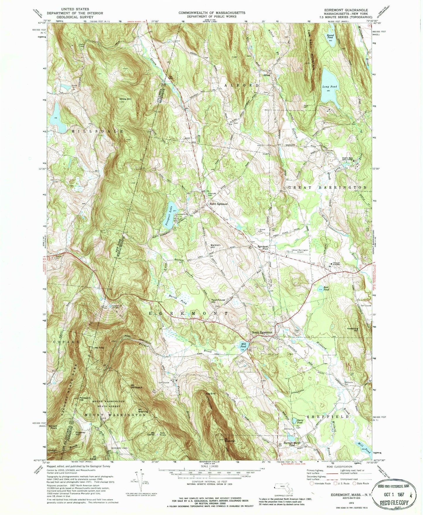
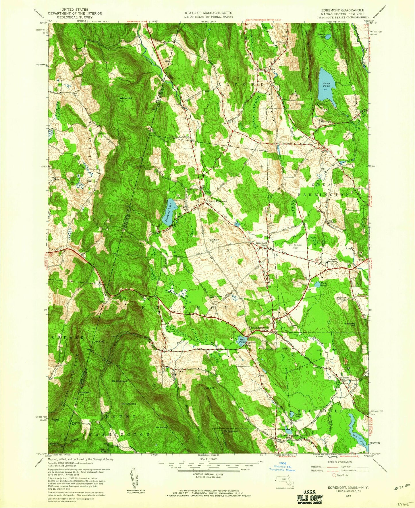
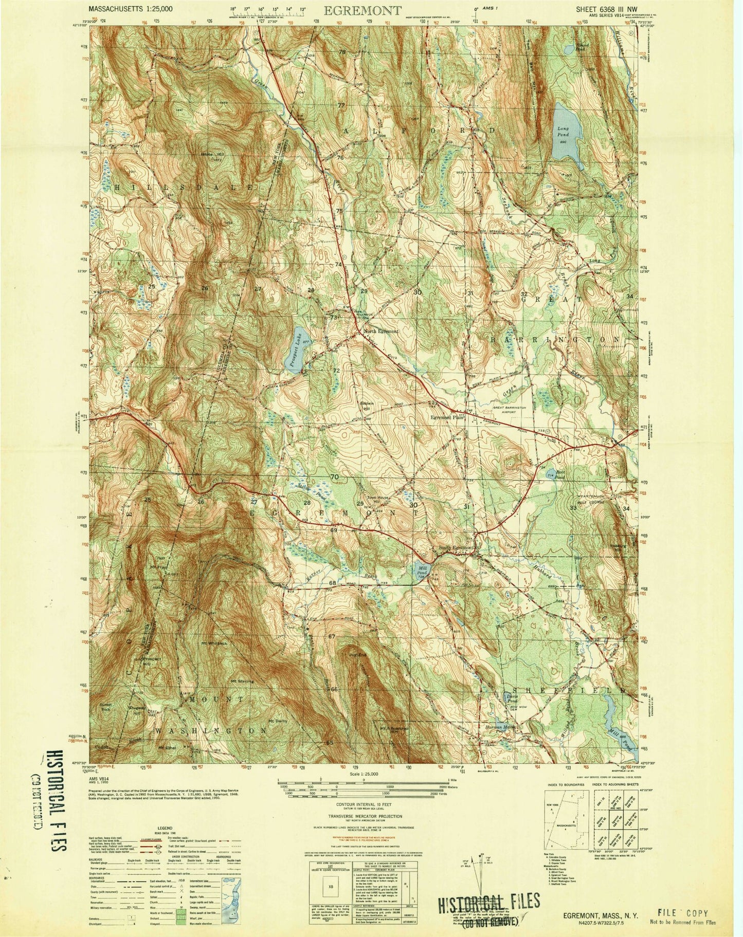
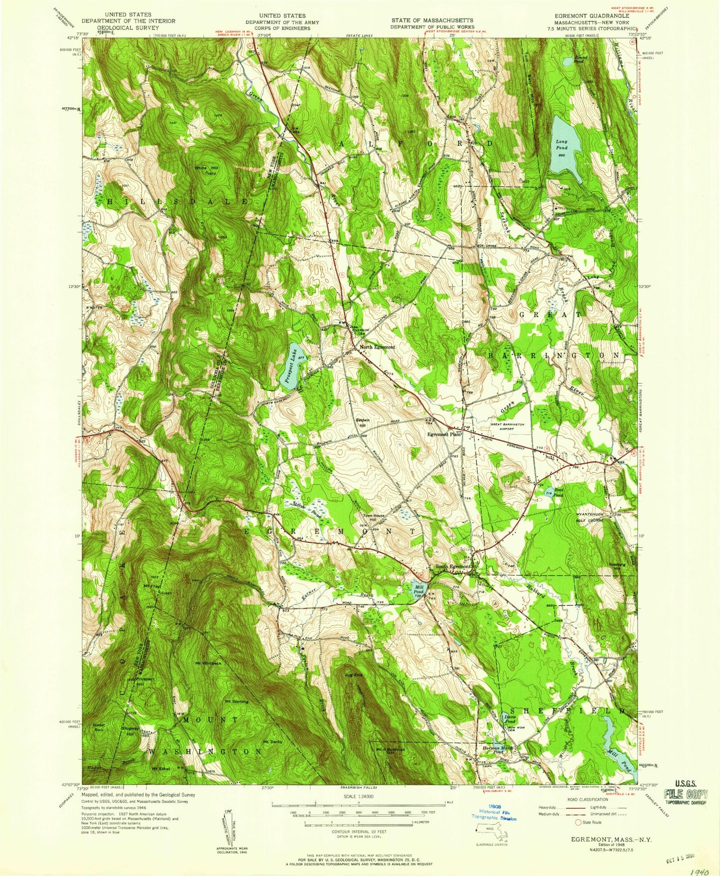
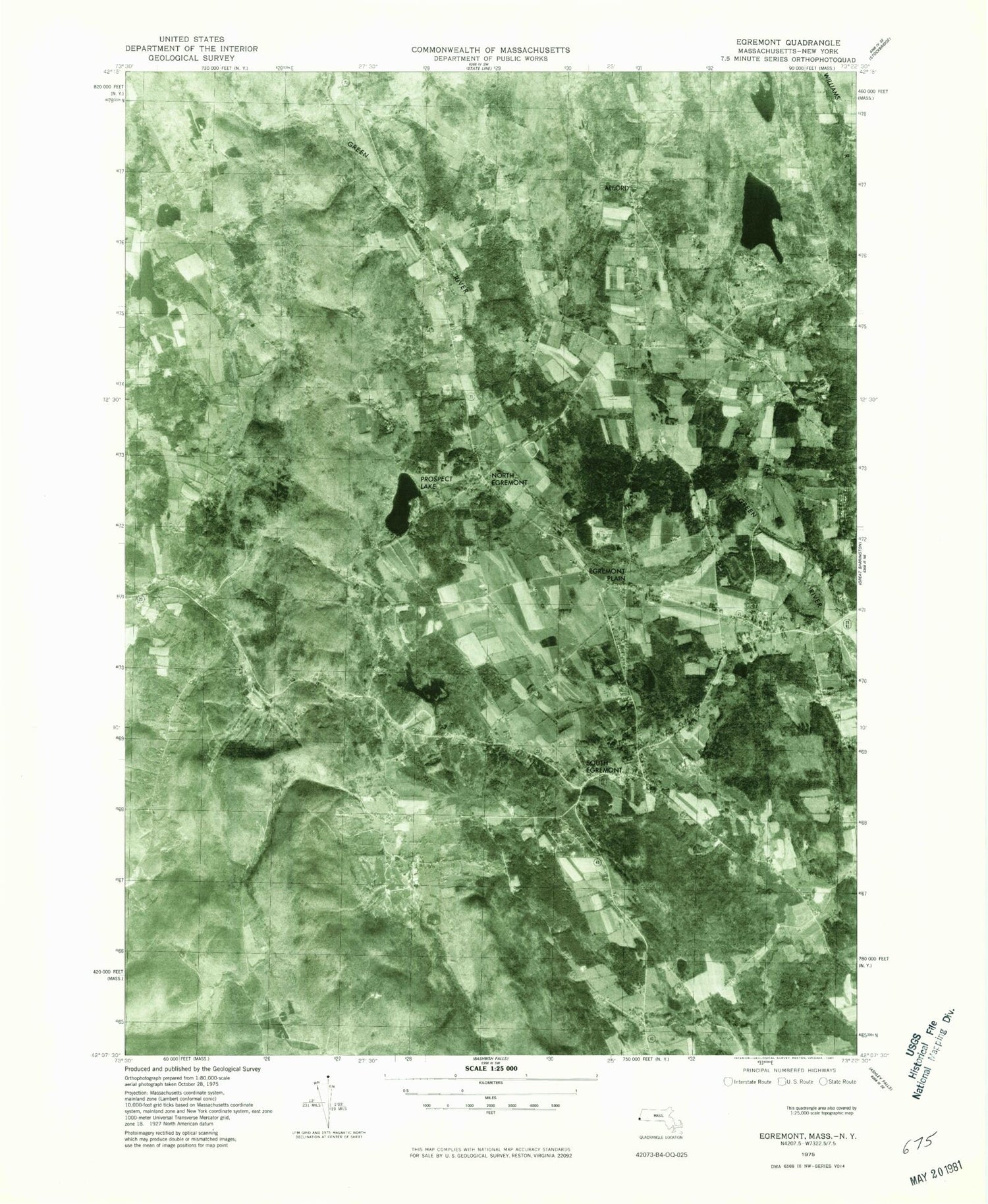
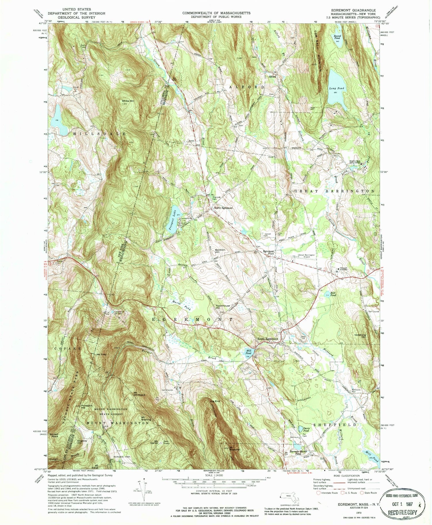
Historical USGS topographic quad map of Egremont in the states of Massachusetts, New York. Typical map scale is 1:24,000, but may vary for certain years, if available. Print size: 24" x 27"
This quadrangle is in the following counties: Berkshire, Columbia.
The map contains contour lines, roads, rivers, towns, and lakes. Printed on high-quality waterproof paper with UV fade-resistant inks, and shipped rolled.
Contains the following named places: North Egremont, Riverside Cemetery, Simons Rock Early College, Cornwall Academy, Battlesite Monument, Mill Pond Dam, Prospect Lake Dam, Long Pond Dam, Albert Schweitzer Center, Mount Washington State Forest, Alford, Alford Brook, Baldwin Hill, Mount Bushnell, Mount Darby, Davis Pond, Dugway Hill, Egremont Plain, Fenton Brook, Mount Fray, Harman Marsh Pond, Jug End, Karner Brook, Long Pond, Long Pond Brook, Marsh Pond, Mill Pond, Prospect Hill, Prospect Lake, Root Pond, Round Pond, Seekonk Brook, South Egremont, Mount Sterling, Townhouse Hill, Vossburg Hill, Mount Whitbeck, Willard Brook, Town of Alford, Town of Egremont, Walter J Koladza Airport, WBBS-FM (Great Barrington), Alford Town Hall, Berkshire Heights Reservoir, First Congregational Church, North Egremont Historic District, Rudolph Steiner School, South Egremont Post Office, South Egremont Village Historic District, Wyantenuck Country Club, Alford Free Public Library, Alford Fire Department, Egremont Fire Department, Egremont Fire Department Main Street, Egremont Police Department, Alford Police Department, Hillside Cemetery, Center Cemetery, Sunset Rock, White Hill, North Egremont, Riverside Cemetery, Simons Rock Early College, Cornwall Academy, Battlesite Monument, Mill Pond Dam, Prospect Lake Dam, Long Pond Dam, Albert Schweitzer Center, Mount Washington State Forest, Alford, Alford Brook, Baldwin Hill, Mount Bushnell, Mount Darby, Davis Pond, Dugway Hill, Egremont Plain, Fenton Brook, Mount Fray, Harman Marsh Pond, Jug End, Karner Brook, Long Pond, Long Pond Brook, Marsh Pond, Mill Pond, Prospect Hill, Prospect Lake, Root Pond, Round Pond, Seekonk Brook, South Egremont, Mount Sterling, Townhouse Hill, Vossburg Hill, Mount Whitbeck, Willard Brook, Town of Alford, Town of Egremont, Walter J Koladza Airport, WBBS-FM (Great Barrington), Alford Town Hall, Berkshire Heights Reservoir, First Congregational Church, North Egremont Historic District, Rudolph Steiner School, South Egremont Post Office, South Egremont Village Historic District, Wyantenuck Country Club, Alford Free Public Library, Alford Fire Department, Egremont Fire Department, Egremont Fire Department Main Street, Egremont Police Department, Alford Police Department, Hillside Cemetery, Center Cemetery, Sunset Rock, White Hill, North Egremont, Riverside Cemetery, Simons Rock Early College, Cornwall Academy, Battlesite Monument, Mill Pond Dam, Prospect Lake Dam, Long Pond Dam, Albert Schweitzer Center, Mount Washington State Forest, Alford, Alford Brook, Baldwin Hill, Mount Bushnell, Mount Darby, Davis Pond, Dugway Hill, Egremont Plain, Fenton Brook, Mount Fray, Harman Marsh Pond, Jug End, Karner Brook, Long Pond, Long Pond Brook, Marsh Pond, Mill Pond, Prospect Hill, Prospect Lake, Root Pond, Round Pond, Seekonk Brook, South Egremont, Mount Sterling, Townhouse Hill, Vossburg Hill, Mount Whitbeck, Willard Brook, Town of Alford, Town of Egremont, Walter J Koladza Airport, WBBS-FM (Great Barrington), Alford Town Hall, Berkshire Heights Reservoir, First Congregational Church, North Egremont Historic District, Rudolph Steiner School, South Egremont Post Office, South Egremont Village Historic District, Wyantenuck Country Club, Alford Free Public Library, Alford Fire Department, Egremont Fire Department, Egremont Fire Department Main Street, Egremont Police Department, Alford Police Department, Hillside Cemetery, Center Cemetery, Sunset Rock, White Hill, North Egremont, Riverside Cemetery, Simons Rock Early College, Cornwall Academy, Battlesite Monument, Mill Pond Dam, Prospect Lake Dam, Long Pond Dam, Albert Schweitzer Center, Mount Washington State Forest, Alford, Alford Brook, Baldwin Hill, Mount Bushnell, Mount Darby, Davis Pond, Dugway Hill, Egremont Plain, Fenton Brook, Mount Fray, Harman Marsh Pond, Jug End, Karner Brook, Long Pond, Long Pond Brook, Marsh Pond, Mill Pond, Prospect Hill, Prospect Lake, Root Pond, Round Pond, Seekonk Brook, South Egremont, Mount Sterling, Townhouse Hill, Vossburg Hill, Mount Whitbeck, Willard Brook, Town of Alford, Town of Egremont, Walter J Koladza Airport, WBBS-FM (Great Barrington), Alford Town Hall, Berkshire Heights Reservoir, First Congregational Church, North Egremont Historic District, Rudolph Steiner School, South Egremont Post Office, South Egremont Village Historic District, Wyantenuck Country Club, Alford Free Public Library, Alford Fire Department, Egremont Fire Department, Egremont Fire Department Main Street, Egremont Police Department, Alford Police Department