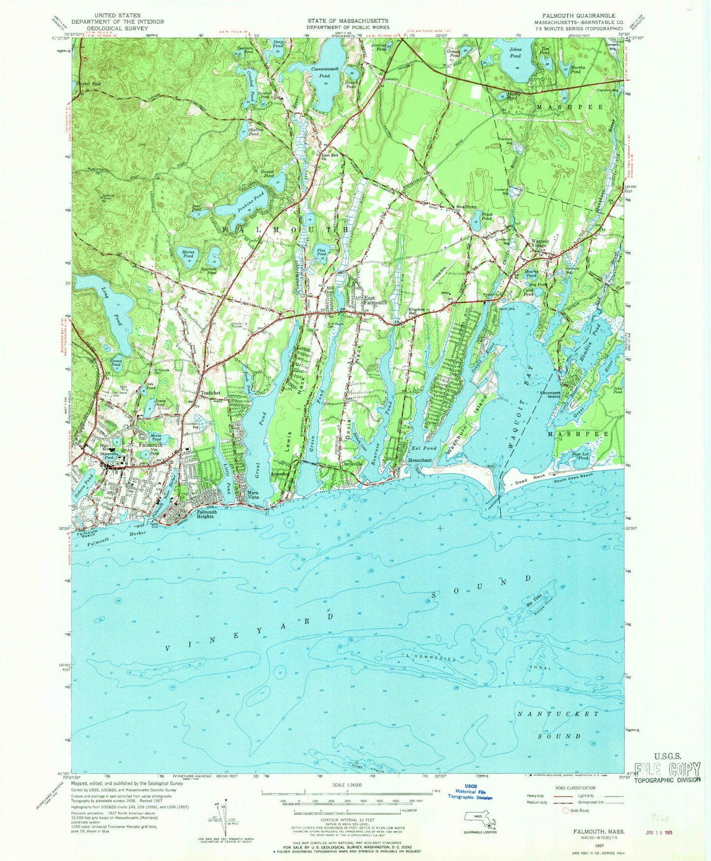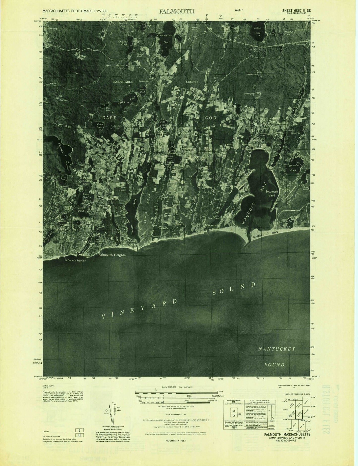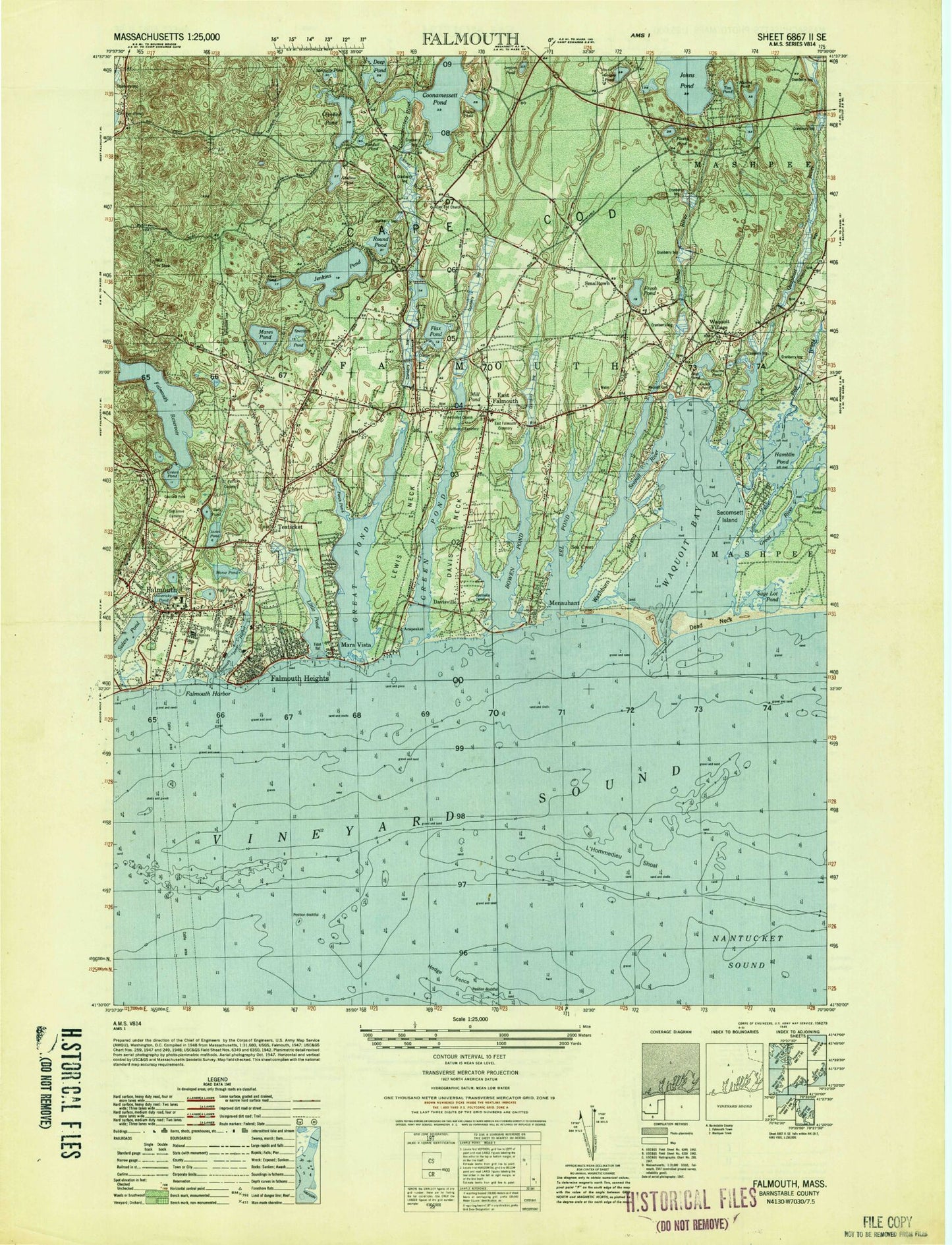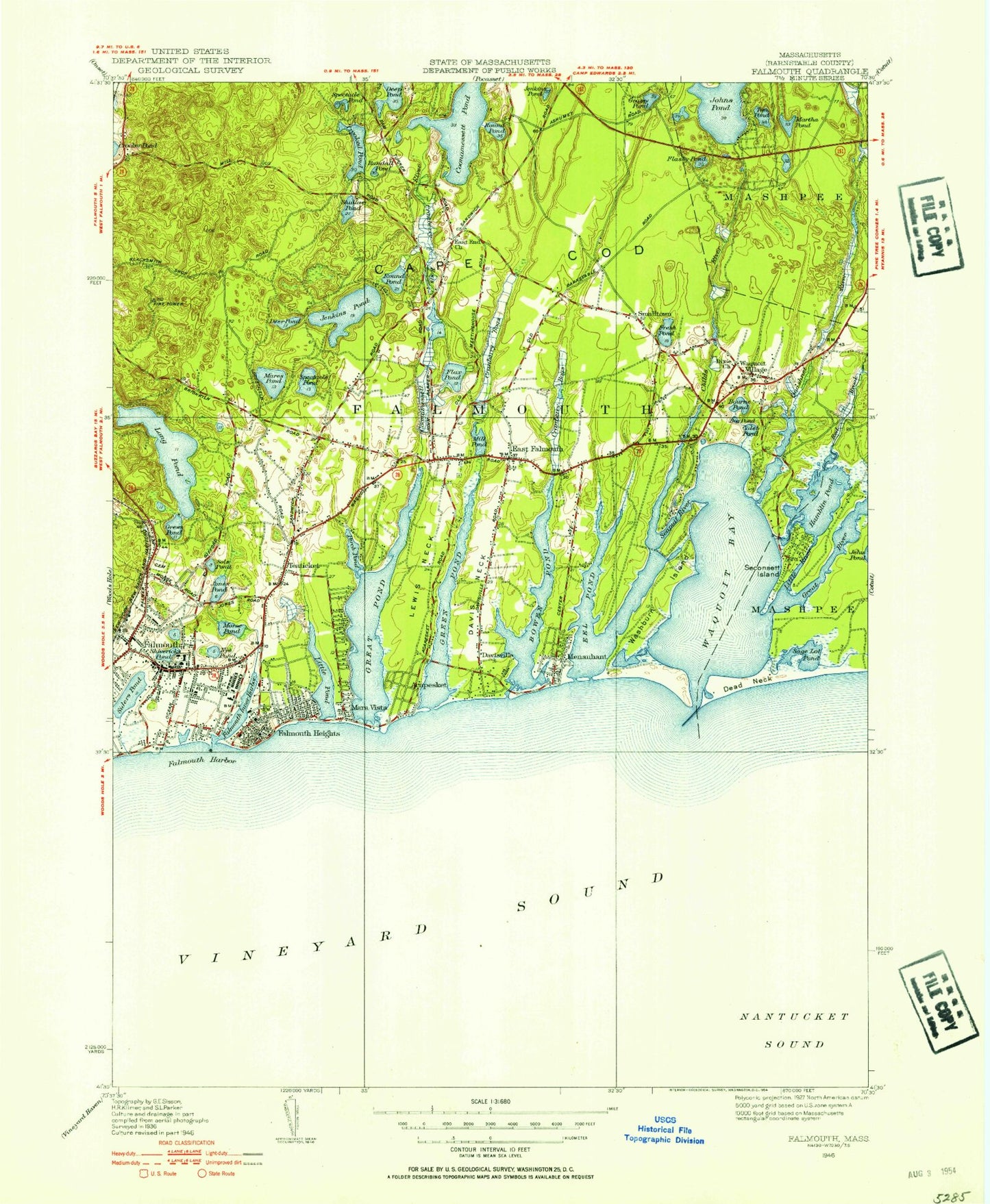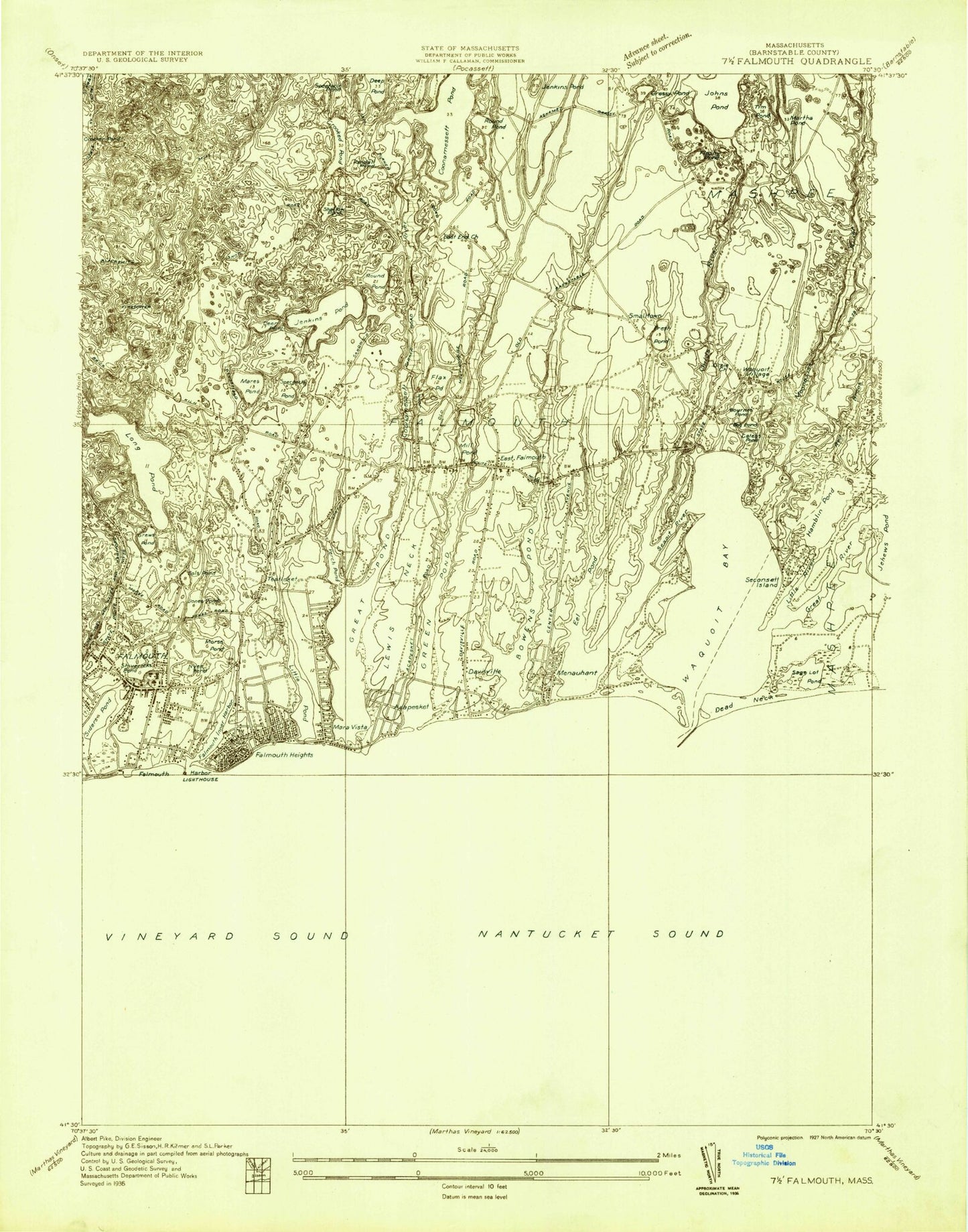
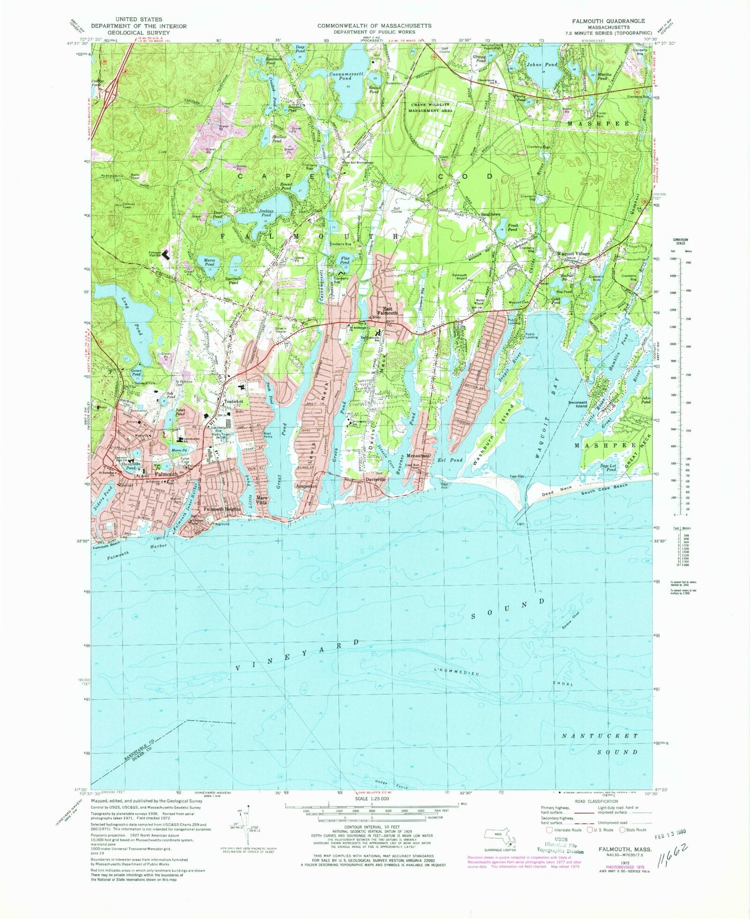
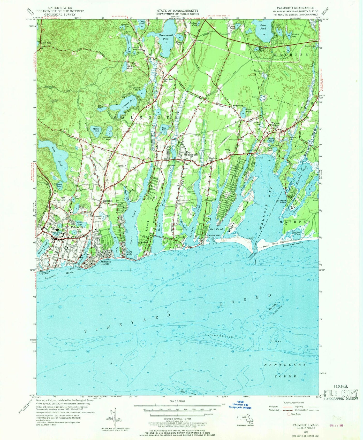


MyTopo
Classic USGS Falmouth Massachusetts 7.5'x7.5' Topo Map
Couldn't load pickup availability
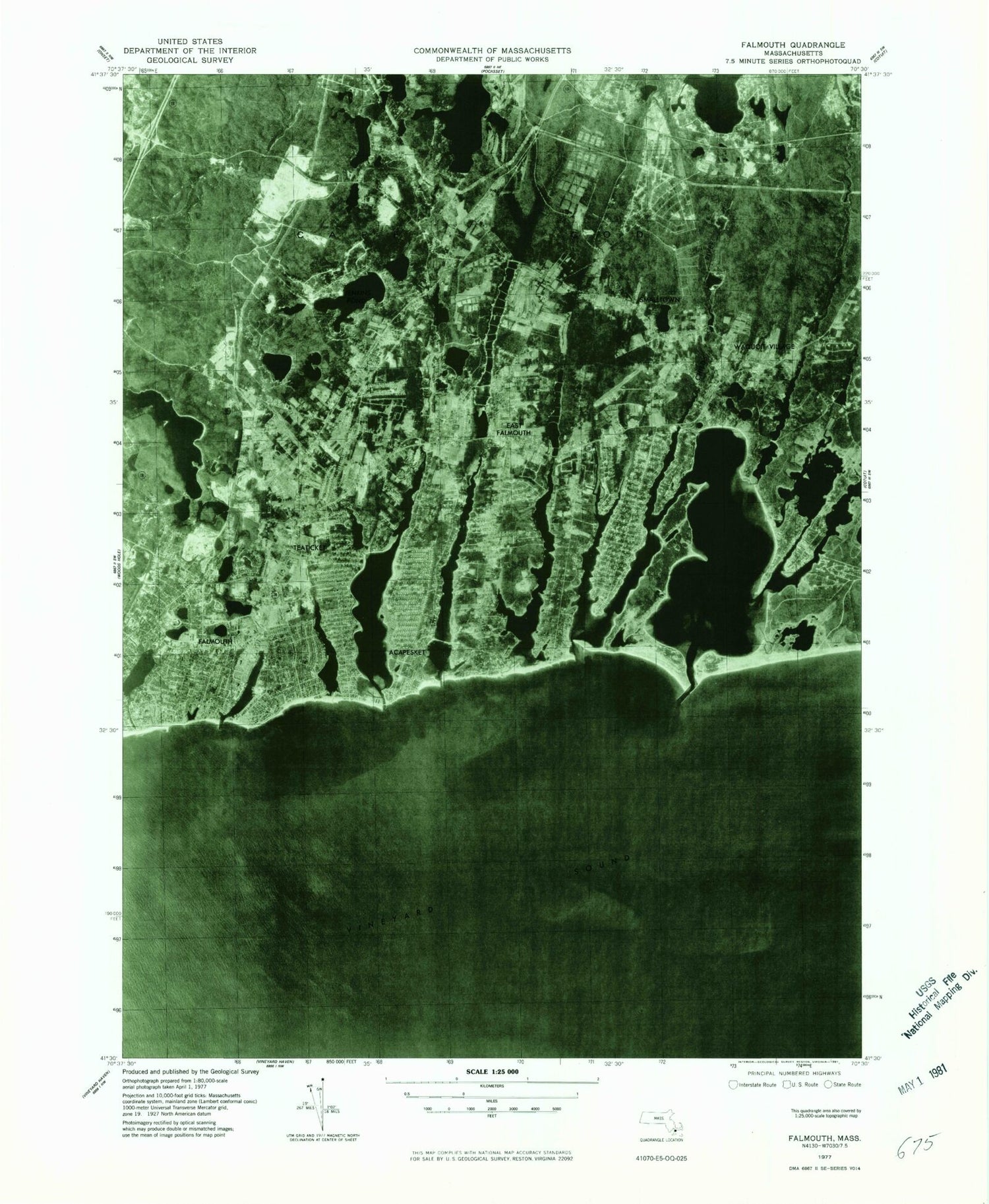
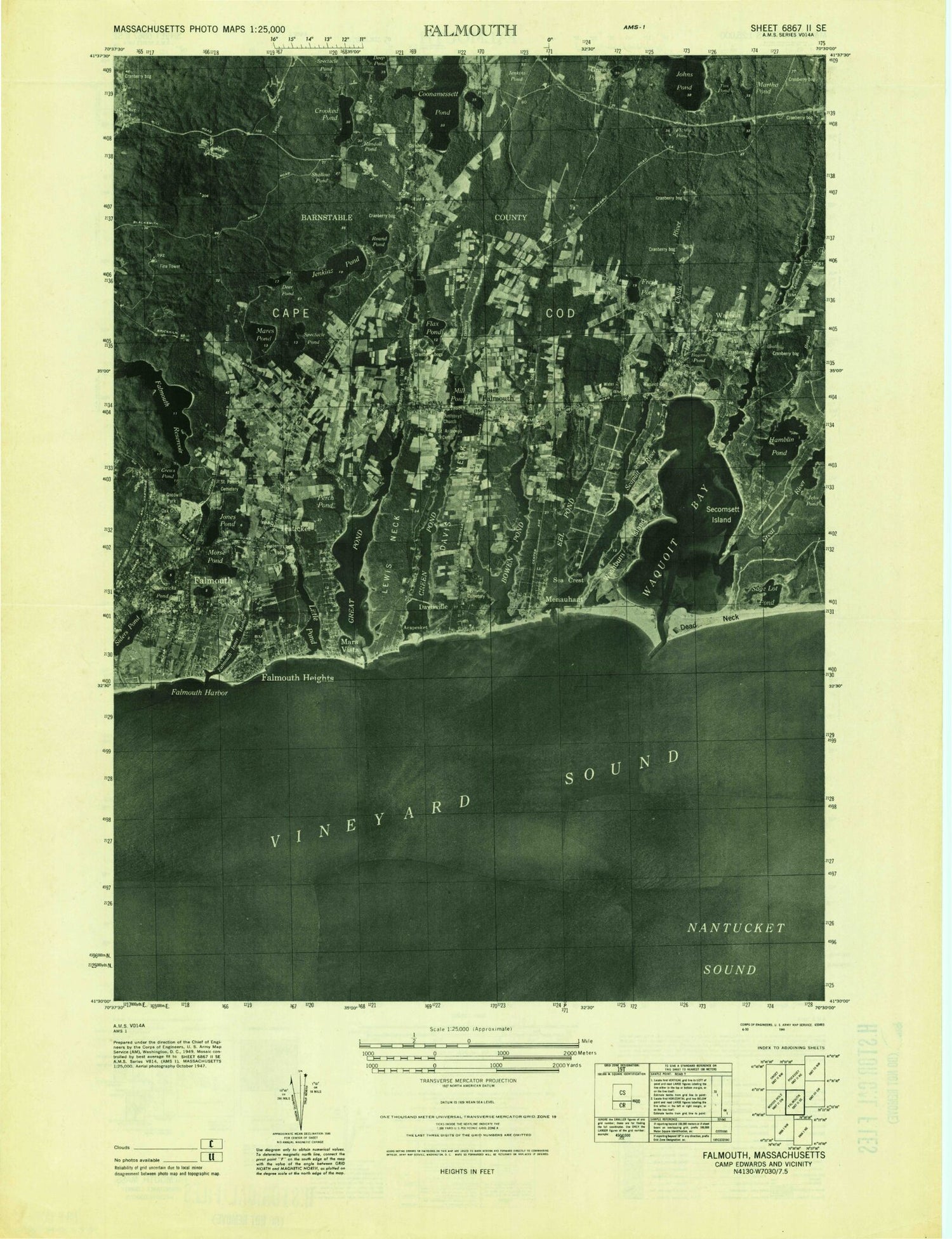
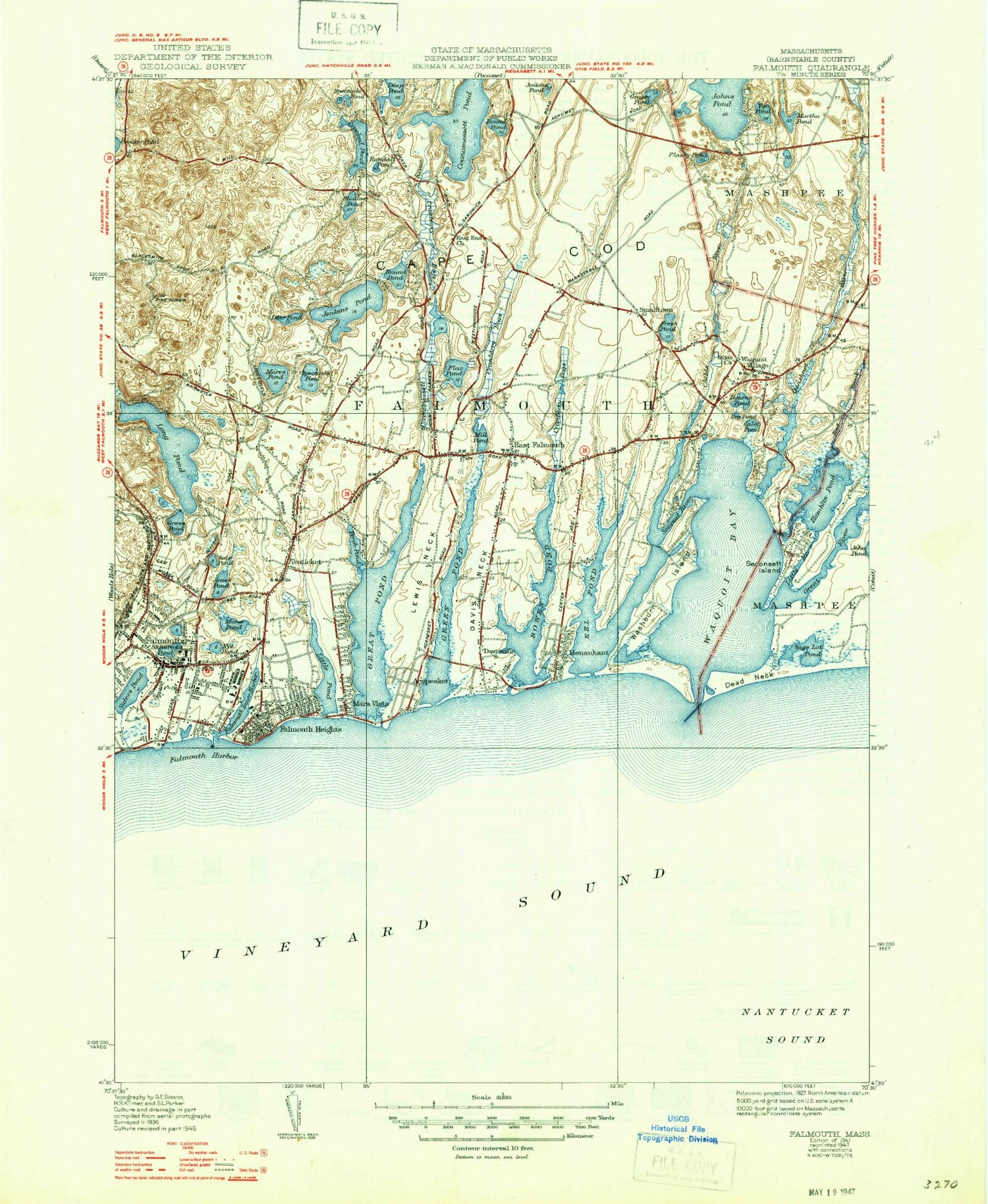
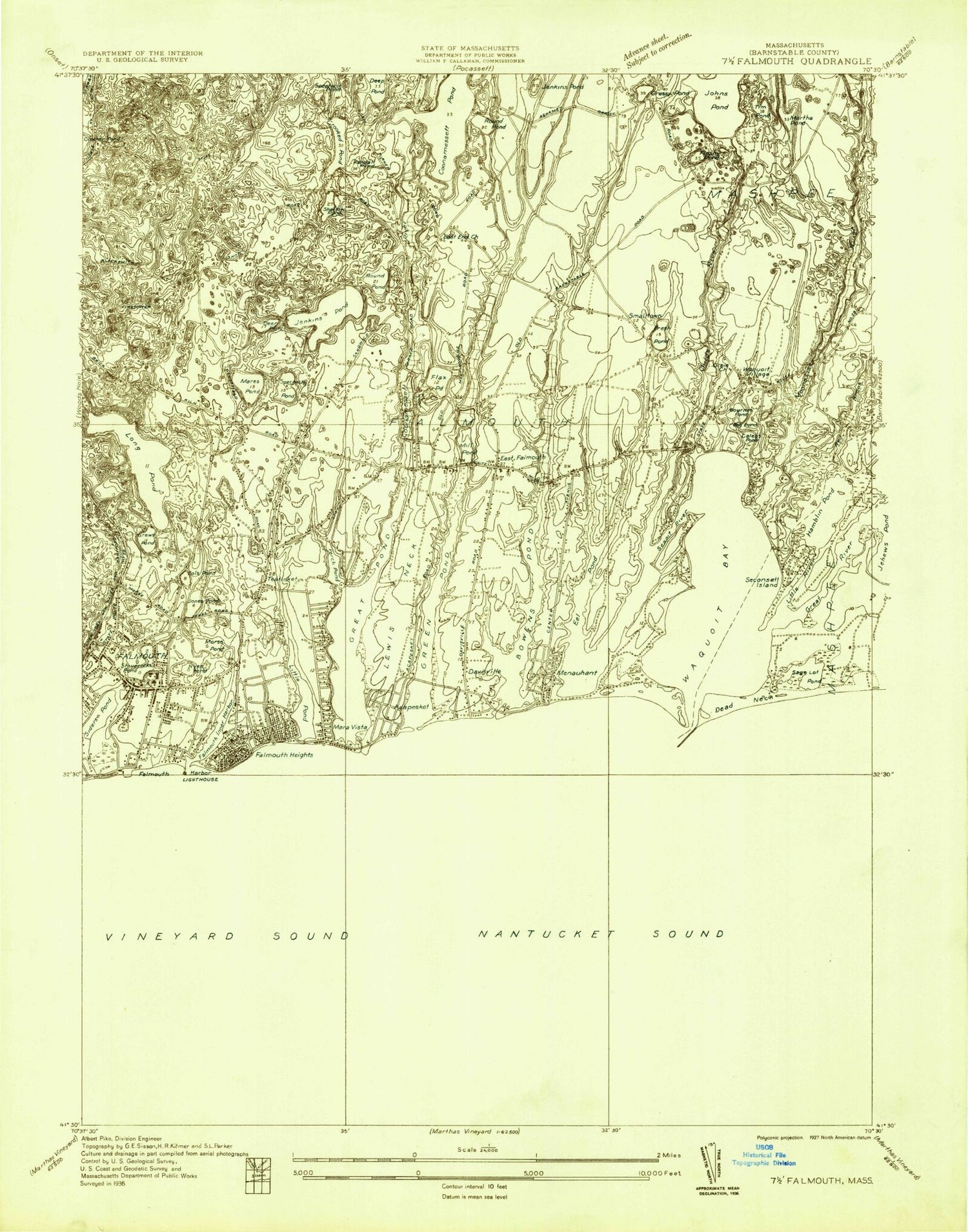
Historical USGS topographic quad map of Falmouth in the state of Massachusetts. Typical map scale is 1:24,000, but may vary for certain years, if available. Print size: 24" x 27"
This quadrangle is in the following counties: Barnstable, Dukes.
The map contains contour lines, roads, rivers, towns, and lakes. Printed on high-quality waterproof paper with UV fade-resistant inks, and shipped rolled.
Contains the following named places: Waquoit Bay East Jetty Light, Green Pond Harbor Light, Falmouth Inner Harbor Light, Waquoit Cemetery, East End Meetinghouse Church, Chesterbrook School, Goodwill Park, Saint Barnabas Church, Saint Patricks Church, Oak Grove Cemetery, Saint Joseph's Cemetery, Saint Thomas Chapel, Falmouth High School, Marine Park, Falmouth Intermediate School, Lawrence High School, Saint Gregory School, Grace Memorial Chapel, Eat Falmouth Elementary School, Saint Anthonys Church, Falmouth Plaza, Teaticket Plaza, Falmouth Mall, Falmouth Townhall, Crane Wildlife Management Area, Fuller Field, Ashumet Holl Reservation, Falmouth Historical Society, The Old Stone Dock, Mill Pond Dam, Red Brook Road Dam, Red Brook Reservoir, Parker Road Bog Dam, Parker Road Pond, Coonamesset Pond Dam, James Pond, Hamblens Point, Wesley Church, Randal Pond, WCIB, Crooked Pond, Crocker Pond, Falmouth, Acapesket, Bardow Shoal, Bog Pond, Bourne Pond, Bournes Pond, Childs River, Coonamessett Pond, Coonamessett River, Davis Neck, Davisville, Dead Neck, Deep Pond, Deer Pond, East Falmouth, Eel Pond, Falmouth Heights, Falmouth Harbor, Falmouth Inner Harbor, Flashy Pond, Flax Pond, Fresh Pond, Grassy Pond, Great Pond, Great River, Green Pond, Grews Pond, Hamblin Pond, Jenkins Pond, Jenkins Pond, Jones Pond, Kingdom Hall, Lewis Neck, L'Hommedieu Shoal, Little Pond, Little River, Long Pond, Mara Vista, Mares Pond, Martha Pond, Menauhant, Mill Pond, Moromoesoy Island, Morse Pond, Nye Pond, Quashnet River, Red Brook, Round Pond, Round Pond, Sage Lot Pond, Seapit River, Seconsett Island, Shallow Pond, Shivericks Pond, Siders Pond, Smalltown, Sols Pond, South Cape Beach, Spectacle Pond, Spectacle Pond, Teaticket, Tim Pond, Waquoit Bay, Washburn Island, Waquoit Village, Town of Falmouth, Bournes Brook (historical), Meadow Neck, Lawrences Neck, Israels Cove, WCIB-FM (Falmouth), WFAL-FM (Falmouth), Fuller House Heliport, Falmouth Airpark, Falmouth Hospital Heliport, Monomoscoy Island, Seconsett Island, Menauhant Beach, Mashpee Public Library, Teaticket Elementary School Media Center, East Falmouth Census Designated Place, Falmouth Census Designated Place, Monomoscoy Island Census Designated Place, Seconsett Island Census Designated Place, Teaticket Census Designated Place, Methodist Society Burying Ground, Old Town Cemetery, Bournes Neck, Falmouth Fire Department, Falmouth Fire Department Station 5, Falmouth Hospital, Falmouth Police Department, Waquoit Post Office, Falmouth Main Post Office, Teaticket Post Office, East Falmouth Post Office, Waquoit Bay East Jetty Light, Green Pond Harbor Light, Falmouth Inner Harbor Light, Waquoit Cemetery, East End Meetinghouse Church, Chesterbrook School, Goodwill Park, Saint Barnabas Church, Saint Patricks Church, Oak Grove Cemetery, Saint Joseph's Cemetery, Saint Thomas Chapel, Falmouth High School, Marine Park, Falmouth Intermediate School, Lawrence High School, Saint Gregory School, Grace Memorial Chapel, Eat Falmouth Elementary School, Saint Anthonys Church, Falmouth Plaza, Teaticket Plaza, Falmouth Mall, Falmouth Townhall, Crane Wildlife Management Area, Fuller Field, Ashumet Holl Reservation, Falmouth Historical Society, The Old Stone Dock, Mill Pond Dam, Red Brook Road Dam, Red Brook Reservoir, Parker Road Bog Dam, Parker Road Pond, Coonamesset Pond Dam, James Pond, Hamblens Point, Wesley Church, Randal Pond, WCIB, Crooked Pond, Crocker Pond, Falmouth, Acapesket, Bardow Shoal, Bog Pond, Bourne Pond, Bournes Pond, Childs River, Coonamessett Pond, Coonamessett River, Davis Neck, Davisville, Dead Neck, Deep Pond, Deer Pond, East Falmouth, Eel Pond, Falmouth Heights, Falmouth Harbor, Falmouth Inner Harbor, Flashy Pond, Flax Pond, Fresh Pond, Grassy Pond, Great Pond, Great River, Green Pond, Grews Pond, Hamblin Pond, Jenkins Pond, Jenkins Pond, Jones Pond, Kingdom Hall, Lewis Neck, L'Hommedieu Shoal, Little Pond, Little River, Long Pond, Mara Vista, Mares Pond, Martha Pond, Menauhant, Mill Pond, Moromoesoy Island, Morse Pond, Nye Pond, Quashnet River, Red Brook, Round Pond, Round Pond, Sage Lot Pond, Seapit River, Seconsett Island, Shallow Pond, Shivericks Pond, Siders Pond, Smalltown