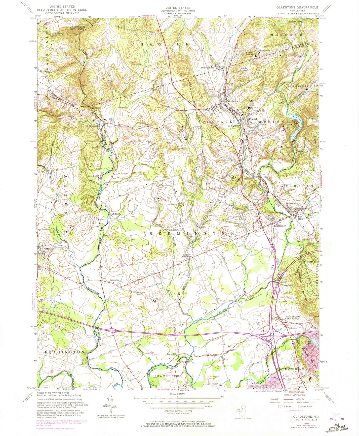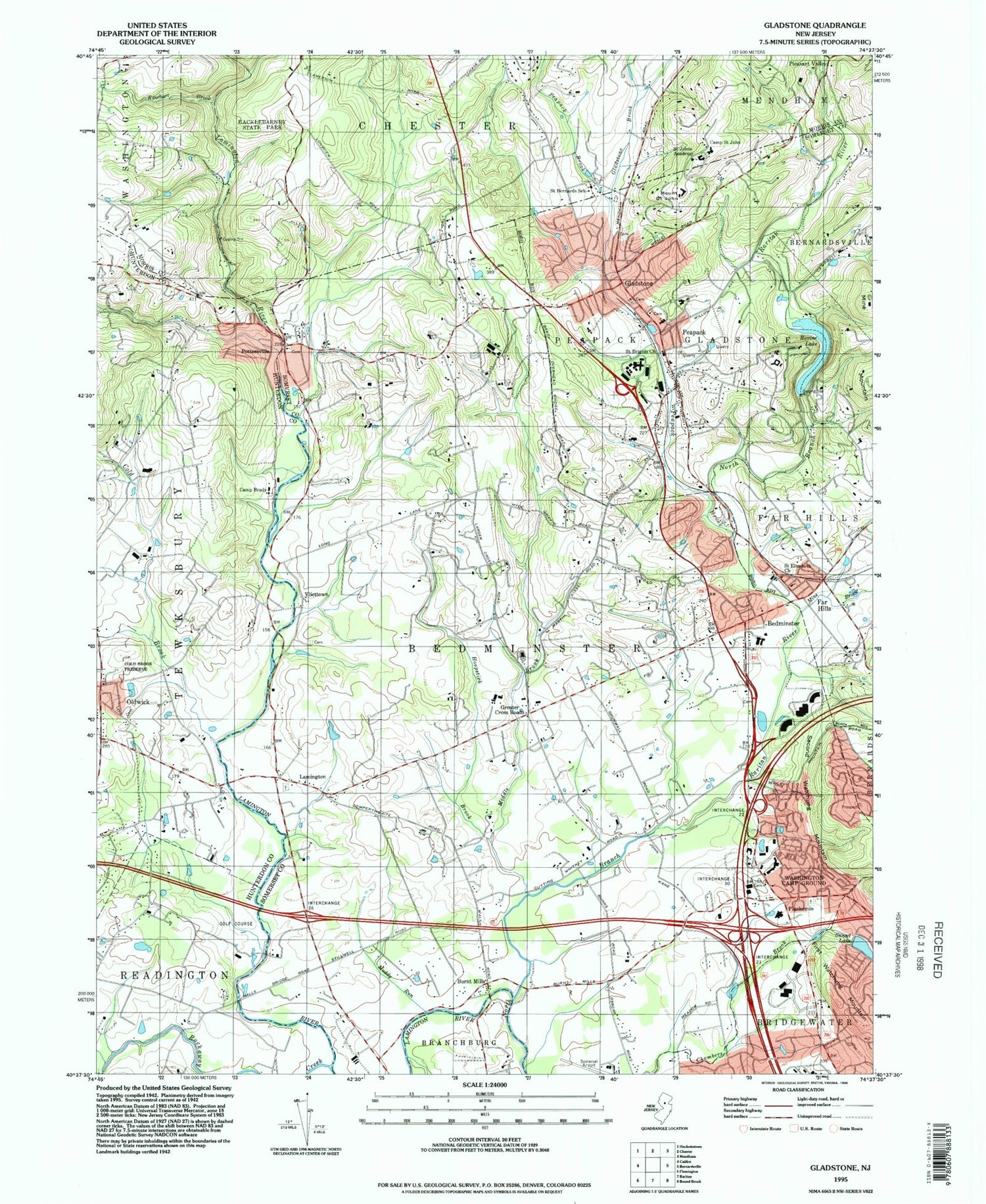
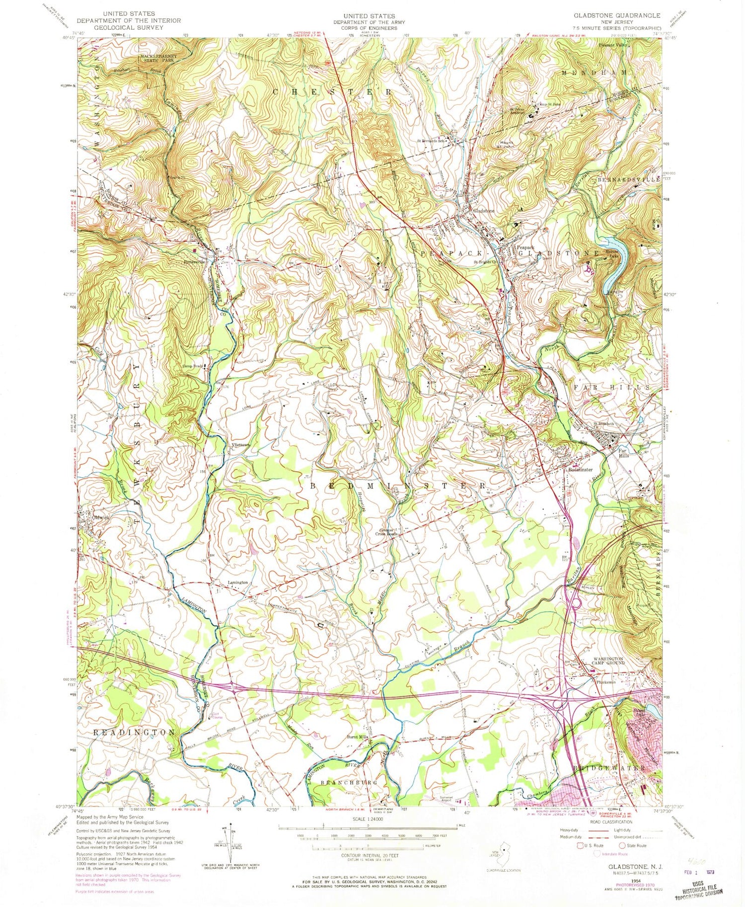
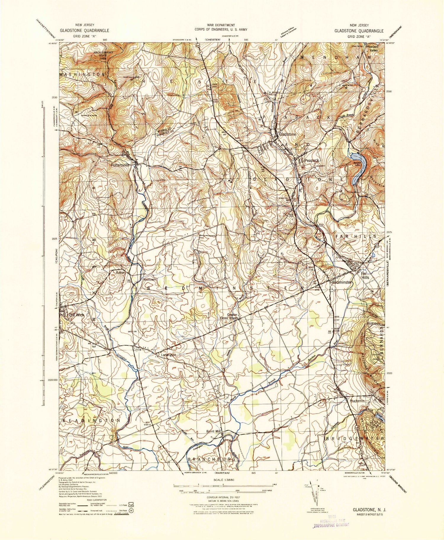
MyTopo
Classic USGS Gladstone New Jersey 7.5'x7.5' Topo Map
Couldn't load pickup availability
Historical USGS topographic quad map of Gladstone in the state of New Jersey. Map scale may vary for some years, but is generally around 1:24,000. Print size is approximately 24" x 27"
This quadrangle is in the following counties: Hunterdon, Morris, Somerset.
The map contains contour lines, roads, rivers, towns, and lakes. Printed on high-quality waterproof paper with UV fade-resistant inks, and shipped rolled.
Contains the following named places: Axle Brook, Bartles Mine, Bedminster, Bedminster Census Designated Place, Bedminster Police Department, Bedminster Post Office, Bedminster Reformed Church, Bedminster Reformed Church Cemetery, Bedminster Township Elementary School, Borough of Far Hills, Borough of Peapack and Gladstone, Burnt Mills, Camp Brady, Camp Saint John, Cedar Lane Farm, Cold Brook, Everitt Academy School, Far Hills, Far Hills - Bedminster Fire Department, Far Hills - Bedminster Fire Department Station 2, Far Hills - Bedminster First Aid Squad, Far Hills Police Department, Far Hills Post Office, Far Hills Station, Fiddler's Elbow Country Club, Fiddlers Elbow Country Club Heliport, Gill Saint Bernards School, Gladstone, Gladstone Brook, Gladstone Post Office, Gladstone Station, Grace Fellowship Chapel, Greater Cross Roads, Hacklebarney State Park, Hamilton Farm Heliport, Herzog Brook, High Time Farm Helistop, Hillside Intermediate School, Hoopstick Brook, Iron Mine, Kiddie Academy School of Bridgewater, Lamington, Lamington Census Designated Place, Lamington House Heliport, Lamington Presbyterian Church, Lamington River, Matheny School, Middle Brook, Mine Brook, Montgomery Academy School, Mount Saint John, Muddy Run, North Branch Peapack Brook, Northstar Air Medical Service, Oldwick, Oldwick Census Designated Place, Oldwick Post Office, Peapack, Peapack and Gladstone First Aid and Rescue Squad, Peapack and Gladstone Police Department, Peapack and Gladstone Volunteer Fire Company, Peapack Brook, Peapack Post Office, Peapack Reformed Church, Peapack Station, Pleasant Valley, Pluckemin, Pluckemin Census Designated Place, Pluckemin Post Office, Pluckemin Presbyterian Church, Pluckemin Presbyterian Church Cemetery, Pottersville, Pottersville Census Designated Place, Pottersville Falls, Pottersville Post Office, Pottersville Reformed Church, Pottersville Volunteer Fire Company, Purnell School, Quail Brook, Ravine Lake, Ravine Lake Dam, Rhinehart Brook, Rockaway Creek, Saint Brigids Church, Saint Elizabeth's Catholic Church, Saint Johns Academy, Saint Luke's Episcopal Church, Somerset Airport, Somerset Hills Learning Institute School, Southdown Heliport, Stonebridge Farm Helistop, Sunset Lake, Sunset Lake Dam, Sutton, The Farm Heliport, The Matheny Hospital and School, The School of the Hills, Township of Bedminster, Trout Brook, Union School, United Methodist Church of Gladstone, United States Equestrian Team Training Center, Vliettown, Washington Camp Ground, Willow School, Willowwood Arboretum, Wortman Mine, ZIP Codes: 07921, 07934, 07977, 07979, 08858