MyTopo
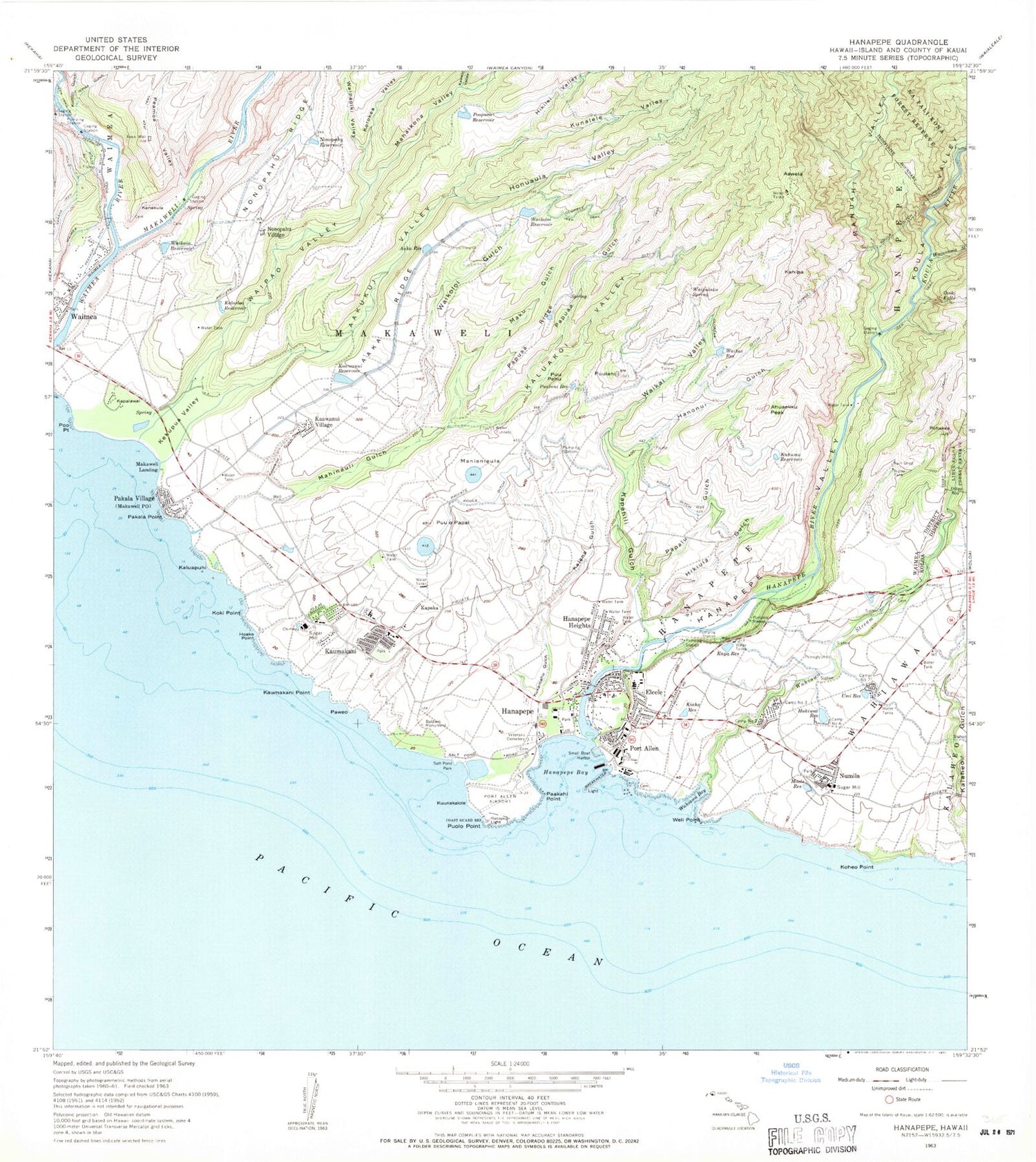
Classic USGS Hanapepe Hawaii 7.5'x7.5' Topo Map
Couldn't load pickup availability
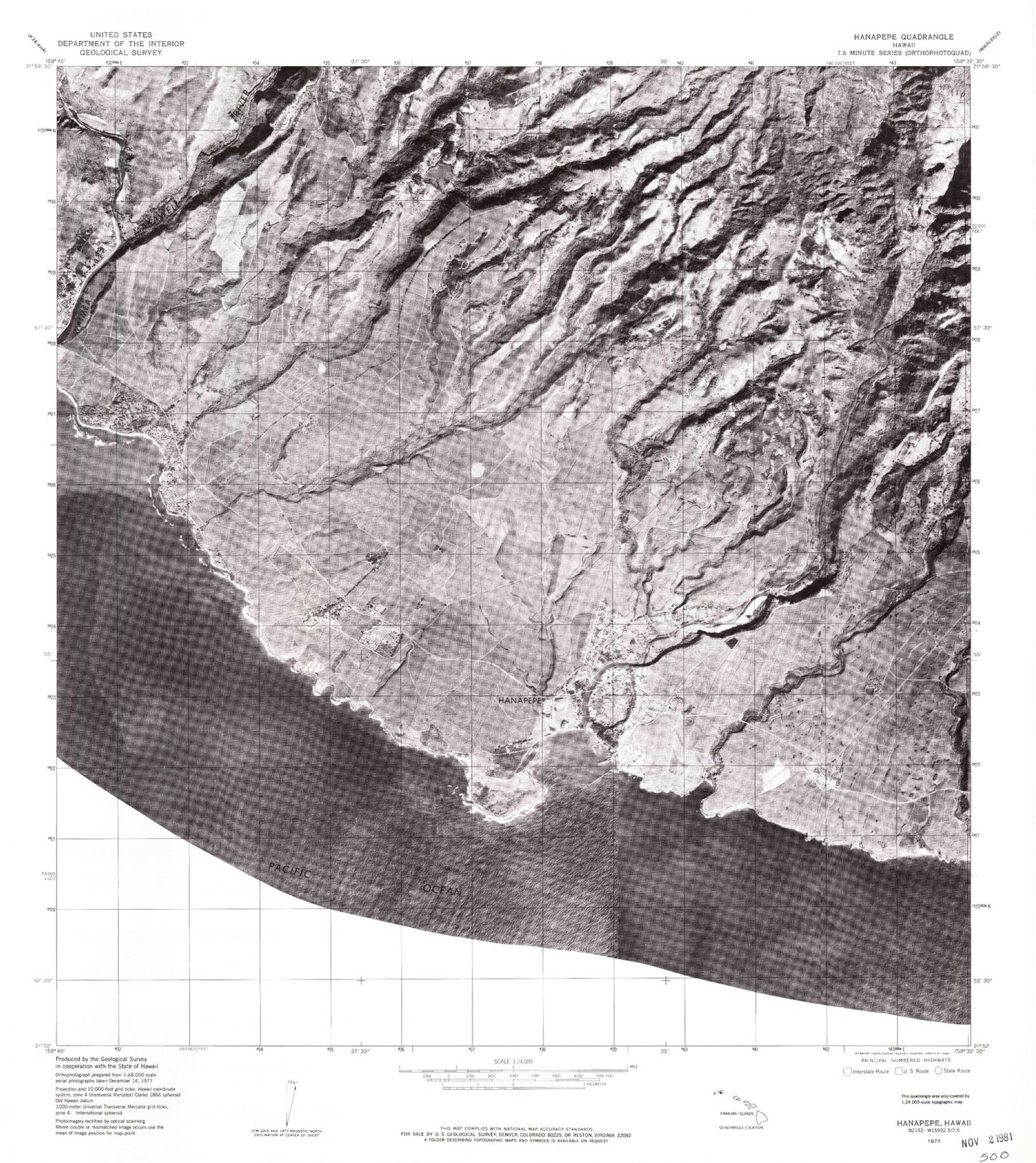
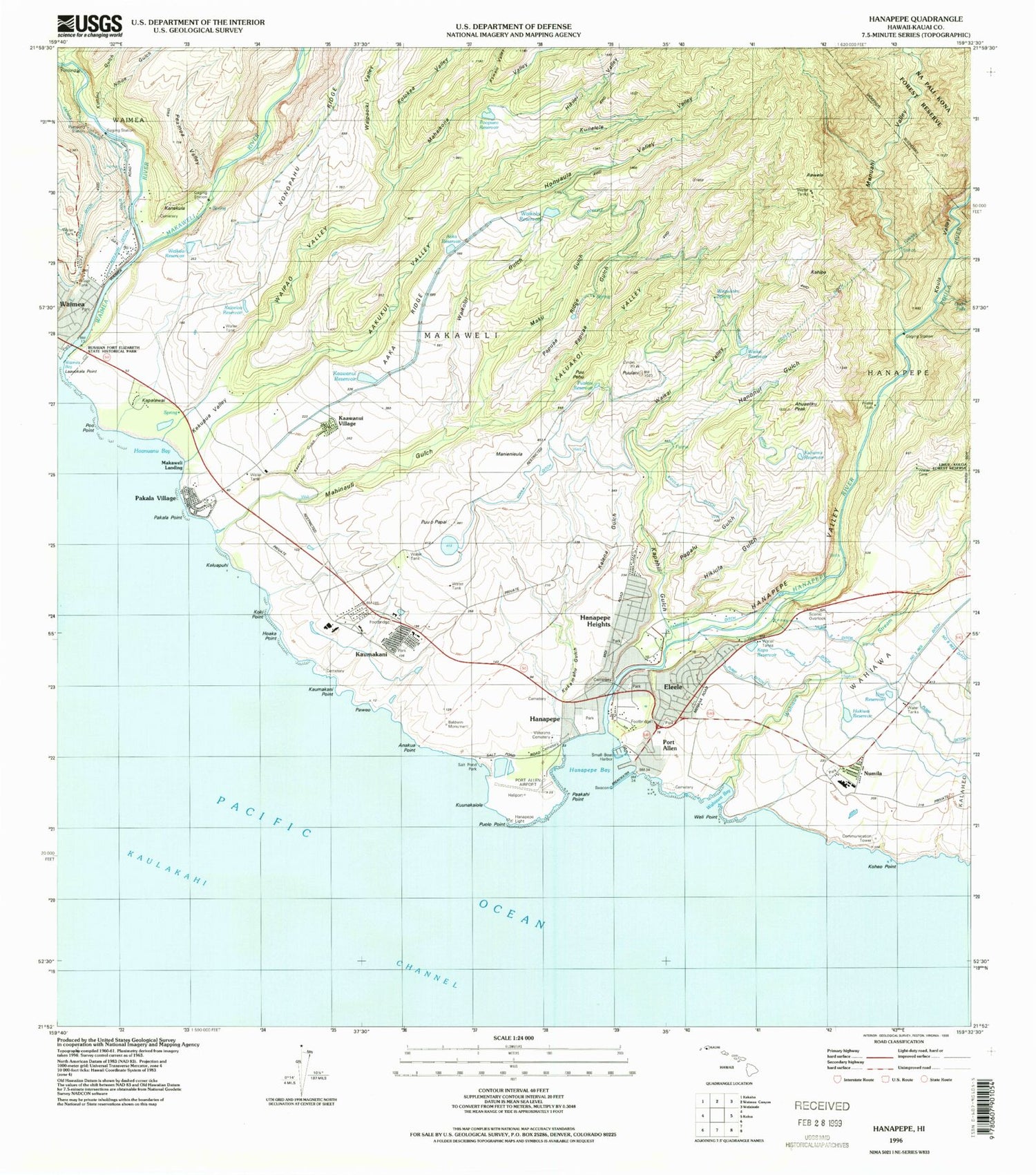
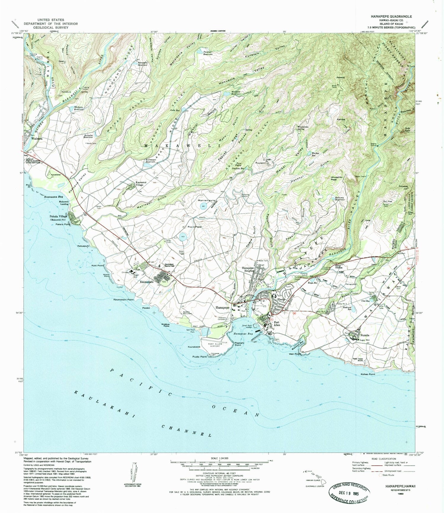
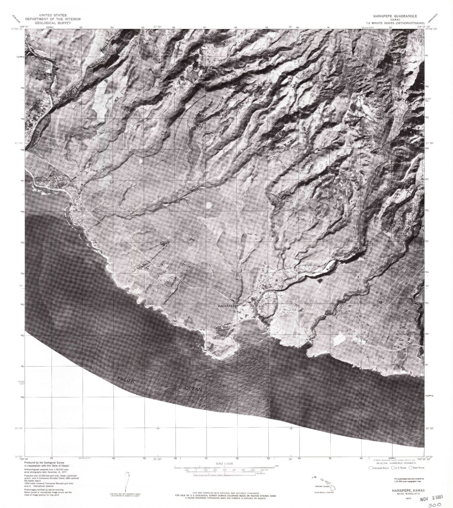
Historical USGS topographic quad map of Hanapepe in the state of Hawaii. Map scale may vary for some years, but is generally around 1:24,000. Print size is approximately 24" x 27"
This quadrangle is in the following counties: Kauai.
The map contains contour lines, roads, rivers, towns, and lakes. Printed on high-quality waterproof paper with UV fade-resistant inks, and shipped rolled.
Contains the following named places: A'aka Reservoir, 'A'aka Ridge, A'akukui Stream, A'akukui Valley, 'A'awela, Ahuaeliku Peak, Baldwin Monument, Camp Number Seven, Camp Number Six, Camp Number Three, Camp Number Two, Cook Landing Site, 'Ele'ele, Eleele Census Designated Place, Eleele Ditch, Eleele Elementary School, Eleele Post Office, Eleele Shopping Center, Filipino Cemetery, First United Church of Christ, Glass Beach, Hanapepe, Hanapepe Bay, Hanapepe Beach Park, Hanapepe Census Designated Place, Hanapepe Ditch, Hanapepe Hawaiian Cemetery, Hanapepe Hawaiian Home Land, Hanapepe Heights, Hanapepe Heights Japanese Cemetery, Hanapepe Japanese Cemetery, Hanapepe Light, Hanapepe Park, Hanapepe Post Office, Hanapepe River, Hanapepe Valley, Hanonui Gulch, Hikilei Valley, Hikiula Gulch, Hiloa Stream, Hoaka Point, Ho'anuanu Bay, Honua'ula Valley, Hukiwai Reservoir, Kaawanui Gulch, Kaawanui Reservoir, Kaawanui Village, Kahipa, Kalaeloa Reservoir, Kalena Gulch, Kaluakoi Valley, Kaluapuhi, Kanekula, Kapa Reservoir, Kapahili Gulch, Kapaka, Kapalawai, Kauai Fire Department Hanapepe Station, Kauai Veterans Cemetery, Kaumakani, Kaumakani Census Designated Place, Kaumakani Point, Kaumakani Post Office, Kaumakani Sports Field, Kawaiu Valley, Kekupua, Kekupua Valley, Kiaha Reservoir, Koheo Point, Koki Point, Kolokea Valley, Ko'ula Ditch, Koula Ditch Tunnel, Ko'ula River, Ko'ula Valley, KUAI-AM (Eleele), Kuhumu Reservoir, Kukamahu Gulch, Kunalele Valley, Kunini Gulch, Kuunakaiole, La'au'okala Point, Maele Reservoir, Mahaikona Valley, Mahinauli Gulch, Makaweli Landing, Makaweli Post Office, Makaweli Reef, Makaweli River, Maku Gulch, Manienie'ula, Manuahi Stream, Manuahi Valley, McBryde Mill, Mokihana Stream, Mokihana Valley, Nihoa Gulch, Nonopahu Reservoir, Nonopahu Village, Numila, Olokele, Olokele Ditch, Olokele Mill, Olokele Trail, Ooiki Falls, Paakahi Point, Pakala Beach, Pakala Point, Pakala Village, Pakala Village Census Designated Place, Papalu Gulch, Papuaa Gulch, Papuaa Ridge, Paweo, Peamoa Valley, Peekauai Ditch, Pohakea, Po'o Point, Po'opueo Reservoir, Port Allen, Port Allen Airport, Port Allen Cemetery, Port Allen Military Reservation, Port Allen Small Boat Harbor, Puolo Point, Puu o Papai, Puu Pehu, Pu'ulani, Pu'ulani Reservoir, Robinson Landing, Salt Pond Beach Park, Secret Beach, Umi Reservoir, Wahiawa Bay, Wahiawa Stream, Waikai Reservoir, Waikai Valley, Waikaia Reservoir, Waikoloi Gulch, Waikoloi Reservoir, Waimea Canyon, Waimea Post Office, Waimea River, Wainonoia Stream, Waipao Valley, Waipaoiki Valley, Waipuloku Spring, Weli Point, ZIP Codes: 96705, 96747