MyTopo
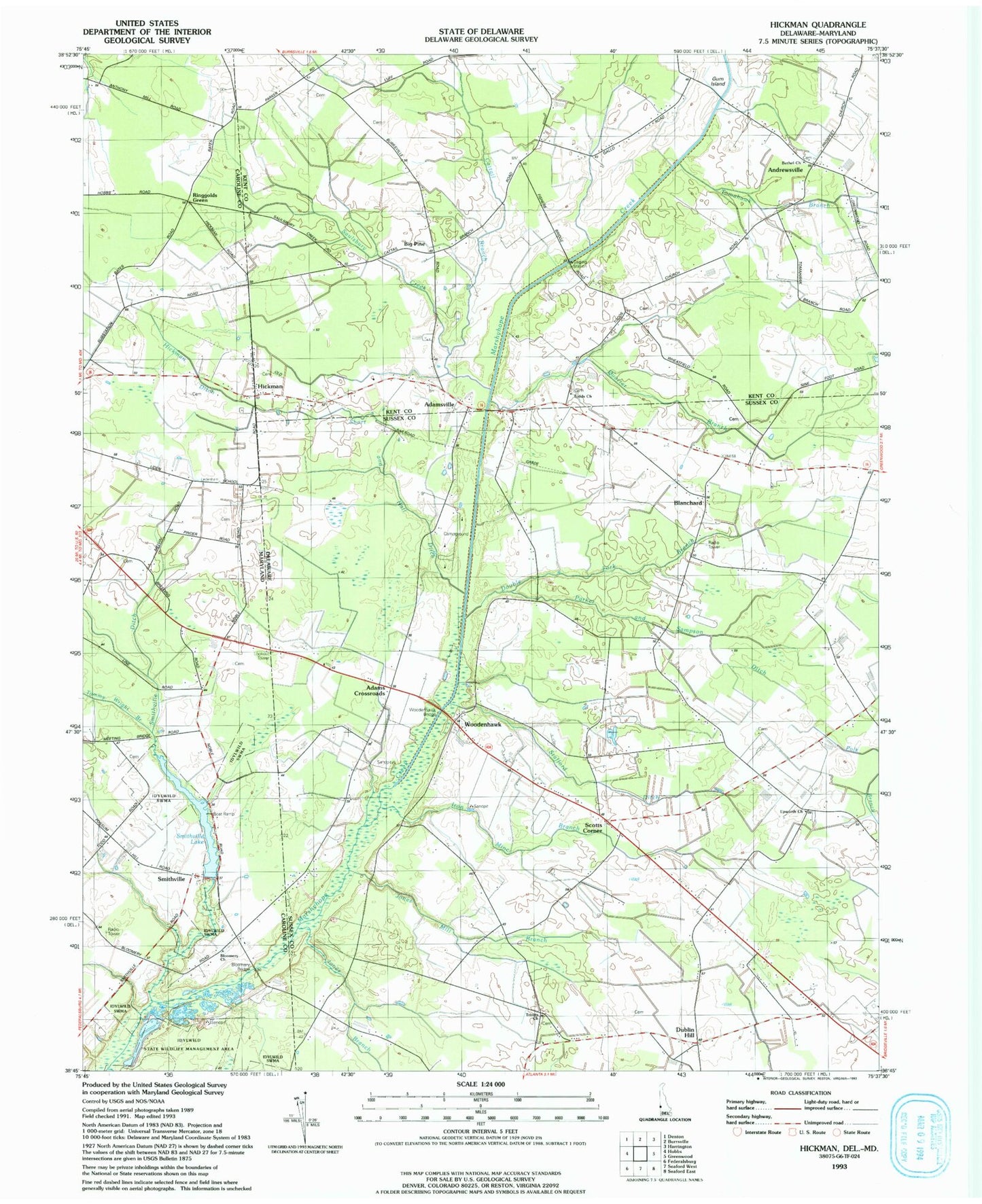
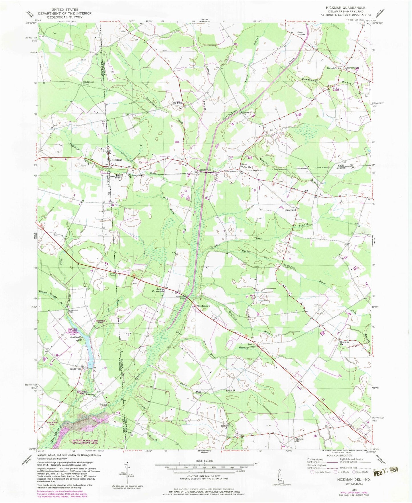
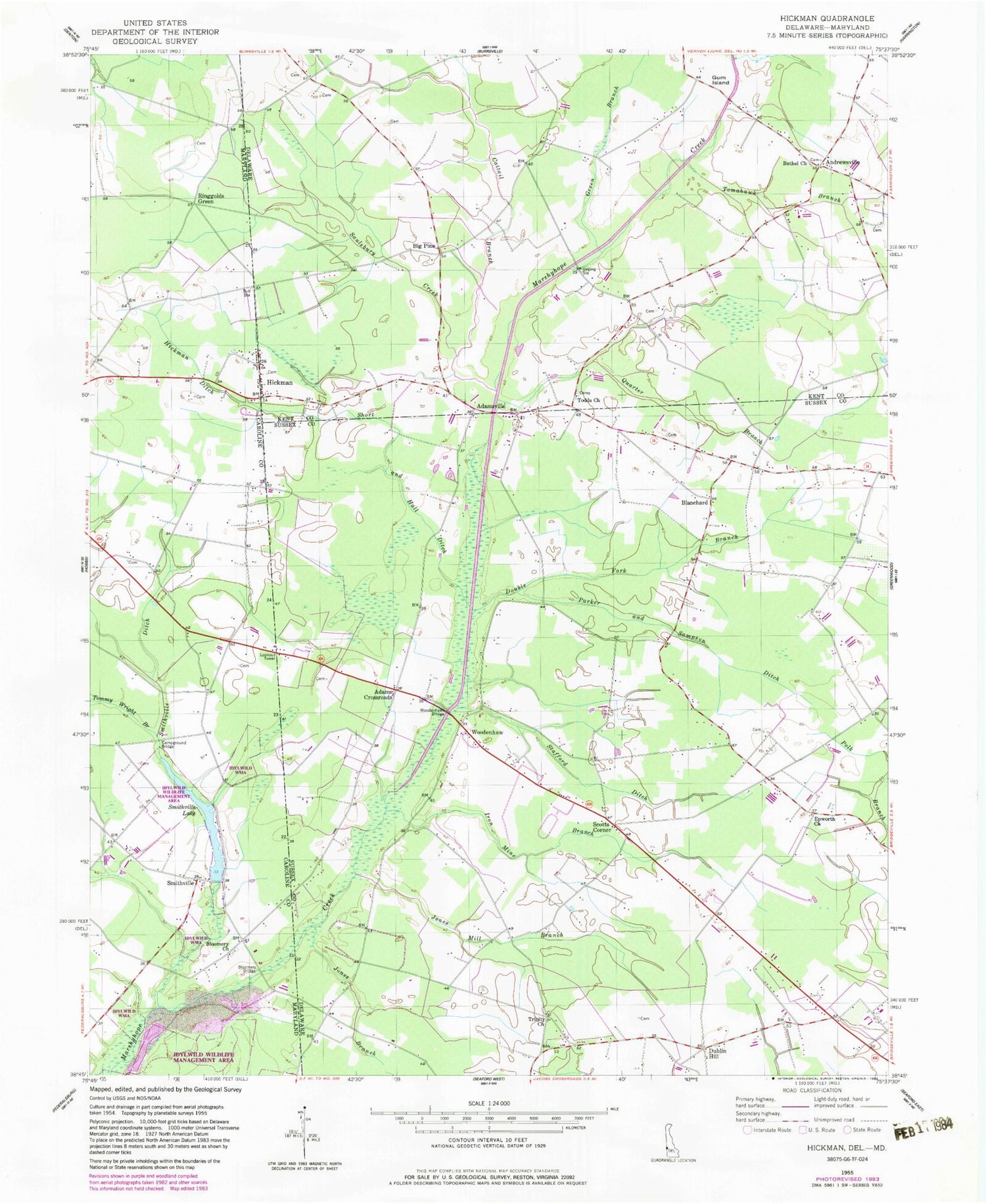
Classic USGS Hickman Delaware 7.5'x7.5' Topo Map
Couldn't load pickup availability
Historical USGS topographic quad map of Hickman in the states of Delaware, Maryland. Map scale may vary for some years, but is generally around 1:24,000. Print size is approximately 24" x 27"
This quadrangle is in the following counties: Caroline, Kent, Sussex.
The map contains contour lines, roads, rivers, towns, and lakes. Printed on high-quality waterproof paper with UV fade-resistant inks, and shipped rolled.
Contains the following named places: Adams Crossroads, Adamsville, Andrewsville, Bethel Cemetery, Bethel Church, Big Pine, Blanchard, Bloomery, Bloomery Bridge, Bloomery Cemetery, Bloomery Church, Bloomery School, Bullock School, Campground Bridge, Cattail Branch, Double Fork Branch, Dublin Hill, Dublin Hill Community House, Epworth Church, Green Branch, Gum Island, Hickman, Hickman Ditch, Iron Mine Branch, Jones Branch, Jones Mill Branch, Northwest Fork Hundred, Parker and Sampson Ditch, Quarter Branch, Saulsbury Creek, School Number 15, Scotts Corner, Short and Hall Ditch, Smithville, Smithville Ditch, Smithville Lake, Smithville Lake Community Park, Smithville Lake Dam, Smithville Mill, Stafford Ditch, Todds Cemetery, Todds Church, Tomahawk Branch, Tommy Wright Branch, Trinity United Methodist Church, WDLE-FM (Federalsburg), Willoughby School, Woodenhawk, Woodenhawk Bridge, Woodenhawk Pines