MyTopo
Classic USGS Keamuku Hawaii 7.5'x7.5' Topo Map
Couldn't load pickup availability
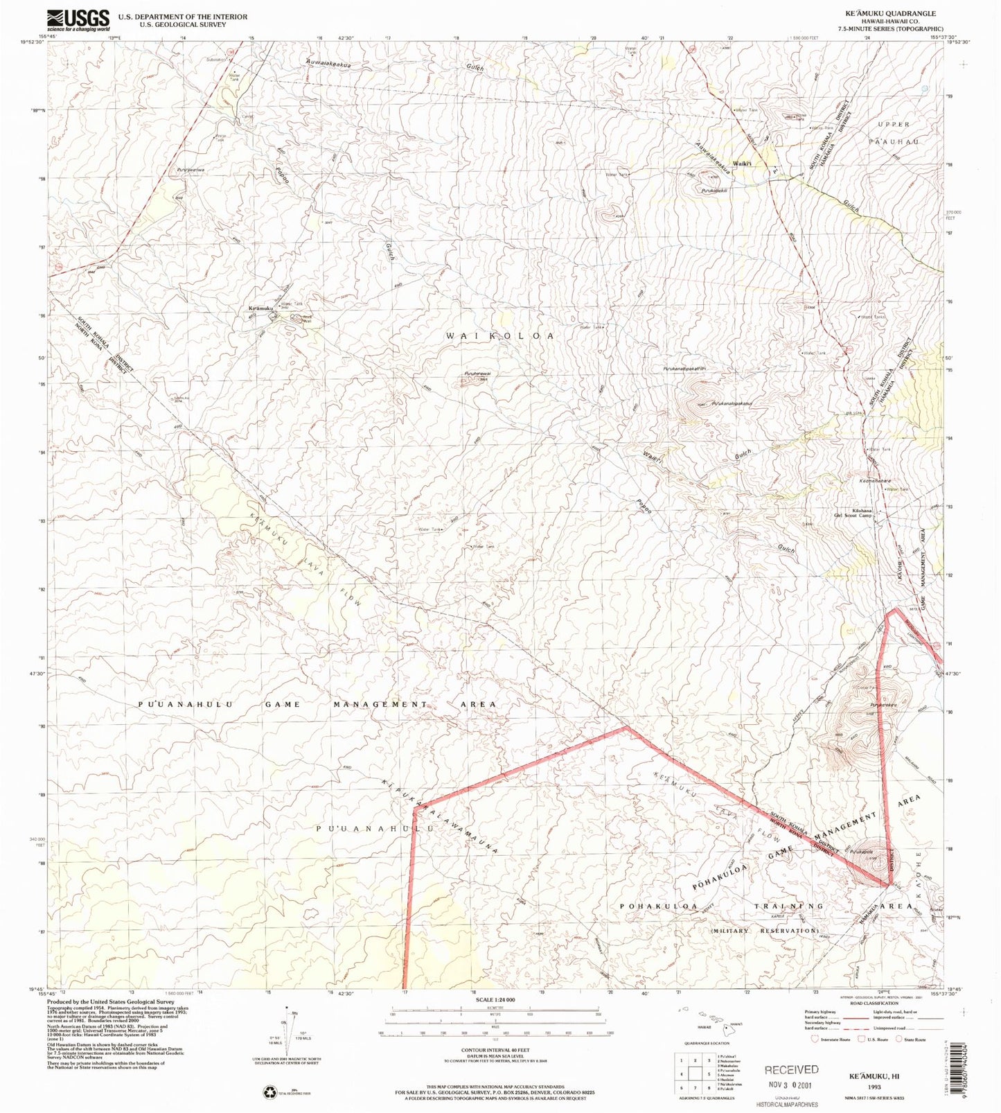
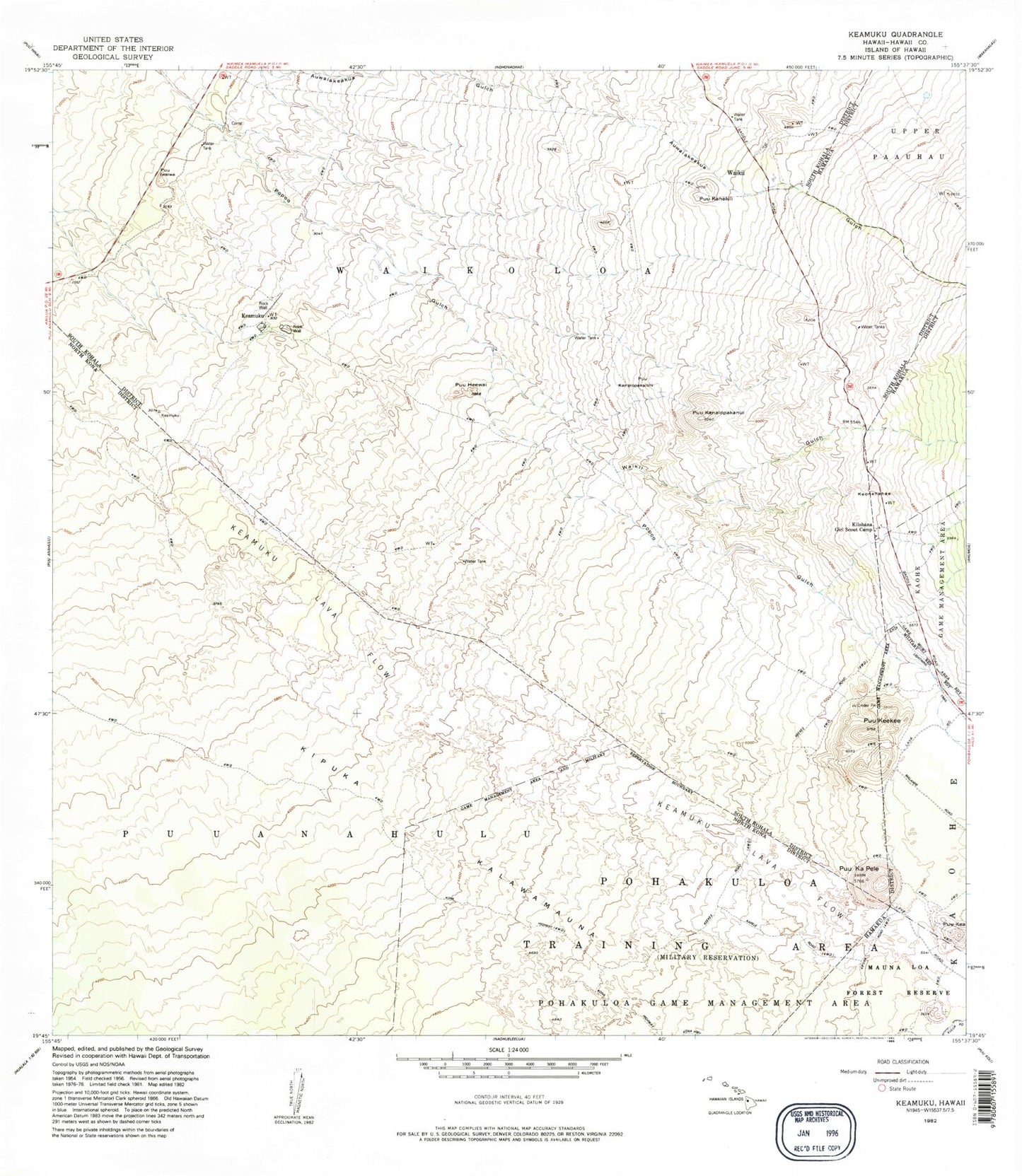
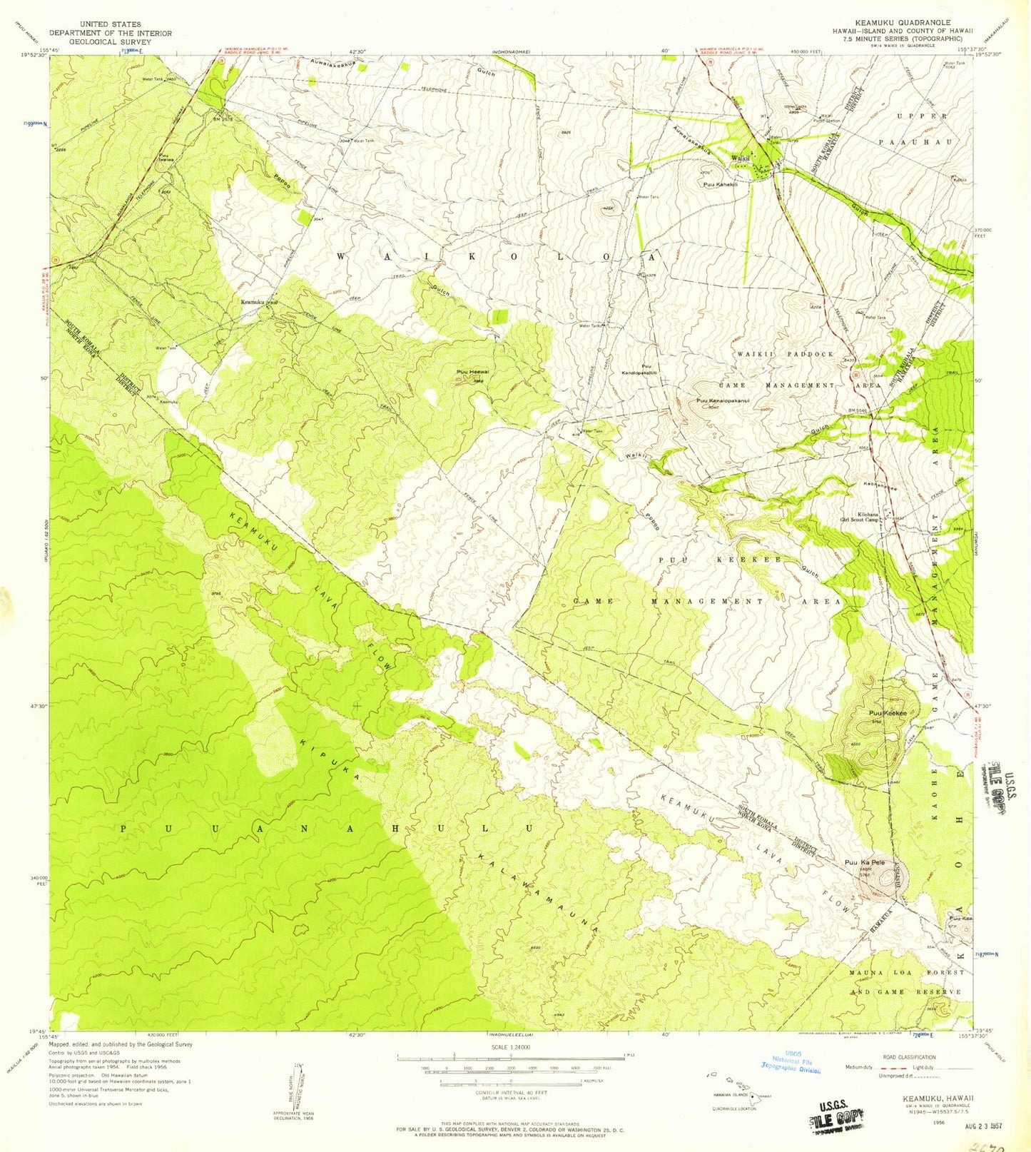
Historical USGS topographic quad map of Keamuku in the state of Hawaii. Map scale may vary for some years, but is generally around 1:24,000. Print size is approximately 24" x 27"
This quadrangle is in the following counties: Hawaii.
The map contains contour lines, roads, rivers, towns, and lakes. Printed on high-quality waterproof paper with UV fade-resistant inks, and shipped rolled.
Contains the following named places: Ke'amuku, Keonehehe'e, Kilohana Girl Scout Camp, Kipukakalawamauna, Lucy Henriques Medical Center Heliport, Pu'uhe'ewai, Pu'u'iwa'iwa, Pu'ukahekili, Pu'ukanalopakali'ili'i, Pu'ukanalopakanui, Pu'ukapele, Pu'uke'eke'e, Pu'uke'eke'e Game Management Area, Waiki'i, Waiki'i Gulch, Waikii Paddock Game Management Area, Waiki'i Pump Station, Waikii Volunteer Fire Station 09A, ZIP Code: 96743