MyTopo
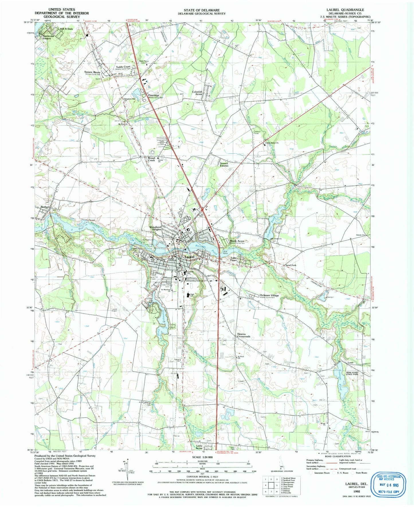
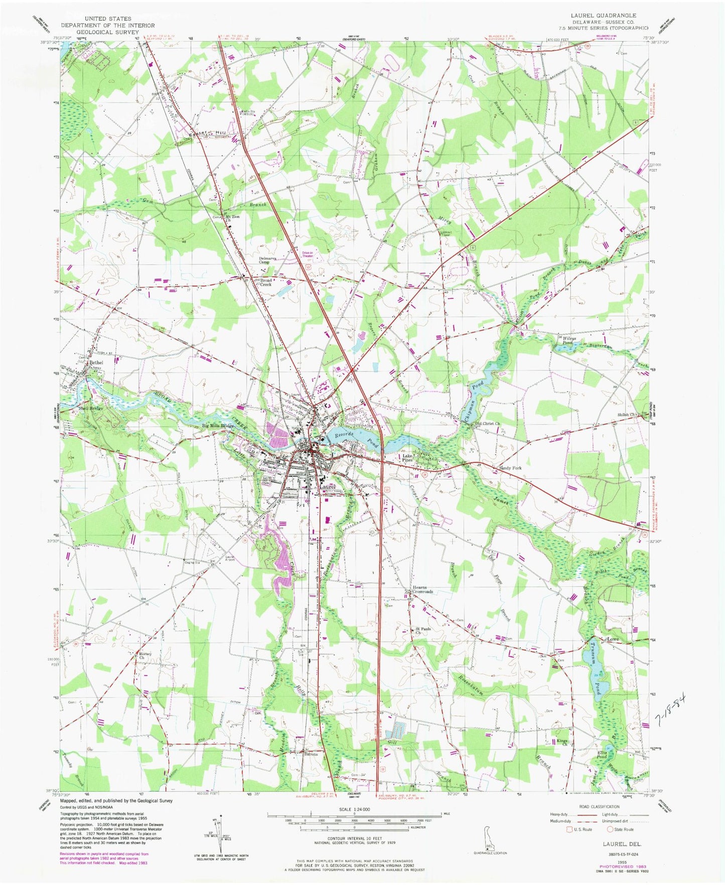
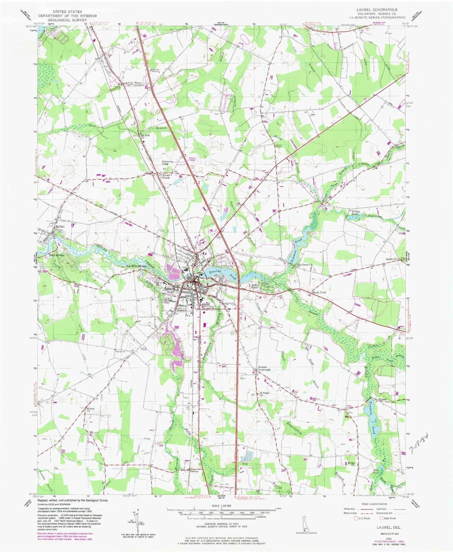
Classic USGS Laurel Delaware 7.5'x7.5' Topo Map
Couldn't load pickup availability
Historical USGS topographic quad map of Laurel in the state of Delaware. Typical map scale is 1:24,000, but may vary for certain years, if available. Print size: 24" x 27"
This quadrangle is in the following counties: Sussex.
The map contains contour lines, roads, rivers, towns, and lakes. Printed on high-quality waterproof paper with UV fade-resistant inks, and shipped rolled.
Contains the following named places: Bacon and Kenney Ditch, Beaverdam Branch, Bethel, Chipman Pond, Collins and Culver Ditch, Cooper Branch, Dukes and Jobs Ditch, Easter Hill, Elliott Pond Branch, Ellis Pond, Gill Branch, Gordon Branch, Hitch Pond Branch, Holly Branch, Holly Ditch, James Branch, Kings Church, Laurel, Laurel Hill Cemetery, Little Creek, Meadow Branch, Mount Zion United Methodist Church, Christ Evangelical Church, Old Ditch, Old Forge Branch, Lake Pines, Records Pond, Rogers Branch, Rossakatum Branch, Saint Pauls United Methodist Church, Shell Bridge, Shiloh Church, Tyndall and James Ditch, Wards Branch, Wileys Pond, Laurel Central Middle School, Laurel Senior High School, Centenary United Methodist Church, New Zion United Methodist Church, Woodland United Methodist Church, Saint Phillips Church, Bethel United Methodist Church, WSUX-FM (Seaford), Black Savannah Ditch, Broad Creek Estates, Records Estates, Dogwood Acres, Hollywoods Park, Pusey Development, Laurel Creek, Sussex Estates, Frederick Acres, Colonial Acres, Wooded Acres, Johnson Development, Bacons, Broad Creek, Hearns Crossroads, Lowe, Sandy Fork, Scottsdale Park Mobile Home Park, Hickman Village Estates Mobile Home Park, Laurel Mobile Home Park, Shady Acres Mobile Home Park, Horns Mobile Village Mobile Home Park, Bulkhead Shoal Channel, Midnight Thicket, Chipman Pond Dam, Records Pond Dam, Horseys Pond, Little Creek Hundred, Broad Creek Hundred, Laurel Airport, Odd Fellows Cemetery, Saint Matthews First Baptist Church, Hill N Dale, Laurel Baptist Church, First Baptist Church of Laurel, Saint Matthews First Baptist Church, Church of God of Prophecy, United Deliverance Bible Center, Living Water Church, Christ Evangelistic Church, Kingdom Hall of Jehovahs Witnesses, Seventh Day Adventist Church, Big Mills Bridge (historical), Delmarva Camp (historical), Horsey Church (historical), Lowes Lakeview Campground (historical), West Laurel School, North Laurel Elementary School, WECY-AM (Seaford), Dickerson Manor, Woodland Heights, Nanticoke Estates, Mumford Manor, Lakeside Manor, Laurel-Delmar Division, Laurel Police Department, Bethel Post Office, Mount Zion Cemetery, New Mount Zion Methodist Cemetery, Laurel Town Hall, Laurel Post Office, Laurel Public Library, Route 13 Market Shopping Center, Town of Bethel, Town of Laurel, Laurel Fire Department Station 1, Harvest Christian Church