MyTopo
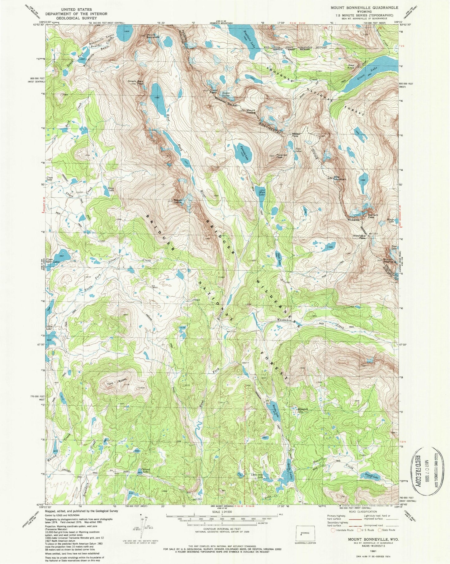
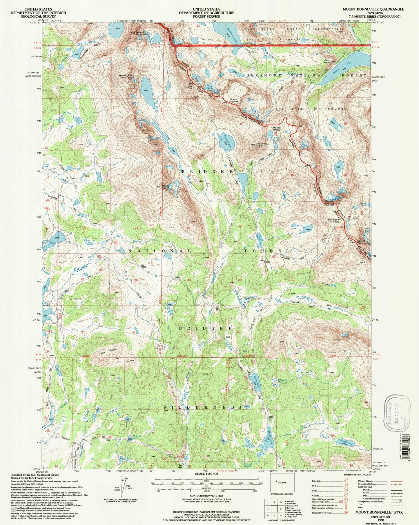
USGS Classic Mount Bonneville Wyoming 7.5'x7.5' Topo Map
Couldn't load pickup availability
Historical USGS topographic quad map of Mount Bonneville in the state of Wyoming. Scale: 1:24000. Print size: 24" x 27"
This quadrangle is in the following counties: Fremont, Sublette.
The map contains contour lines, roads, rivers, towns, lakes, and grids including latitude / longitude and UTM / MGRS. Printed on high-quality waterproof paper with UV fade-resistant inks.
Contains the following named places: Baptiste Creek, Baptiste Lake, Bears Ears Trail, Bernard Peak, Bonneville Basin, Bonneville Lakes, Mount Bonneville, Chilcoot Lake, Dads Lake, Dike Mountain, Donald Creek, Donald Lake, East Park Lakes, Elizabeth Lake, Mount Geikie, Grave Lake, Haily Pass, Hooker Glacier, Mount Hooker, Mays Lake, Pyramid Lake, Pyramid Peak, Raid Peak, Sheep Lake, Skull Lake, Tower Peak, Twin Buttes, Washakie Creek, Washakie Pass, Washakie Peak, Pilot Knob, Little Dads Lake, Marms Lake, Hailey Pass Trail, Pyramid Lake Trail, Shadow Lake Trail, Crossover Trail, Twin Lakes