MyTopo
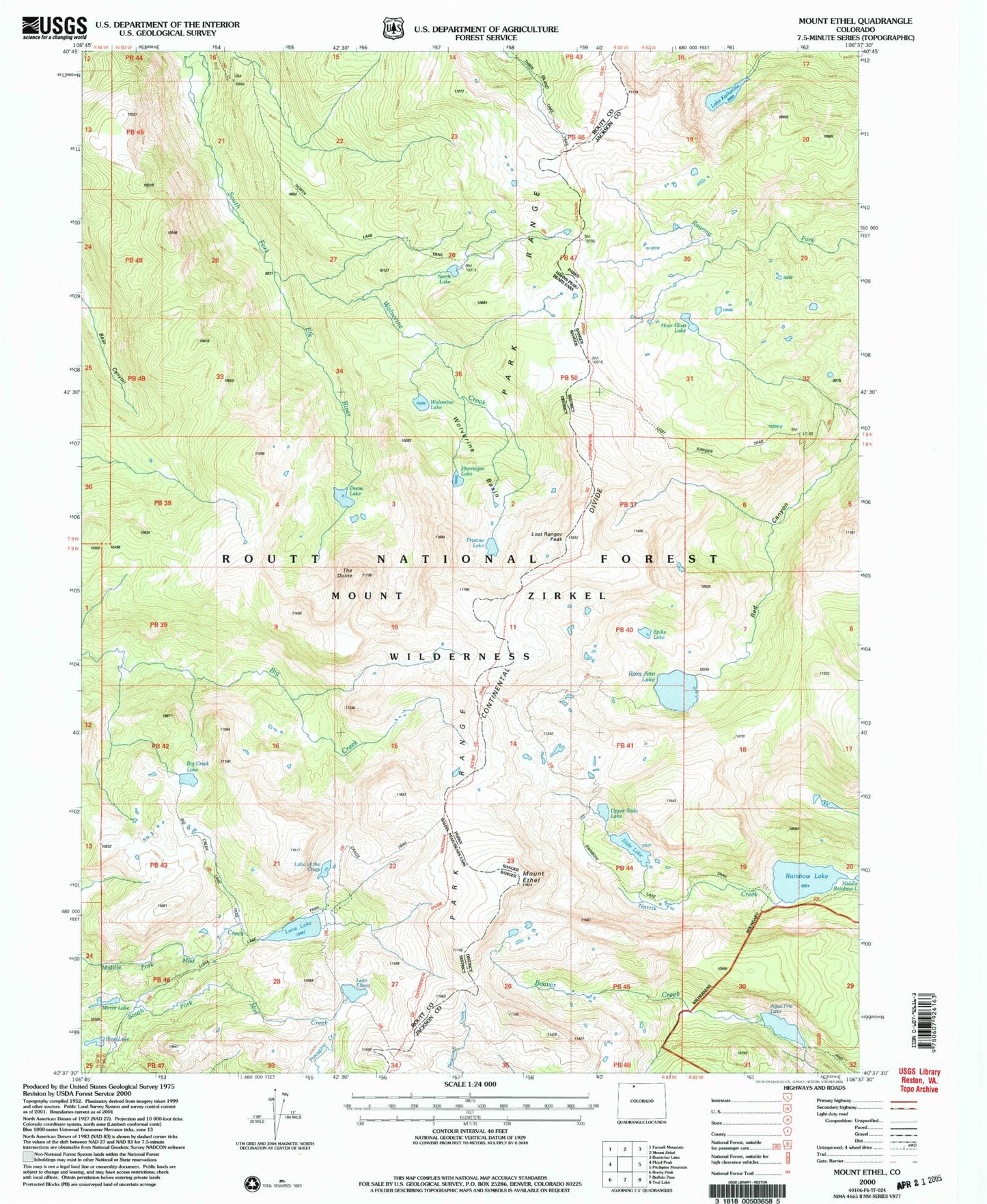
USGS Classic Mount Ethel Colorado 7.5'x7.5' Topo Map
Couldn't load pickup availability
Historical USGS topographic quad map of Mount Ethelin the states of Colorado, Wyoming. Scale: 1:24000. Print size: 24" x 27"
This quadrangle is in the following counties: Jackson, Routt.
The map contains contour lines, roads, rivers, towns, lakes, and grids including latitude / longitude and UTM / MGRS. Printed on high-quality waterproof paper with UV fade-resistant inks.
Contains the following named places: North Lake, Rosa Lake, Mirror Lake, Dome Lake, Wolverine Lake, Wolverine Basin, Lake Katherine, Wolverine Creek, Big Creek Lake, Ptarmigan Lake, Pristine Lake, The Dome, Lost Ranger Peak, Roxy Ann Lake, Upper Slide Lake, Slide Lake, Rainbow Lake, Agua Fria Lake, Lake Elbert, Luna Lake, Lake of the Crags, Mount Ethel, Wyoming Trail, Park Range, Spike Lake, Crags Trail, Big Creek Lake Trail, Aqua Fria Dam, Aqua Fria Reservoir, North Lake Trail, Rainbow Lake Trail, Lost Ranger Trail, Park Range