MyTopo
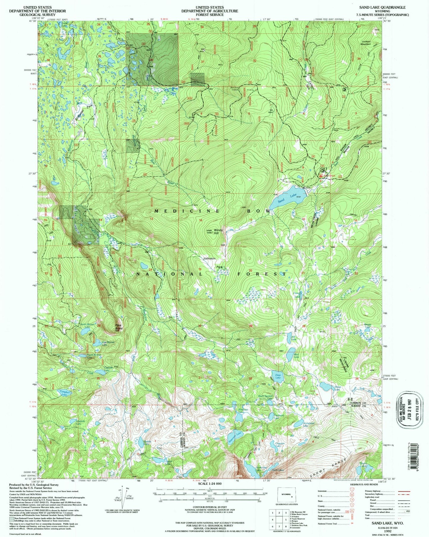
USGS Classic Sand Lake Wyoming 7.5'x7.5' Topo Map
Couldn't load pickup availability
Historical USGS topographic quad map of Sand Lake in the state of Wyoming. Scale: 1:24000. Print size: 24" x 27"
This quadrangle is in the following counties: Albany, Carbon.
The map contains contour lines, roads, rivers, towns, lakes, and grids including latitude / longitude and UTM / MGRS. Printed on high-quality waterproof paper with UV fade-resistant inks.
Contains the following named places: Arrowhead Lake, Bow River Overlook, Campbell Lake, Carlson Park, Carlson Park Guard Station, Cascade Lake, Corral Lake, Crescent Lake, Cutthoat Lake, Deep Creek Campground, Deep Lake, East Banner Lake, Glacier Lakes, Jeff Lake, Johnson Park, Lookout Mountain, Meadows Lakes, Mutt Lake, North Banner Lake, North Gap Lake, Pine Butte, Quealy Lake, Reservoir Lake, Sand Lake, Sheep Lake, Shelf Lakes, South Banner Lake, Stillwater Park, Vagner Lake, Windy Hill, Snowy Range, Edwards Lake, Black Spotted Lake, Bow River Observation Site, Wheatland Reservoir Dam, Corpening Dam, Corpening Reservoir, Drillers Lake, Grassy Lake, Little Long Lake, Waterloo Prospect, Golden Crown Mining Syndicate Mine, Sand Lake Lodge, Upper Long Lake, Vosseller Lake