MyTopo
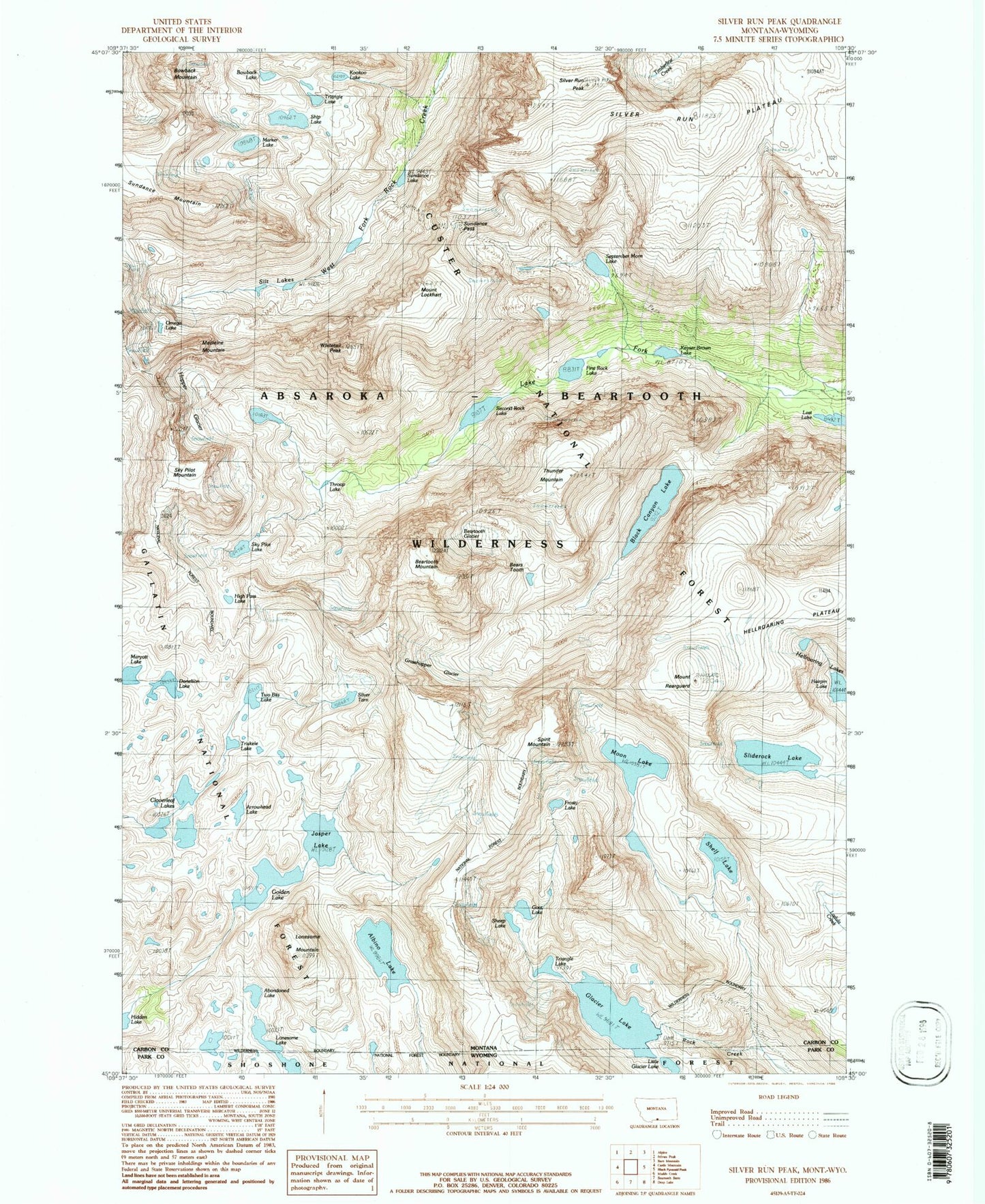
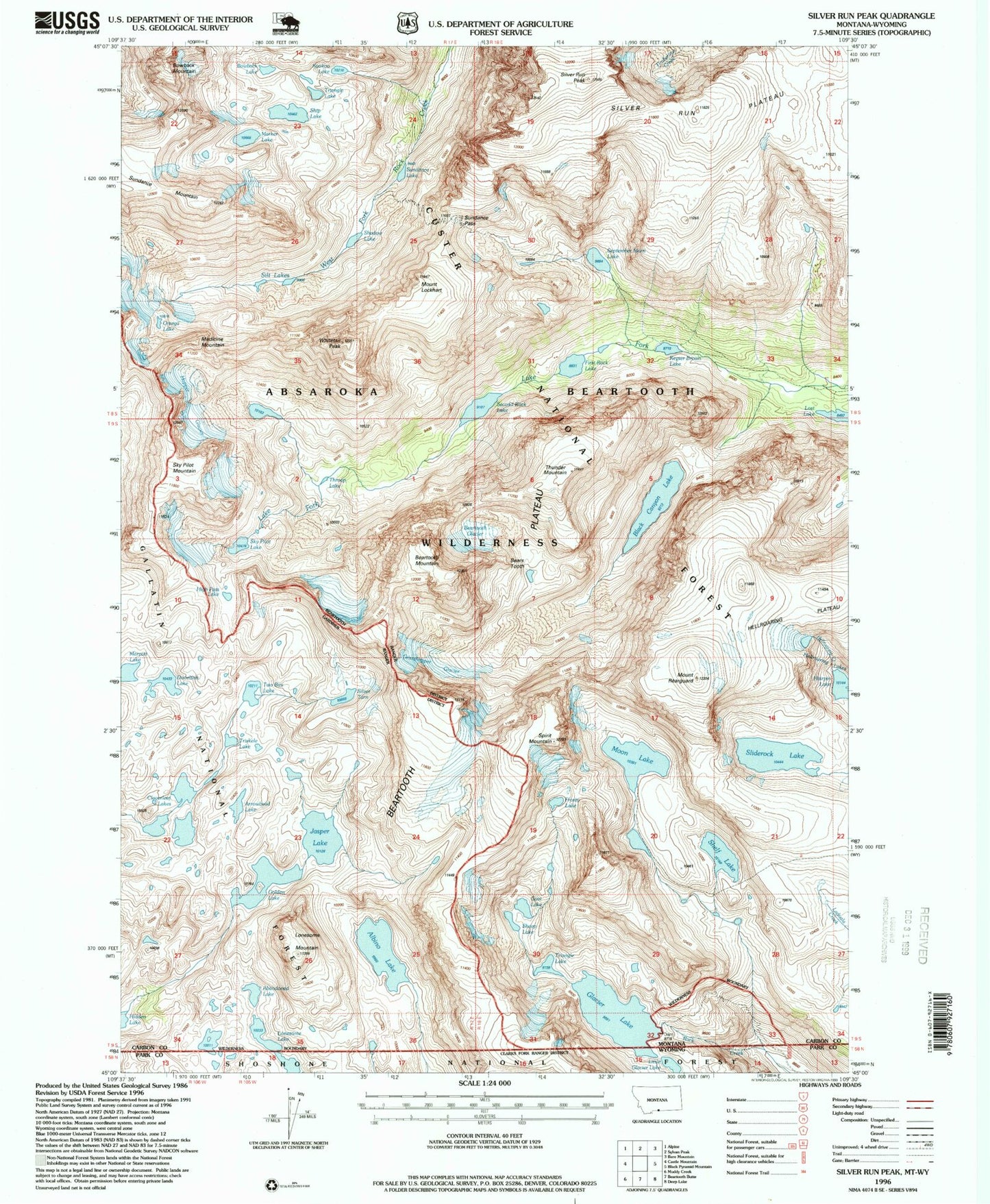
USGS Classic Silver Run Peak Montana 7.5'x7.5' Topo Map
Couldn't load pickup availability
Historical USGS topographic quad map of Silver Run Peakin the states of Montana, Wyoming. Scale: 1:24000. Print size: 24" x 27"
This quadrangle is in the following counties: Carbon, Park.
The map contains contour lines, roads, rivers, towns, lakes, and grids including latitude / longitude and UTM / MGRS. Printed on high-quality waterproof paper with UV fade-resistant inks.
Contains the following named places: Albino Lake, Beartooth Glacier, Beartooth Mountain, Black Canyon Lake, Bowback Lake, Cloverleaf Lakes, First Rock Lake, Frosty Lake, Glacier Lake, Golden Lake, Grasshopper Glacier, Hopper Glacier, Jasper Lake, Keyser Brown Lake, Mount Lockhart, Lonesome Lake, Lonesome Mountain, Lost Lake, Medicine Mountain, Moon Lake, Omega Lake, Mount Rearguard, Second Rock Lake, September Morn Lake, Shadow Lake, Shelf Lake, Ship Lake, Silt Lakes, Silver Run Peak, Sliderock Lake, Sundance Lake, Sundance Mountain, Sundance Pass, Thunder Mountain, Triangle Lake, Whitetail Peak, Glacier Lake North Dam, Glacier Lake, Glacier Lake South Dam, Hairpin Lake, Bears Tooth, Spirit Mountain, Sheep Lake, Goat Lake, Abandoned Lake, Arrowhead Lake, Kookoo Lake, Marker Lake, Triskele Lake, Silver Tarn, Two Bits Lake, Donelson Lake, High Pass Lake, Sky Pilot Lake, Metcalf Mountain, Glacier Lake, Lonesome Lake, Little Glacier Lake