MyTopo
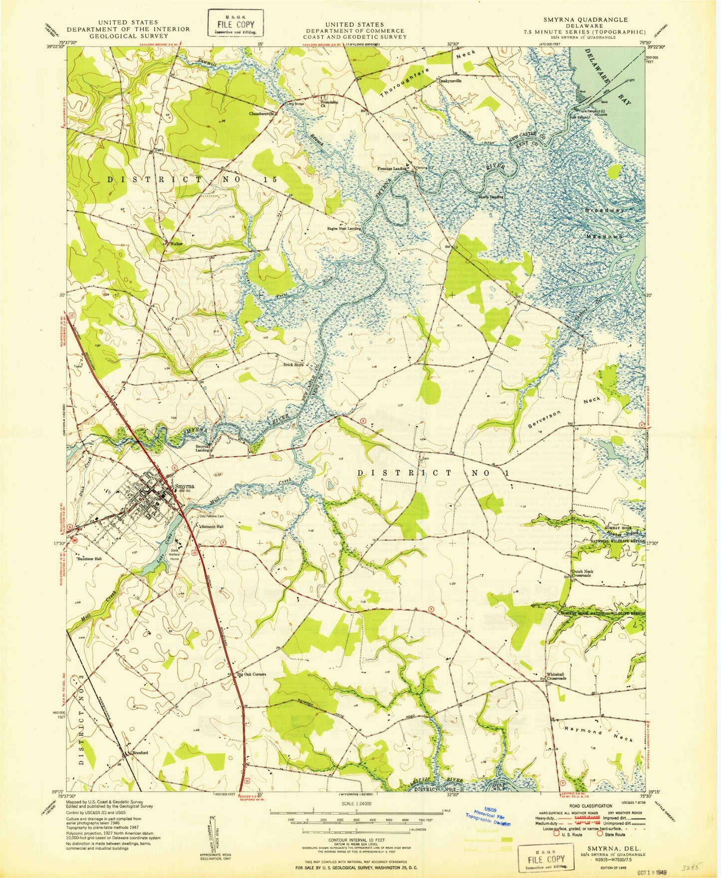
Classic USGS Smyrna Delaware 7.5'x7.5' Topo Map
Couldn't load pickup availability
Historical USGS topographic quad map of Smyrna in the state of Delaware. Map scale may vary for some years, but is generally around 1:24,000. Print size is approximately 24" x 27"
This quadrangle is in the following counties: Kent, New Castle.
The map contains contour lines, roads, rivers, towns, and lakes. Printed on high-quality waterproof paper with UV fade-resistant inks, and shipped rolled.
Contains the following named places: American Legion Ambulance, Appoqueneme, Asbury United Methodist Church, Bannister Hall, Belmont Hall, Bennefield Branch, Bethel African Methodist Episcopal Church, Big Oak Corners, Bombay Woods, Brenford, Brick Store, Broadway Meadows, Burtonwood Village, Carroltown, Cedarbrook Acres, Centennial United Methodist Church, Chambersville, Church of the Nazarene, Citizens' Hose Company Station 44, Colmar Manor, Commerce Square, Corks Point Ditch, Deakyneville, Delaware Correctional Center, Delaware State Emergency Management Agency, Duck Creek, Duck Creek Hundred, Duck Creek Landing, Duck Creek Pond Dam, Dutch Neck Crossroads, Eagles Nest Landing, East Elementary Early Childhood Center, First Presbyterian Church, Fleming House, Flemings Landing, Friendship United Methodist Church, Gardenside, Garrison Lake Golf Course, Greens Branch, Hay Point Landing, Hedgerow Hollow Mobile Home Park, Hickory Ridge, Ivy Dale Farm, James T Vaughn Correctional Center, John Bassett Moore Middle School, Lake Como, Lake Como Dam, Lawndale, Little Neck, Long Bridge, Long Point Landing, Loving Care Nursery School and Kindergarten Incorporated, Mallards Run, Maplehurst, Mill Creek, Millcreek, Morris Branch, Mount Olive Pentecostal Church, Nandains Landing, Newberg Airport, North Gateway Shopping Center, Peace Lutheran Church, Ravenwood, Raymond Neck, Ridgewood Manor, Saint Peters Church, Saint Polycarp Catholic Church, Salisbury, Sawmill Branch, Serverson Neck, Sheriden, Shorts Landing, Smyrna, Smyrna Airport, Smyrna Christian School, Smyrna Division, Smyrna Elementary School, Smyrna Landing, Smyrna Middle School, Smyrna Municipal Park, Smyrna North Elementary School, Smyrna Police Department, Smyrna Post Office, Smyrna Public Library, Smyrna River, Smyrna School District, Smyrna Town Hall, Spruance City, Spruances Branch, Spruances Neck, Straight Ditch, Sunnyside Acres, Sunnyside Village, Tadpole Neck, Taylors Gut, Taylors Gut Landing, Tent, Thorofare, Town of Smyrna, Village of Garrison Lake, Walker, Wesleyan Church, West Shore, Whitehall Crossroads, Windy Way, Woodland Beach State Wildlife Management Area, Woodland Court Mobile Home Park, ZIP Code: 19977