MyTopo
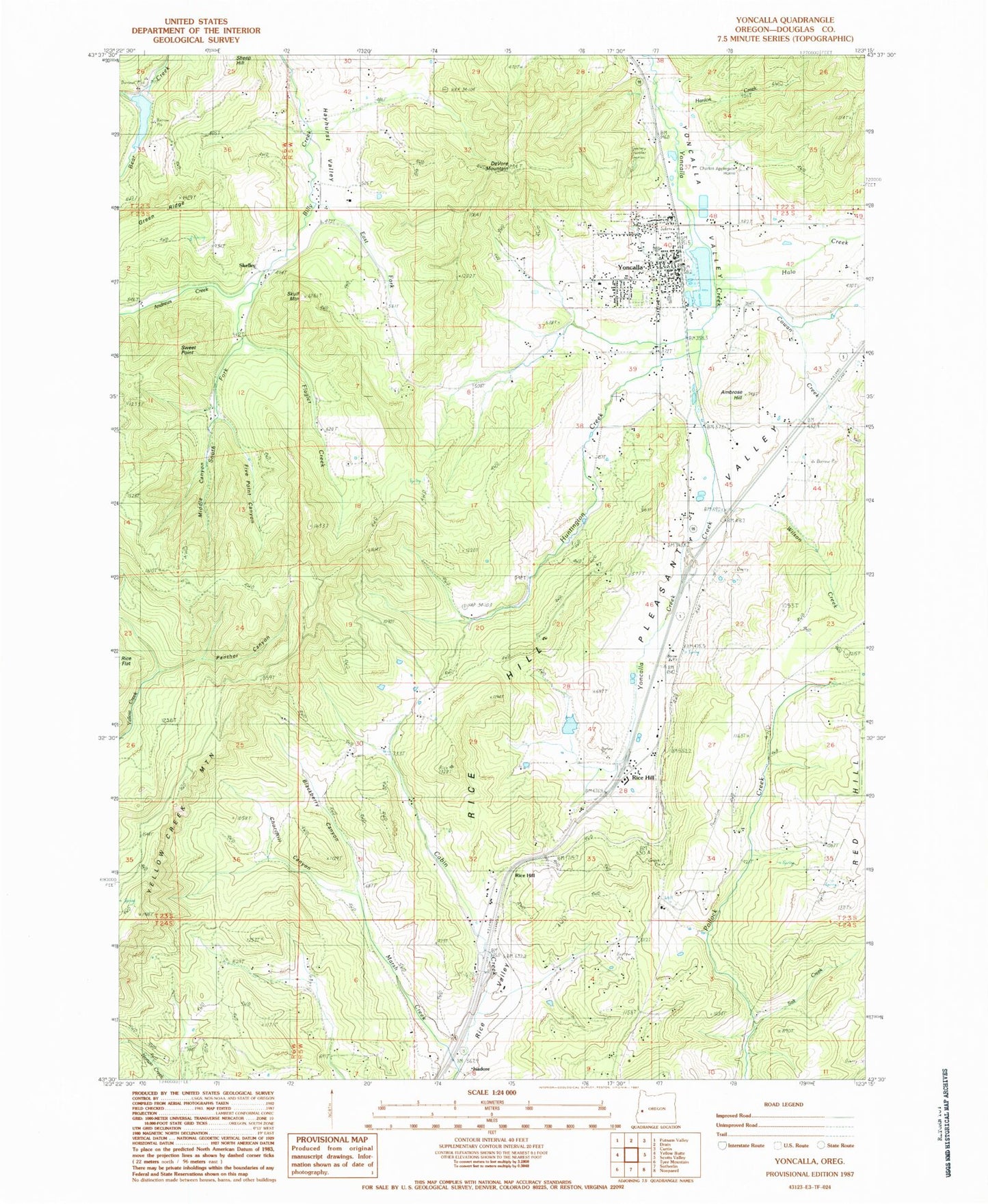
Classic USGS Yoncalla Oregon 7.5'x7.5' Topo Map
Couldn't load pickup availability
Historical USGS topographic quad map of Yoncalla in the state of Oregon. Map scale may vary for some years, but is generally around 1:24,000. Print size is approximately 24" x 27"
This quadrangle is in the following counties: Douglas.
The map contains contour lines, roads, rivers, towns, and lakes. Printed on high-quality waterproof paper with UV fade-resistant inks, and shipped rolled.
Contains the following named places: Ambrose Hill, Andrews Creek, Bear Creek Dam, Bear Creek Reservoir, Blackberry Canyon, Charles Applegate House, Churchill Canyon, City of Yoncalla, Cold Creek, Cougar Pass, Cowan Creek, Devore, DeVore Mountain, East Fork Billy Creek, Five Point Canyon, Flagler Creek, Halo Creek, Halo Valley, Hanlon Creek, Hayhurst Valley, Huntington Creek, Isadore, Kopp Creek, Locust Grove Post Office, Lost Cabin Creek, Marsh Creek, McDaniel Creek, Middle Canyon, North Douglas County Fire and Emergency Medical Services Station 2, North Douglas County Fire and Emergency Medical Services Station 3, North Douglas County Fire and Emergency Medical Services Station 6, North Fork Wilson Creek, Panther Canyon, Poodle Creek, Red Hill School, Rice Hill, Rice Hill Owners Association Sewage Treatment Facility, Rice Hill Post Office, Salt Creek, Skelley, Skelley Post Office, Skull Mountain, South Fork Billy Creek, South Fork Flagler Creek, Sweet Point, Thurman Weaver Reservoir, Weaver Dam, Wilson Creek, Yoncalla, Yoncalla Branch Library, Yoncalla Cemetery, Yoncalla City Hall, Yoncalla Elementary School, Yoncalla High School, Yoncalla Log Pond, Yoncalla Lumber Company Log Pond Dam, Yoncalla Post Office, Yoncalla Public Works, Yoncalla Rodeo, Yoncalla Sewage Treatment Plant, Yoncalla Valley, Yoncalla Water Treatment Plant