MyTopo
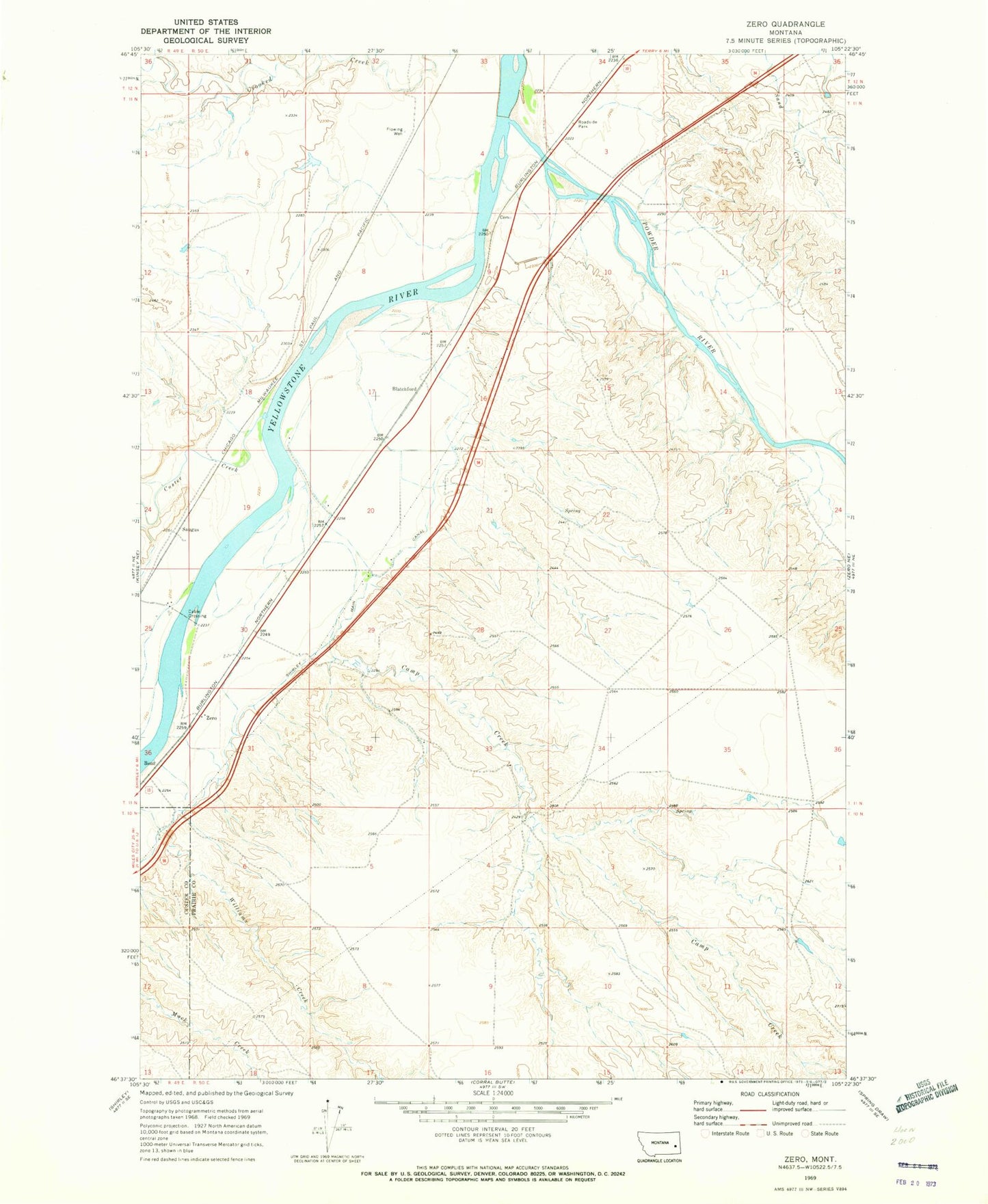
Classic USGS Zero Montana 7.5'x7.5' Topo Map
Couldn't load pickup availability
Historical USGS topographic quad map of Zero in the state of Montana. Map scale may vary for some years, but is generally around 1:24,000. Print size is approximately 24" x 27"
This quadrangle is in the following counties: Custer, Prairie.
The map contains contour lines, roads, rivers, towns, and lakes. Printed on high-quality waterproof paper with UV fade-resistant inks, and shipped rolled.
Contains the following named places: 10N50E03BBDD01 Well, 11N49E24DAAD01 Well, 11N49E25ADBA01 Well, 11N50E03BC__01 Well, 11N50E05ADBD01 Well, 11N50E08DD__01 Well, 11N50E12BC__01 Well, 11N50E20DC__01 Well, 11N50E32ADDD01 Well, 11N50E32CD__01 Well, Baker Rapids, Batchelor Creek, Blatchford, Calypso School, Camp Creek, Clear View School, Custer Creek, Dan Number 2 Dam, Foley, Foley Post Office, Garfield Post Office, Gate Coulee, McQuiod Creek, North Fork Crooked Creek, Powder Post Office, Powder River, Powder River Bridge, Powder River Depot Fishing Access Site, Powder River Historical Marker, Powder River Station, Saugus, Saugus Post Office, Saugus School, Susan, Terrys Supply Camp, Townsend Stage Station, Yellowstone Coulee, Zero, Zero Post Office, Zero School