MyTopo
Woodland Washington US Topo Map
Couldn't load pickup availability
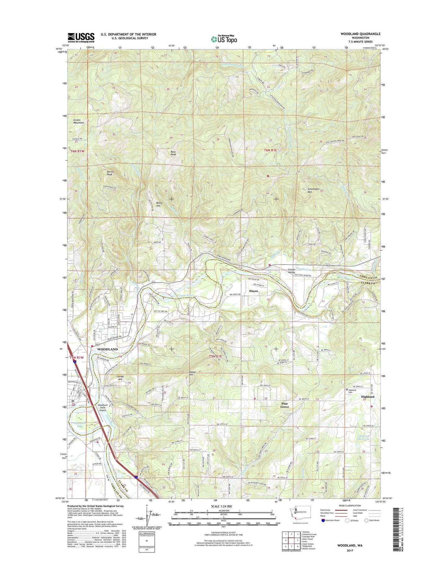
2020 topographic map quadrangle Woodland in the state of Washington. Scale: 1:24000. Based on the newly updated USGS 7.5' US Topo map series, this map is in the following counties: Cowlitz, Clark. The map contains contour data, water features, and other items you are used to seeing on USGS maps, but also has updated roads and other features. This is the next generation of topographic maps. Printed on high-quality waterproof paper with UV fade-resistant inks.
Quads adjacent to this one:
West: Deer Island
Northwest: Kalama
North: Woolford Creek
Northeast: Georges Peak
East: Ariel
Southeast: Battle Ground
South: Ridgefield
Southwest: Saint Helens
Contains the following named places: Binford Reservoir, Binford Reservoir Dam, Butte Hill, Cardai Hill, Cedar Creek School, Clark County Fire and Rescue Station 25 Woodland Fire Department, Clark County Fire and Rescue Station 28 Woodland Fire Department, Clark County Fire District 12 Ridgefield/la Center Station 5, Clark County Fire Rescue Station 29, Clover Valley, Cowlitz Cemetery, Cowlitz County Fire Protection District 1, Cowlitz County Fire Protection District 1 Station 3, Dee Creek, Devils Peak, Finn Hall, Goose Hill, Hayes, Hayes Creek, Highland Cemetery, Horseshoe Lake, Houghton Creek, Johnson Creek, Lewis River Golf Course Airport, Pine Grove, Reno, Robinson Creek, Ross Creek, Ross Peak, Schumaker Mountain, Staples Creek, Woodland, Woodland Middle School, Woodland Police Department, Woodland Post Office, Woodland State Airport, ZIP Code: 98674