MyTopo
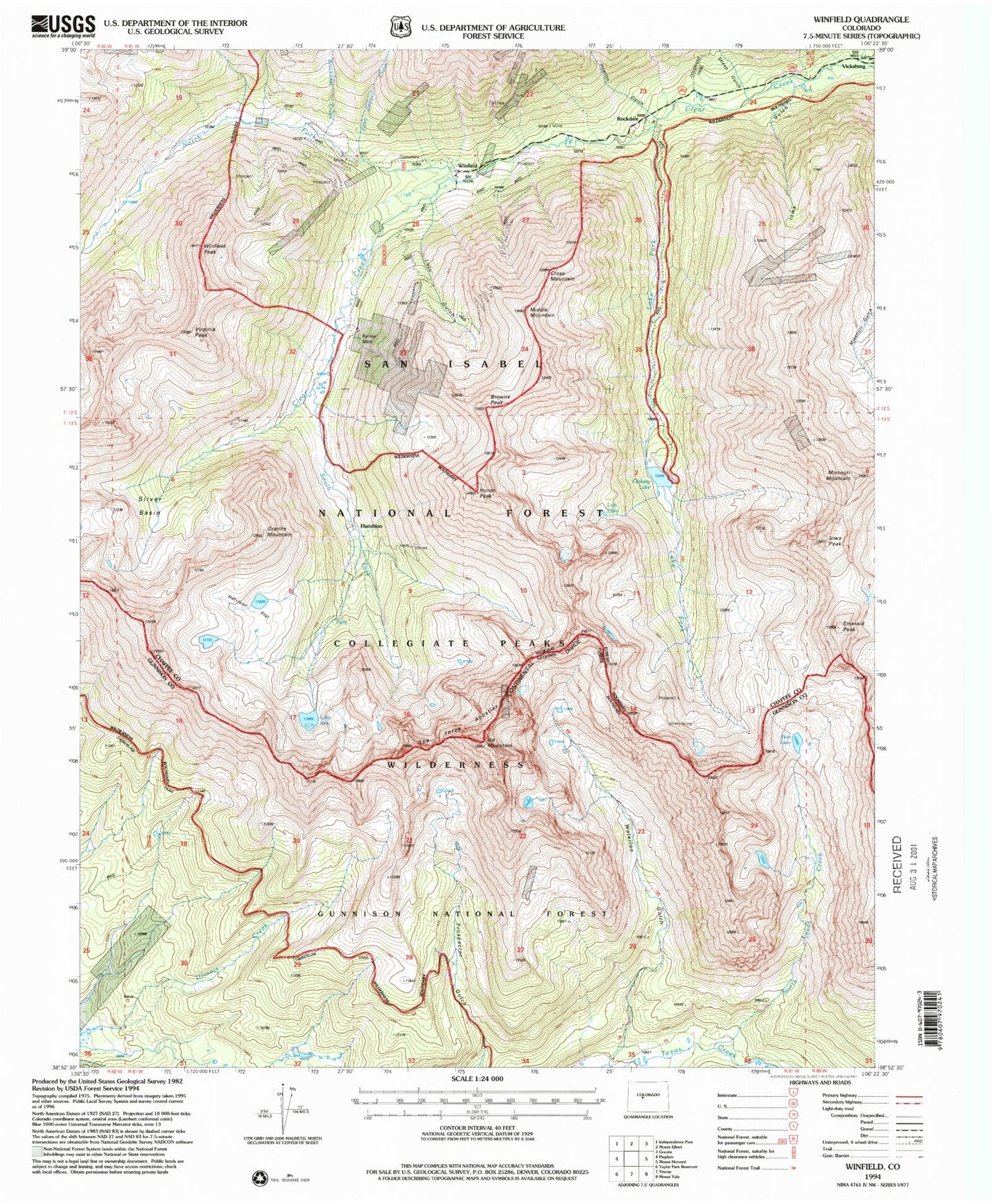
USGS Classic Winfield Colorado 7.5'x7.5' Topo Map
Couldn't load pickup availability
Historical USGS topographic quad map of Winfield in the state of Colorado. Scale: 1:24000. Print size: 24" x 27"
This quadrangle is in the following counties: Chaffee, Gunnison.
The map contains contour lines, roads, rivers, towns, lakes, and grids including latitude / longitude and UTM / MGRS. Printed on high-quality waterproof paper with UV fade-resistant inks.
Contains the following named places: Collegiate Peaks Wilderness, Sheep Gulch, Blackbear Creek, North Fork Clear Creek, Ice Mountain, Waterloo Gulch, North Texas Creek, Pear Lake, Winfield Peak, Virginia Peak, Winfield, South Fork Clear Creek, Cross Mountain, Middle Mountain, Banker Mine, Browns Peak, Huron Peak, Hamilton, Granite Mountain, Harrison Flat, Lois Lake, The Three Apostles, Lake Ann, Lake Fork, Missouri Basin, Emerald Peak, Iowa Peak, Missouri Mountain, Clohesy Lake, Rockdale, Vicksburg, Hewitts Gulch, Grey Copper Creek, Iowa Gulch, Lulu Gulch, Silver Basin, Mike Rabbit Mine, Swiss Boy Dump Mine, Fortune Mine, Last Dollar Mine, Little Guy Mine, Middle Mountain Mine, Tasmania Mine