MyTopo
Tripod Peak Idaho US Topo Map
Couldn't load pickup availability
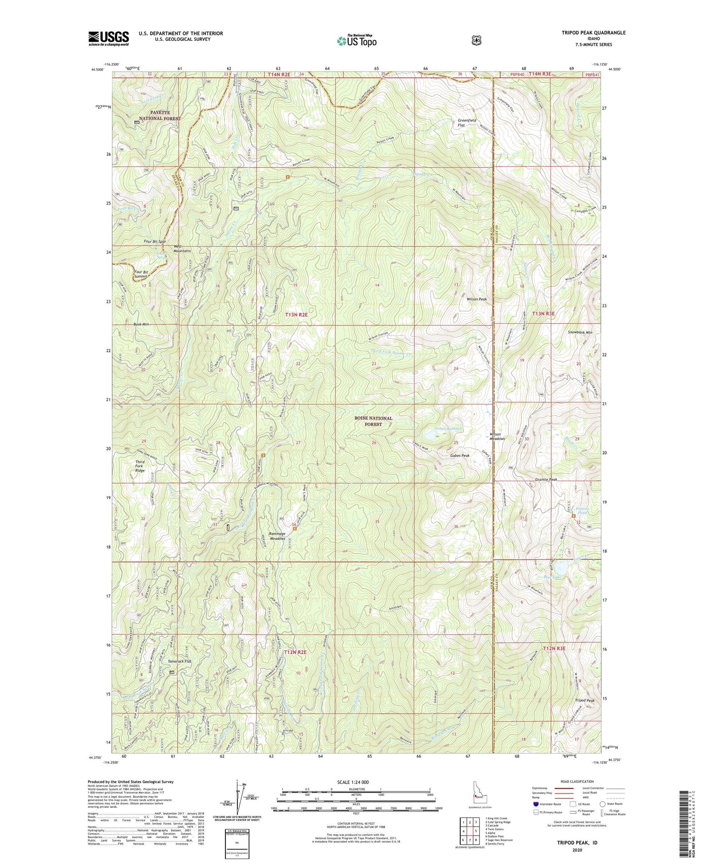
2020 topographic map quadrangle Tripod Peak in the state of Idaho. Scale: 1:24000. Based on the newly updated USGS 7.5' US Topo map series, this map is in the following counties: Gem, Valley, Adams. The map contains contour data, water features, and other items you are used to seeing on USGS maps, but also has updated roads and other features. This is the next generation of topographic maps. Printed on high-quality waterproof paper with UV fade-resistant inks.
Quads adjacent to this one:
West: Twin Sisters
Northwest: King Hill Creek
North: Cold Spring Ridge
Northeast: Cascade
East: Alpha
Southeast: Smiths Ferry
South: Sage Hen Reservoir
Southwest: Dodson Pass
Contains the following named places: Antelope Trail, Bed Ground Creek, Blue Lake, Buck Canyon Trail, Buck Mountain, Division D Stock Trail, FAA Radar Site, Four Bit Spur, Four Bit Summit, Fourbit Spring, Gabes Bathtub, Gabes Peak, Gabes Peak Trail, Granite Peak, Greenfield Flat, Hangman Tree, Mesa Creek, Poison Creek, Pole Creek, Potters Pond, Rammage Meadows, Renwyck Trail, Shirts Lake, Snowbank Mountain, Tamarack Flat, Tripod Peak, Tripod Peak Lookout, West Mountain Trail, West Mountains, Wilson Corrals Trail, Wilson Creek Trail, Wilson Meadows, Wilson Mountain Trail, Wilson Peak, Woody Creek, Woody Creek Trail