MyTopo
Isle Au Haut East Maine US Topo Map
Couldn't load pickup availability
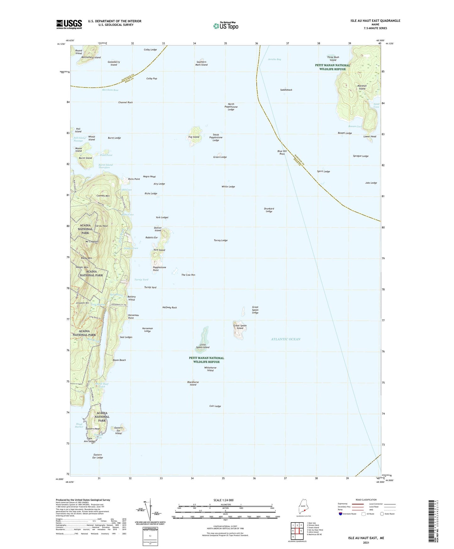
2021 topographic map quadrangle Isle Au Haut East in the state of Maine. Scale: 1:24000. Based on the newly updated USGS 7.5' US Topo map series, this map is in the following counties: Knox, Hancock. The map contains contour data, water features, and other items you are used to seeing on USGS maps, but also has updated roads and other features. This is the next generation of topographic maps. Printed on high-quality waterproof paper with UV fade-resistant inks.
Quads adjacent to this one:
West: Isle Au Haut West
Northwest: Deer Isle
North: Stinson Neck
Northeast: Swans Island
East: Johns Island
Southwest: Matinicus OE NE
Contains the following named places: Airy Ledge, Barter Creek, Battery Island, Blackhorse Island, Blue Hill Rock, Boom Beach, Boxam Cove, Boxam Ledge, Bull Brook, Burnt Island, Burnt Island Thorofare, Burnt Ledge, Cape Ann Ledge, Channel Rock, Colby Ledge, Colby Pup, Colt Ledge, Coombs Mountain, Dodges Cove, Doliver Island, Drunkard Ledge, Duck Brook, Eastern Ear Island, Eastern Ear Ledge, Eastern Head, Edies Trail, Fog Island, Gooseberry Island, Great Meadow, Great Spoon Island, Great Spoon Ledge, Green Ledge, Halfway Rock, Head Harbor, Horseman Ledge, Horseman Point, Horseman Point Trail, Isle Au Haut, Jerusalem Mountain, Jerusalem Mountain Trail, Jobs Ledge, Little Spoon Island, Long Pond, Lower Head, Marshall Island, McGlathery Island, Mount Chaplain, Mouse Island, Negro Head, North Popplestone Ledge, Old Cove, Old Cove Trail, Pats Brook, Pell Island Passage, Pond Point, Popplestone Point, Rabbits Ear, Richs Cove, Richs Ledge, Richs Point, Rocky Mountain, Saddleback, Sawyer Mountain, Seal Ledges, Sheep Thief Gulch, South Popplestone Ledge, Southern Mark Island, Spirit Ledge, Sprague Ledge, The Cow Pen, Three Bush Island, Thunder Gulch, Thunder Gulch Trail, Torrey Ledge, Town of Isle au Haut, Turnip Yard, Unorganized Territory of Marshall Island, Wheat Island, White Ledge, Whitehorse Island, York Island, York Ledges, ZIP Code: 04645