MyTopo
Bellegrove Maryland US Topo Map
Couldn't load pickup availability
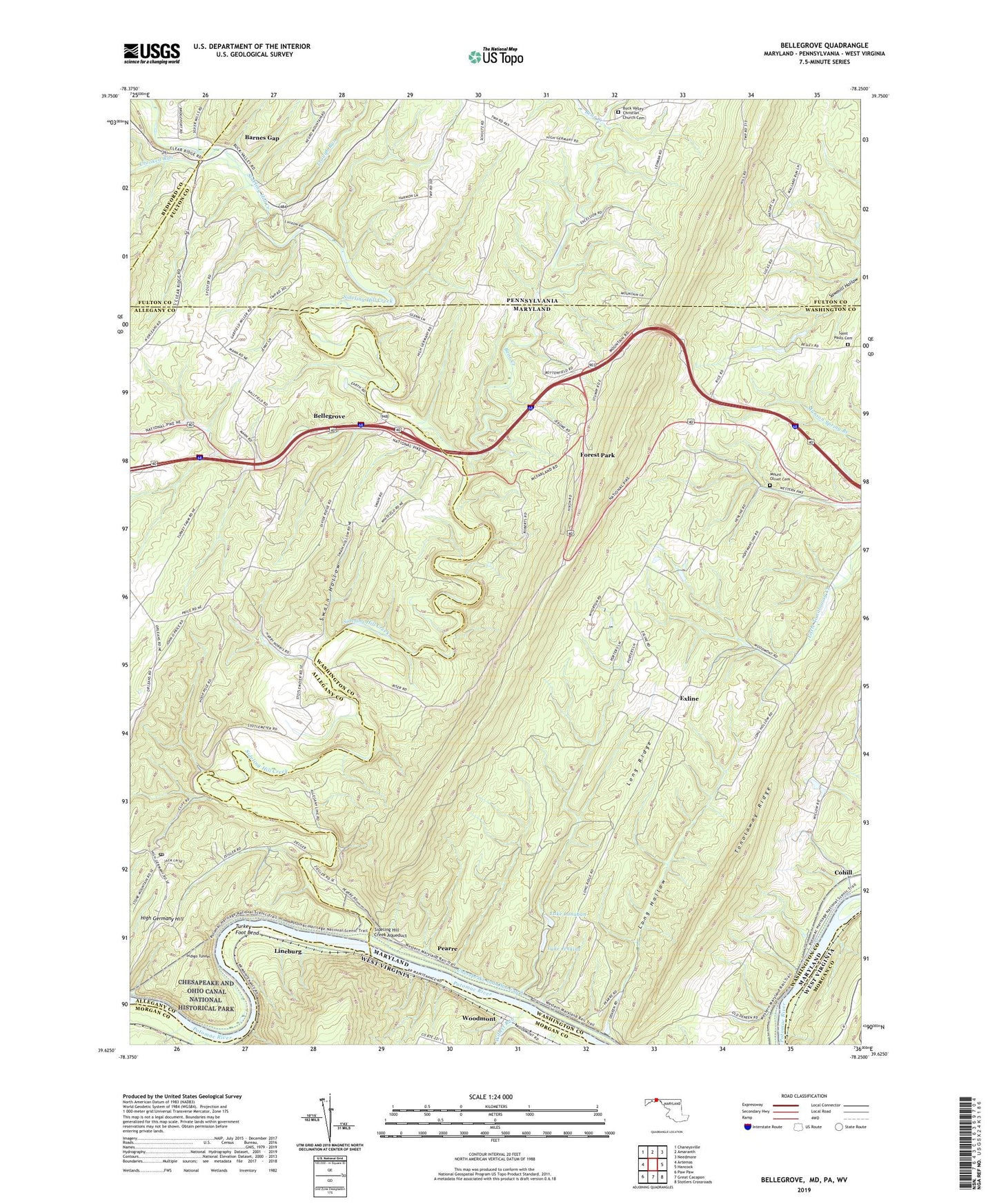
2019 topographic map quadrangle Bellegrove in the states of Maryland, Pennsylvania, West Virginia. Scale: 1:24000. Based on the newly updated USGS 7.5' US Topo map series, this map is in the following counties: Washington, Allegany, Fulton, Morgan, Bedford. The map contains contour data, water features, and other items you are used to seeing on USGS maps, but also has updated roads and other features. This is the next generation of topographic maps. Printed on high-quality waterproof paper with UV fade-resistant inks.
Quads adjacent to this one:
West: Artemas
Northwest: Chaneysville
North: Amaranth
Northeast: Needmore
Southeast: Stotlers Crossroads
South: Great Cacapon
Southwest: Paw Paw
Contains the following named places: Barnes Gap, Bear Creek, Bellegrove, Big Ridge Church, Buck Valley Christian Church Cemetery, Buck Valley Church, Camp Strauss, Cohill, Crooked Run, Exline, Forest Park, Harmonia School, Harvey, High Germany Hill, Indigo Neck Campground, Indigo Tunnel, Lake Jenkins, Lake Jenkins Dam, Lake Lanahan, Lake Lanahen Dam, Lineburg, Little Orleans Post Office, Lock 55, Lock 56, Lock 57, Long Hollow, Long Ridge, Long Ridge Church, Mann, Mount Olivet Cemetery, Mount Olivet Presbyterian Church, Northcraft, Northcraft Post Office, Pearre, Piney Plains United Methodist Church, Saint Pauls Church, Saint Pauls Lutheran Church Cemetery, Sideling Hill Creek, Sideling Hill Creek Aqueduct, Sideling Hill Wildlife Management Area, Stahle Run, Swain Hollow, Tonoloway Club, Trough Run, Turkey Foot Bend, Willett Run, Woodmont, Woodmont Club, Woodmont Rod and Gun Club