MyTopo
Blackwater River Maryland US Topo Map
Couldn't load pickup availability
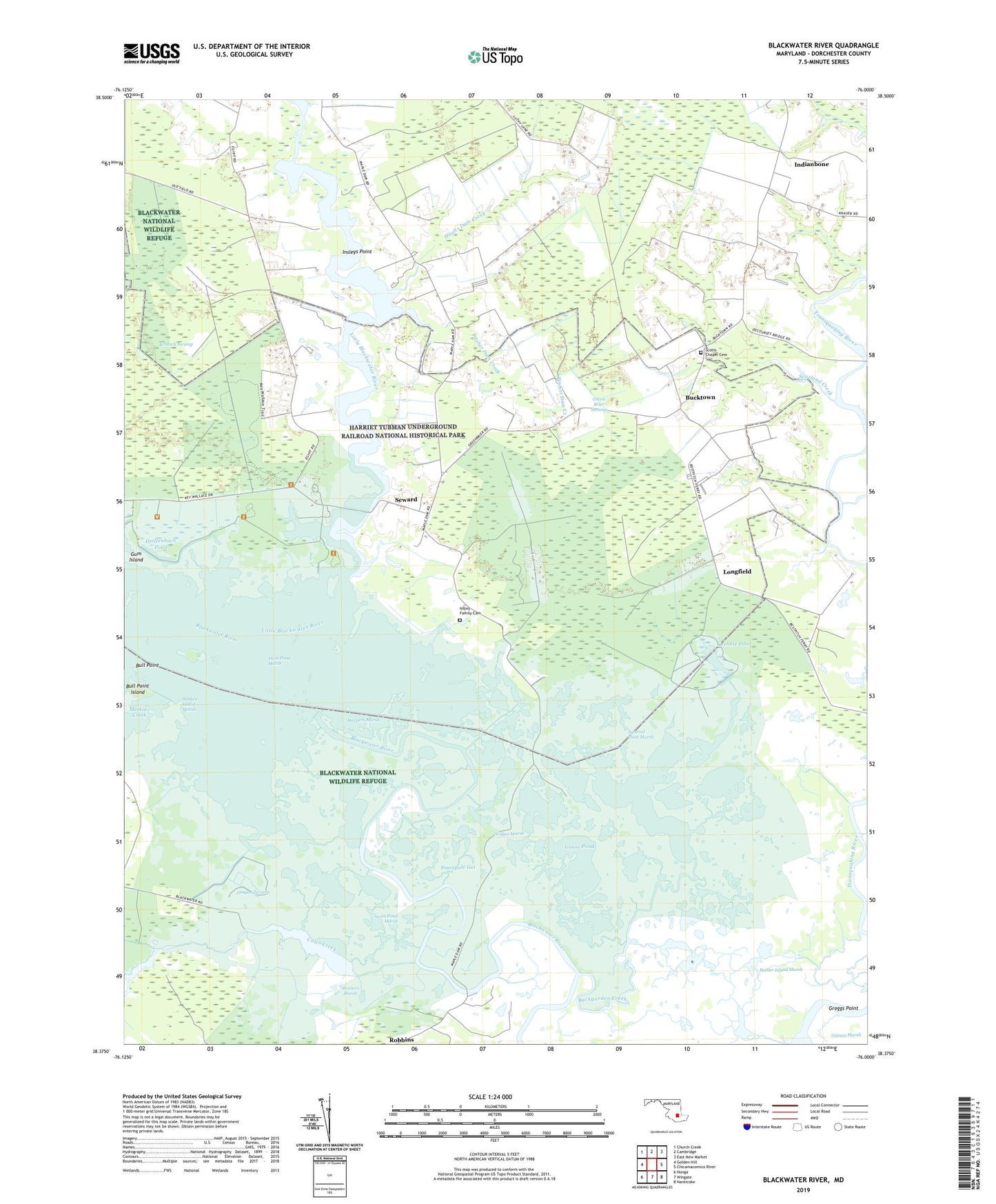
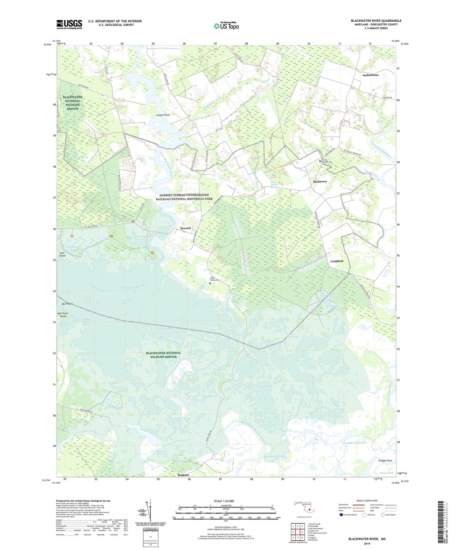
2019 topographic map quadrangle Blackwater River in the state of Maryland. Scale: 1:24000. Based on the newly updated USGS 7.5' US Topo map series, this map is in the following counties: Dorchester. The map contains contour data, water features, and other items you are used to seeing on USGS maps, but also has updated roads and other features. This is the next generation of topographic maps. Printed on high-quality waterproof paper with UV fade-resistant inks.
Quads adjacent to this one:
West: Golden Hill
Northwest: Church Creek
North: Cambridge
Northeast: East New Market
East: Chicamacomico River
Southeast: Nanticoke
South: Wingate
Southwest: Honga
Contains the following named places: Backgarden Creek, Backgarden Pond, Barbadoes Pond, Barnes Landing, Bazzel Church, Becker Island Marsh, Between the Dams, Blackwater National Wildlife Refuge, Blackwater National Wildlife Refuge Center, Blackwater Pond, Bonds Church, Bucktown, Bull Point, Bull Point Island, Bullock Creek, Bullock Pond, Cattail Pond, Coles Creek, Coulson Pond, Dieffenbach Pond, District 13 Bucktown, Dorchester County, Dragon Swamp, Goose Pond, Green Brier Swamp, Groggs Point, Guinea Marsh, Harpers Marsh, Harpers Pond, Hog Rooting Pond, Hughs Dam Creek, Indianbone, Insley Family Cemetery, Insleys Point, Keenes Ditch, Kentuck Swamp, Kuehnle Pond, Lans Pond, Little Blackwater River, Longfield, Lot Lane, Otter Pond, Pitcher Dam Creek, Raymond Pond, Robbins, Robbins Landing, Round Pond, Scotland Creek, Scotts Chapel, Scotts Chapel Cemetery, Seward, Shorters Marsh, Shorters Wharf, Shorts Creek Pond, Simons Ditch, Snarepole Gut, Squirrel Point Marsh, Sunken Island Marsh, Swan Pond, Swan Pond Marsh, Twin Pond Marsh, Twin Ponds, Wolfpit Marsh, Wolfpit Pond