MyTopo
Gorman Maryland US Topo Map
Couldn't load pickup availability
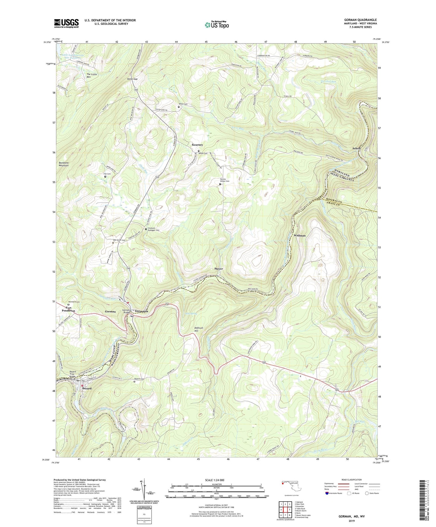
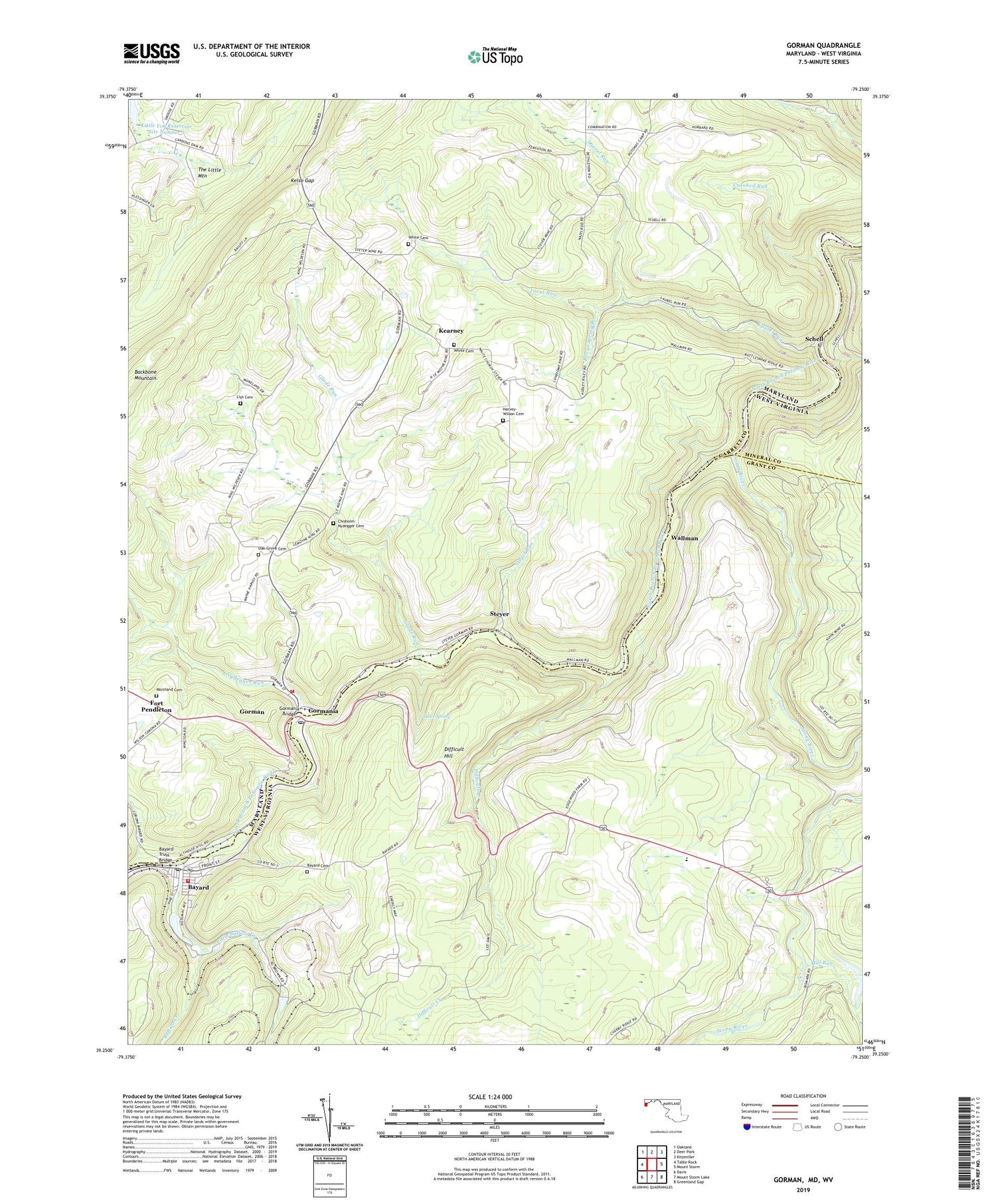
2019 topographic map quadrangle Gorman in the states of Maryland, West Virginia. Scale: 1:24000. Based on the newly updated USGS 7.5' US Topo map series, this map is in the following counties: Garrett, Grant, Mineral. The map contains contour data, water features, and other items you are used to seeing on USGS maps, but also has updated roads and other features. This is the next generation of topographic maps. Printed on high-quality waterproof paper with UV fade-resistant inks.
Quads adjacent to this one:
West: Table Rock
Northwest: Oakland
North: Deer Park
Northeast: Kitzmiller
East: Mount Storm
Southeast: Greenland Gap
South: Mount Storm Lake
Southwest: Davis
Contains the following named places: Bayard, Bayard Cemetery, Bayard Post Office, Bayard Truss Bridge, Bayard Volunteer Fire Department, Berrett, Bethlehem Church, Bethlehem School, Bradshaw, Buffalo Creek, Chisholm - Nydegger Cemetery, Crooked Run, Dales Spring, Difficult Creek, Difficult Hill, District 16 Mountain Lake Park, Fort Pendleton, Glade Run, Gorman, Gorman Census Designated Place, Gorman Volunteer Fire Department Station 120, Gormania, Gormania Bridge, Gormania Post Office, Harvey - Wilson Cemetery, Kearney, Kelso Gap, Laurel Run, Lish Cemetery, Little Buffalo Creek, Little Buffalo Creek - North Branch Dam, Little Yok Reservoir Site Number 5, Mill Run, Moreland Cemetery, North Prong Lostland Run, Nydegger Run, Oak Grove Cemetery, Oak Grove Church, Potomac State Forest, Rileys Spring Branch, Schell, South Prong Lostland Run, Steyer, Steyer Run, Stony River, Town of Bayard, Trout Run, Union Educational Complex, Wallman, White Cemetery, White Church, White Church Community Cemetery, ZIP Code: 26720