MyTopo
Aura Michigan US Topo Map
Couldn't load pickup availability
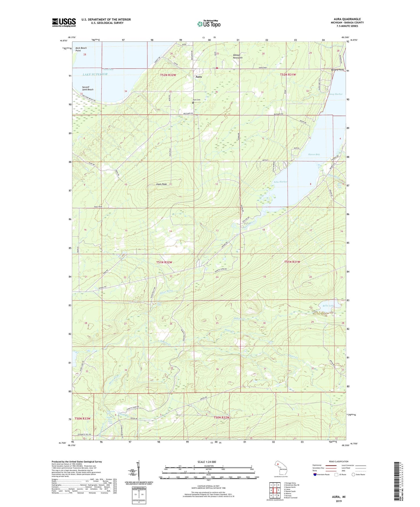
2019 topographic map quadrangle Aura in the state of Michigan. Scale: 1:24000. Based on the newly updated USGS 7.5' US Topo map series, this map is in the following counties: Baraga. The map contains contour data, water features, and other items you are used to seeing on USGS maps, but also has updated roads and other features. This is the next generation of topographic maps. Printed on high-quality waterproof paper with UV fade-resistant inks.
Quads adjacent to this one:
Northwest: Portage Entry
North: Keweenaw Bay NE
Northeast: Skanee North
East: Skanee South
Southeast: Mount Curwood
South: Herman
Southwest: Alberta
Contains the following named places: Aura, Aura Cemetery, Aura Post Office, Aura School, Aura Station, Aura Town Hall, Aura Volunteer Fire Department, Bella Lake, Bendry Point, Camp Creek, Dakota Creek, Echo Harbor, Elmblad Camp, Gomanche Creek, Gomanche Falls, Middle Silver River Falls, Page Creek, Pages Creek, Pikes Peak, Ravine River, Rock Beach Point, Sand Bay, Second Sand Beach, Second Sand Beach Park, Silver Falls, Silver River, Slate River, Slate River Falls, Snug Harbor