MyTopo
Banfield Michigan US Topo Map
Couldn't load pickup availability
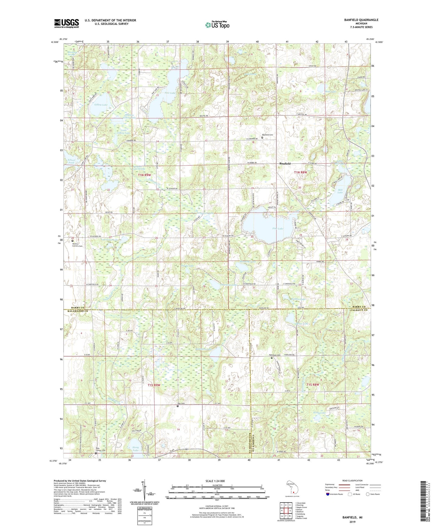
2019 topographic map quadrangle Banfield in the state of Michigan. Scale: 1:24000. Based on the newly updated USGS 7.5' US Topo map series, this map is in the following counties: Barry, Kalamazoo, Calhoun. The map contains contour data, water features, and other items you are used to seeing on USGS maps, but also has updated roads and other features. This is the next generation of topographic maps. Printed on high-quality waterproof paper with UV fade-resistant inks.
Quads adjacent to this one:
West: Delton
Northwest: Cloverdale
North: Dowling
Northeast: Maple Grove
East: Bedford
Southeast: Battle Creek
South: Augusta
Southwest: Galesburg
Contains the following named places: Banfield, Banfield Cemetery, Banfield Post Office, Banfield School, Bulkey Lake, Burroughs School, Coleman Lake, Day Bible Church, Day Cemetery, East Hickory Corners Cemetery, Fair Lake, Fine Lake, Gaskill Post Office, Gilkey Lake, Hamilton Cemetery, Hamilton Lake, Howe Lake, Johnstown Post Office, King School, Kirby Lake, Kirby School, Lawrence Lake, Little Gilkey Lake, Little Mill Lake, Long Swamp, Manning Lake, Maple Hills Golf Course, Marshall Lake, Mill Lake, Mud Lake, Pickliss Lake, Pitchfork Lake Swamp, Purdy Lake, Ross Center Cemetery, School Pond, Seventh-Day Adventist Church, Shallow Gilkey Lake, Spring Brook, Stony Lake, Strewins Lake, Tamarack Lake, Township of Barry, Township of Ross