
MyTopo
Bay Port West Michigan US Topo Map
Couldn't load pickup availability
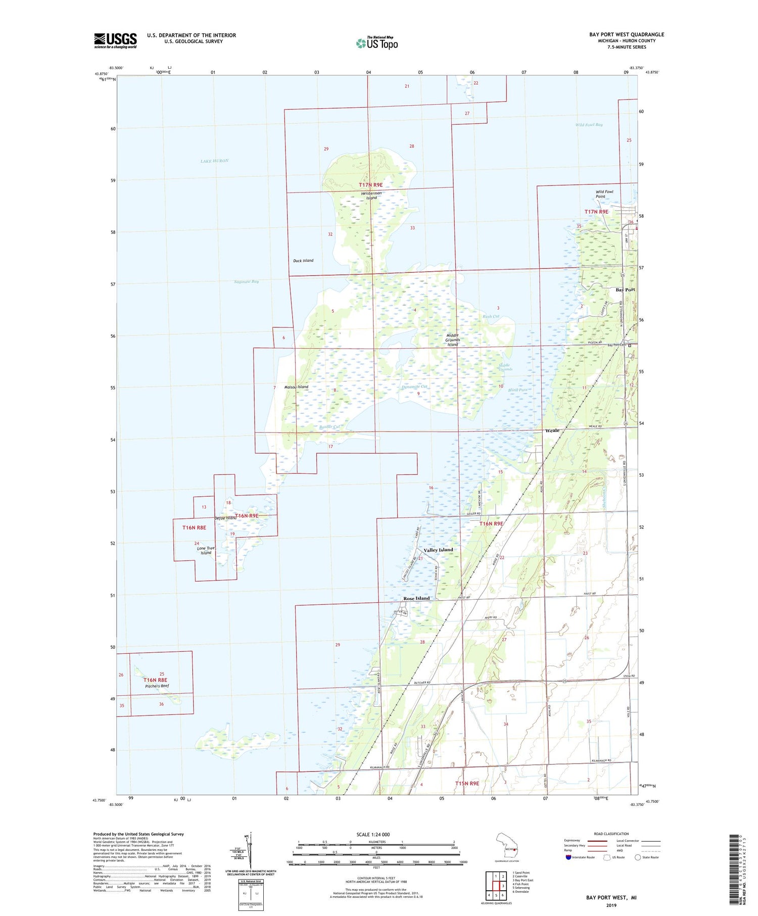
2019 topographic map quadrangle Bay Port West in the state of Michigan. Scale: 1:24000. Based on the newly updated USGS 7.5' US Topo map series, this map is in the following counties: Huron. The map contains contour data, water features, and other items you are used to seeing on USGS maps, but also has updated roads and other features. This is the next generation of topographic maps. Printed on high-quality waterproof paper with UV fade-resistant inks.
Quads adjacent to this one:
North: Sand Point
Northeast: Caseville
East: Bay Port East
Southeast: Owendale
South: Sebewaing
Southwest: Fish Point
Contains the following named places: Bay Port Cemetery, Bay Port Police Department, Bayside Estates Mobile Home Park, Blind Pass, Boxcar Cut, Community of Christ Church, Defoe Island, Duck Island, Dynamite Cut, Fairhaven Church, Fairhaven Township Fire Department, Faith Bible Church, Great Fire of 1881 Historical Marker, Heisterman Island, Henne Drain, Lone Tree Island, Maisou Island, Middle Grounds, Middle Grounds Island, North Island, Pitchers Reef, Rose Island, Rush Cut, Sanford Brown Roadside Park, Shebeon Creek, Tarry Post Office, Tarry Station, Valley Island, Weale, Wild Fowl Bay State Park, Wild Fowl Point, WWMI-FM (Sebewaing)


