MyTopo
Bentley Michigan US Topo Map
Couldn't load pickup availability
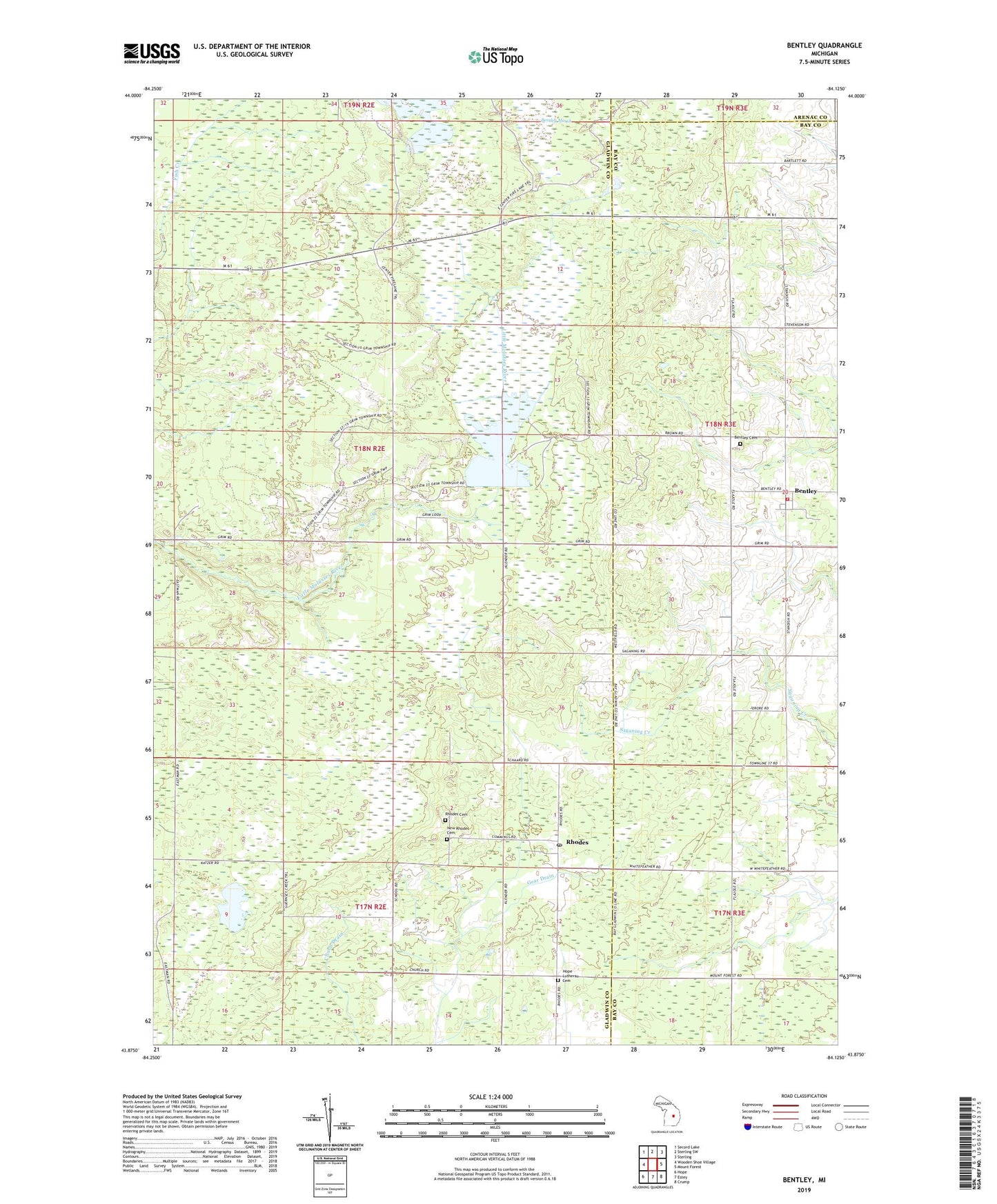
2019 topographic map quadrangle Bentley in the state of Michigan. Scale: 1:24000. Based on the newly updated USGS 7.5' US Topo map series, this map is in the following counties: Gladwin, Bay, Arenac. The map contains contour data, water features, and other items you are used to seeing on USGS maps, but also has updated roads and other features. This is the next generation of topographic maps. Printed on high-quality waterproof paper with UV fade-resistant inks.
Quads adjacent to this one:
West: Wooden Shoe Village
Northwest: Secord Lake
North: Sterling SW
Northeast: Sterling
East: Mount Forest
Southeast: Crump
South: Estey
Southwest: Hope
Contains the following named places: Bentley, Bentley Cemetery, Bentley Post Office, Bentley United Methodist Church, Center Fireline Trail, Chubb Drain, Community of Christ Church, Estey Seventh-Day Adventist Church, Gear Drain, Gibson Township Fire Department Station, Glover Post Office, Glover Station, Hope Church, Hope Lutheran Cemetery, Molasses River Flooding Number Three, New Rhodes Cemetery, Rhodes, Rhodes Cemetery, Rhodes Missionary Church, Rhodes Post Office, Rhodes Station, Township of Grim, ZIP Code: 48613