MyTopo
Bliss Michigan US Topo Map
Couldn't load pickup availability
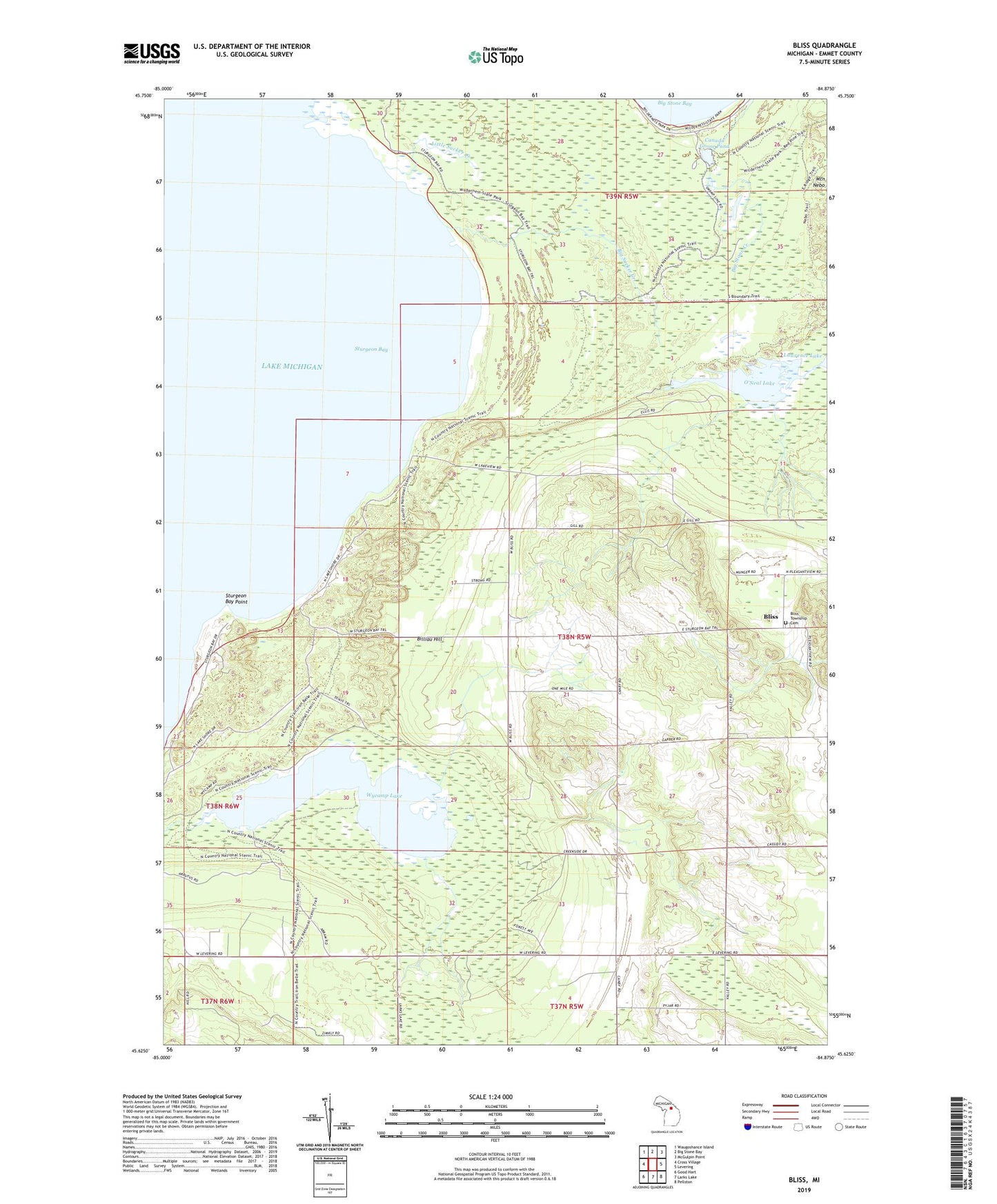
2019 topographic map quadrangle Bliss in the state of Michigan. Scale: 1:24000. Based on the newly updated USGS 7.5' US Topo map series, this map is in the following counties: Emmet. The map contains contour data, water features, and other items you are used to seeing on USGS maps, but also has updated roads and other features. This is the next generation of topographic maps. Printed on high-quality waterproof paper with UV fade-resistant inks.
Quads adjacent to this one:
West: Cross Village
Northwest: Waugoshance Island
North: Big Stone Bay
Northeast: McGulpin Point
East: Levering
Southeast: Pellston
South: Larks Lake
Southwest: Good Hart
Contains the following named places: Big Stone Bay, Big Sucker Creek, Billiau Hill, Bliss, Bliss Branch Library, Bliss Lookout Tower, Bliss Pioneer Memorial Church, Bliss Pioneer Memorial Church Historical Marker, Bliss Post Office, Bliss Township Cemetery, Bliss Township Park, Canada Goose Pond, Canby Corners, Canby Post Office, Canby School, Cetus Corner, Collins Creek, Little Sucker Creek, O'Neal Lake, Pioneer Memorial Church, Sturgeon Bay Point, Sturgeon Bay Post Office, Township of Bliss, Websters Corners, West Bliss School, Wilderness State Park, Wycamp Lake