MyTopo
Boyne Falls Michigan US Topo Map
Couldn't load pickup availability
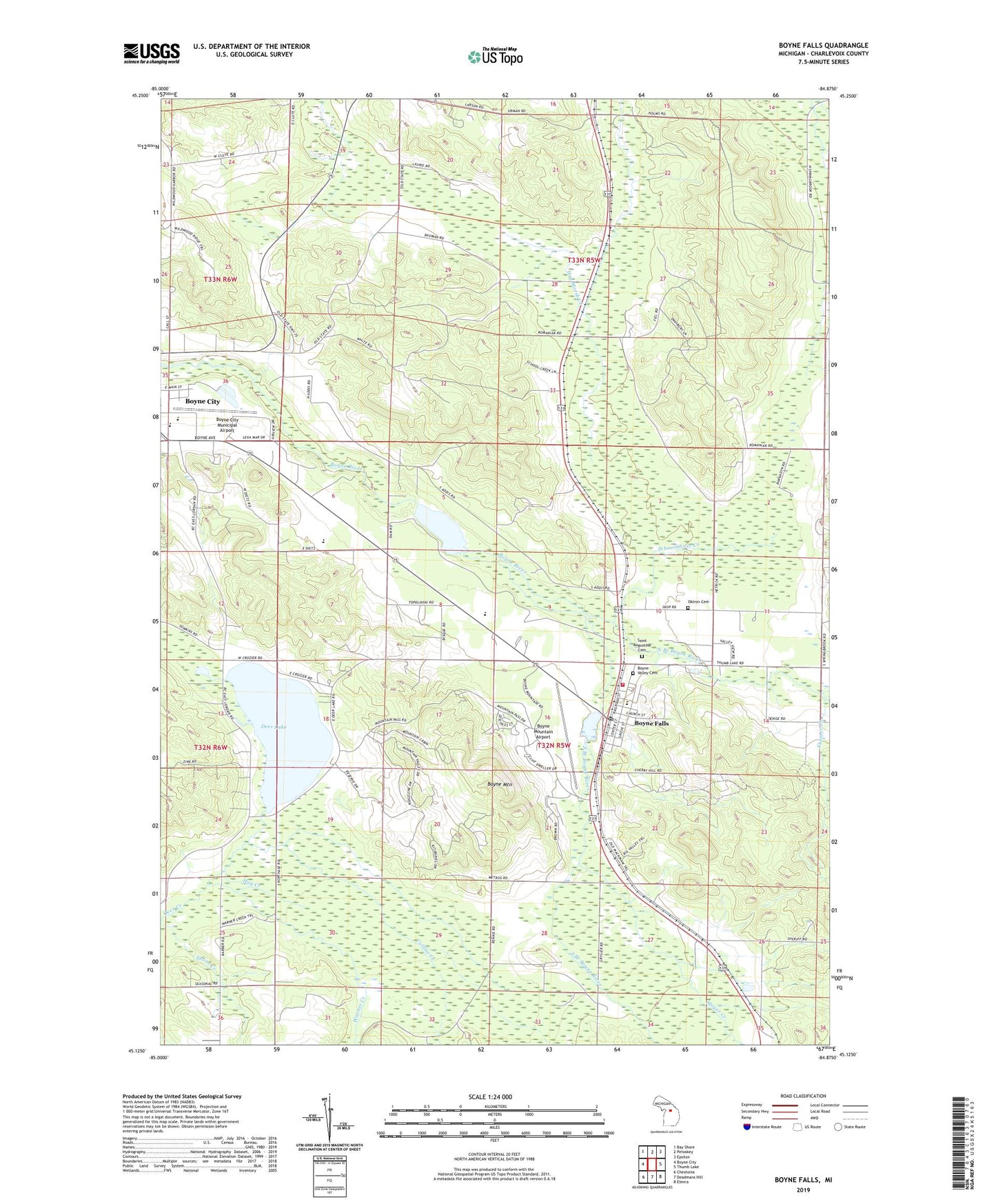
2019 topographic map quadrangle Boyne Falls in the state of Michigan. Scale: 1:24000. Based on the newly updated USGS 7.5' US Topo map series, this map is in the following counties: Charlevoix. The map contains contour data, water features, and other items you are used to seeing on USGS maps, but also has updated roads and other features. This is the next generation of topographic maps. Printed on high-quality waterproof paper with UV fade-resistant inks.
Quads adjacent to this one:
West: Boyne City
Northwest: Bay Shore
North: Petoskey
Northeast: Epsilon
East: Thumb Lake
Southeast: Elmira
South: Deadmans Hill
Southwest: Chestonia
Contains the following named places: Audei's Alley Ski Trail, Aurora Ski Trail, Bernie's Ski Trail, Bob Sled Ski Trail, Boyne City Elementary School, Boyne City Municipal Airport, Boyne Falls, Boyne Falls City Hall, Boyne Falls Post Office, Boyne Falls Public School, Boyne Falls Station, Boyne Falls United Methodist Church, Boyne Mountain, Boyne Mountain Airport, Boyne Mountain Golf Course, Boyne Mountain Ski Area, Boyne Rapids Golf Course, Boyne River Pond, Boyne Valley Cemetery, Boyne Valley Township Fire and Rescue, Boyneland Ski Trail, Buz-z-z Ski Trail, Campbells Alley Ski Trail, Center McLouth Ski Trail, Charlevoix County Sheriff's Office, Chmielewski Ski Trail, Cold Springs Ski Trail, Collins Creek, Community of Christ Church, Cramer Creek, Crooked Tree Library, Deer Lake, Deer Run Ski Trail, Devil's Dive Ski Trail, DL's Drop Ski Trail, Doc's Canal Ski Trail, Donna's Delight Ski Trail, Easy Access Ski Trail, Eaton Creek, Escape Ski Trail, First Baptist Church, Free Methodist Church, Gimlet Creek, Grice's Way Ski Trail, Hemingway Ski Trail, Hemlock Ski Trail, Hilda's Hideway Ski Trail, Hog Creek, Idiot's Delight Ski Trail, In The Woods Ski Trail, Johnny Mac Ski Trail, Kunkle's Cut Ski Trail, Miller's Time Ski Trail, Molly C's Ski Trail, Moyer Creek, Mr Noll Ski Trail, Mrs K's Ski Trail, North Boyne Ski Trail, North Branch Boyne River, North Branch Spring Brook, North McLouth Ski Trail, Nose Dive Ski Trail, Okiron Cemetery, Pat's Knob Ski Trail, Pierson Ski Trail, Pritchard's Pass Ski Trail, Ramshead Ski Trail, Ron's Run Ski Trail, Saint Augustine Cemetery, Saint Matthews Church, Schoolhouse Creek, See-No-Land Ski Trail, Shepherd's Trail Ski Trail, Skop Ski Trail, South Branch Boyne River, South Branch Spring Brook, South McLouth Ski Trail, Stein's Mambo Ski Trail, Superbowl Ski Trail, Te-Bowl Ski Trail, The Bowl Ski Trail, The Meadows Ski Trail, Thunder Ski Trail, To Disciples Ridge Ski Trail, Township of Boyne Valley, Township of Melrose, Victor Ski Trail, Village of Boyne Falls, Warner Creek, Wesley O Ski Trail, Zippie's Ski Trail