MyTopo
Channing Michigan US Topo Map
Couldn't load pickup availability
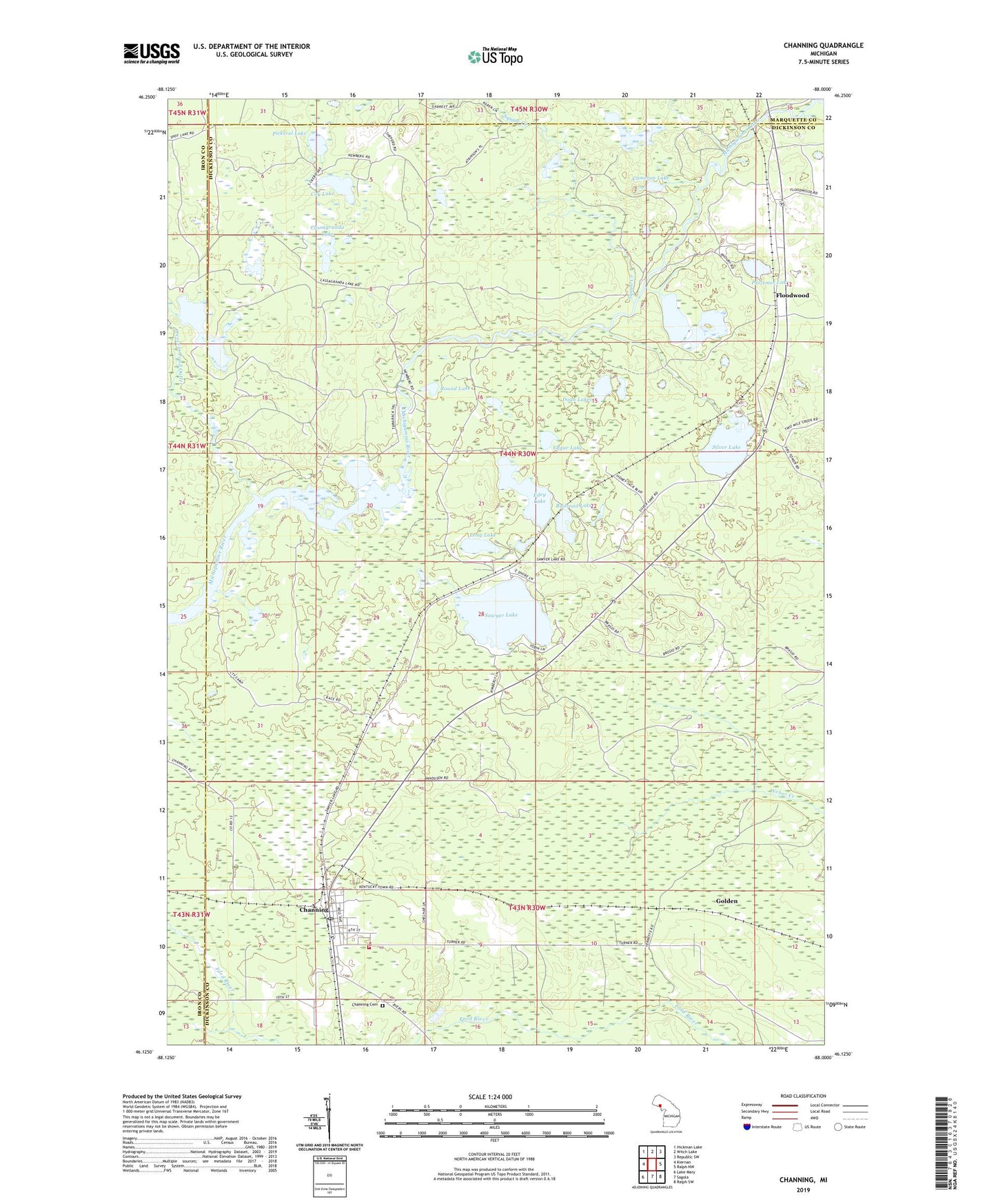
2019 topographic map quadrangle Channing in the state of Michigan. Scale: 1:24000. Based on the newly updated USGS 7.5' US Topo map series, this map is in the following counties: Dickinson, Iron, Marquette. The map contains contour data, water features, and other items you are used to seeing on USGS maps, but also has updated roads and other features. This is the next generation of topographic maps. Printed on high-quality waterproof paper with UV fade-resistant inks.
Quads adjacent to this one:
West: Kiernan
Northwest: Hickman Lake
North: Witch Lake
Northeast: Republic SW
East: Ralph NW
Southeast: Ralph SW
South: Sagola
Southwest: Lake Mary
Contains the following named places: Cameron Lake, Camp Floodwood, Cassagranda Lake, Channing, Channing Cemetery, Channing Post Office, Channing Station, Coy Lake, Crescent Pond, Crescent Pond Outlet, Doan Lakes, Edey Lake, Edgar Lake, Floodwood, Floodwood Lakes, Floodwood Post Office, Floodwood Station, Golden, Lake Charles, Long Lake, Michigamme State Forest, North Dickinson Branch Library, North Dickinson School, Parlemee Lake, Pickerel Lake, Railroad Lake, Round Lake, Sagola Township Area Rescue Volunteer Ambulance Service, Sagola Township Volunteer Fire Department, Saint Rose Church, Sawyer Lake, Silver Lake, Silver Lake Lookout Tower, Squaw Creek, Weber Lake