MyTopo
Elberta Michigan US Topo Map
Couldn't load pickup availability
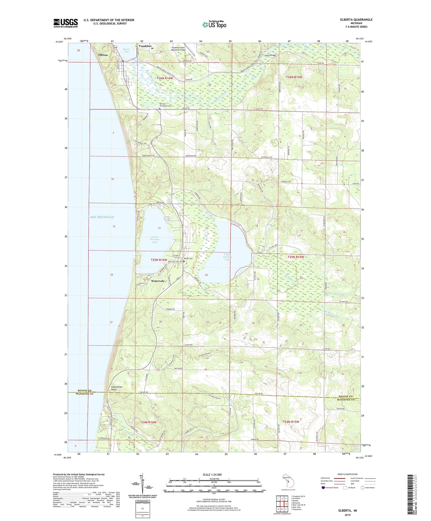
2019 topographic map quadrangle Elberta in the state of Michigan. Scale: 1:24000. Based on the newly updated USGS 7.5' US Topo map series, this map is in the following counties: Benzie, Manistee. The map contains contour data, water features, and other items you are used to seeing on USGS maps, but also has updated roads and other features. This is the next generation of topographic maps. Printed on high-quality waterproof paper with UV fade-resistant inks.
Quads adjacent to this one:
Northwest: Frankfort OE W
North: Frankfort
Northeast: Beulah
East: Benzonia
Southeast: Pleasanton
South: Bear Lake
Southwest: Bear Lake OE W
Contains the following named places: Betsie River Campsite, Betsie River State Game Refuge, Blaine Cemetery, Blaine Church, Butwell Station, Car Ferries on Lake Michigan Historical Marker, Elberta, Elberta Post Office, Elberta United Methodist Church, Elberta Volunteer Fire Department, Frankfort Dow Memorial Field, Fredrickson School, Gilmore Church, Gilmore Post Office, Gilmore Township Cemetery, Grace Church, Grace Post Office, Herring Creek, Herring Lake Church, Herring Lake Outlet, Herring Lake School, Howard School, Inspiration Point, Inspiration Point Scenic Lookout, Lewis Bridge, Lincoln School, Lower Herring Lake, North Branch Herring Creek, Putney Corners, South Branch Herring Creek, Township of Blaine, Township of Gilmore, Upper Herring Lake, Village of Elberta, Watervale, Watervale Post Office, WBNZ-FM (Frankfort), Wood School, ZIP Codes: 49613, 49628, 49635