
MyTopo
Empire Michigan US Topo Map
Couldn't load pickup availability
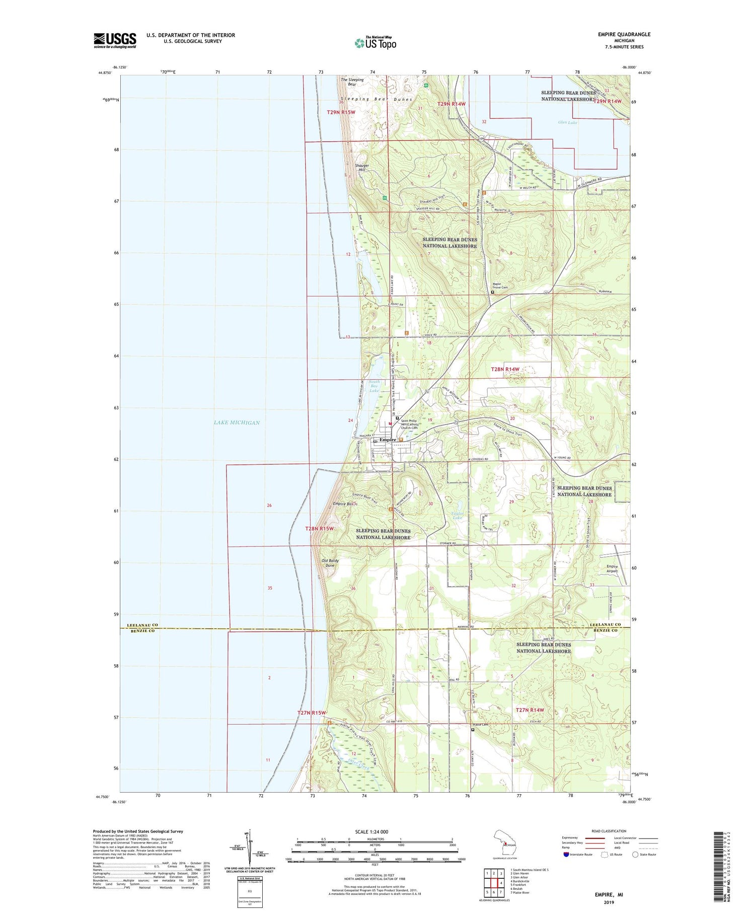
2019 topographic map quadrangle Empire in the state of Michigan. Scale: 1:24000. Based on the newly updated USGS 7.5' US Topo map series, this map is in the following counties: Leelanau, Benzie. The map contains contour data, water features, and other items you are used to seeing on USGS maps, but also has updated roads and other features. This is the next generation of topographic maps. Printed on high-quality waterproof paper with UV fade-resistant inks.
Quads adjacent to this one:
Northwest: South Manitou Island OE S
North: Glen Haven
Northeast: Glen Arbor
East: Burdickville
Southeast: Platte River
South: Beulah
Southwest: Frankfort
Contains the following named places: Aral, Aral Post Office, Empire, Empire Airport, Empire Area Museum, Empire Bluffs, Empire Lumber County Historical Marker, Empire Post Office, Empire Station, Empire Township Campground, Empire United Methodist Church, Empire Volunteer Fire Department, First Church, Glen Lake Community Library, Glen Lake Trailer Park, Glenmere Post Office, James R Johnson Park, Manitou Medical Center, Maple Grove Cemetery, North Bar Lake, North Empire Park, Old Baldy Dune, Otter Creek, Pierce Stocking Visitor Center, Platte Cemetery, Platte Post Office, Saint Philip Neri Catholic Church Cemetery, Saint Philip Neri Church, Shauger Hill, Sleeping Bear Dunes, South Bar Lake, South Manitou Post Office, Taylor Lake, The Sleeping Bear, Township of Empire, Village of Empire, Village Park, ZIP Code: 49630


