MyTopo
Ewen Michigan US Topo Map
Couldn't load pickup availability
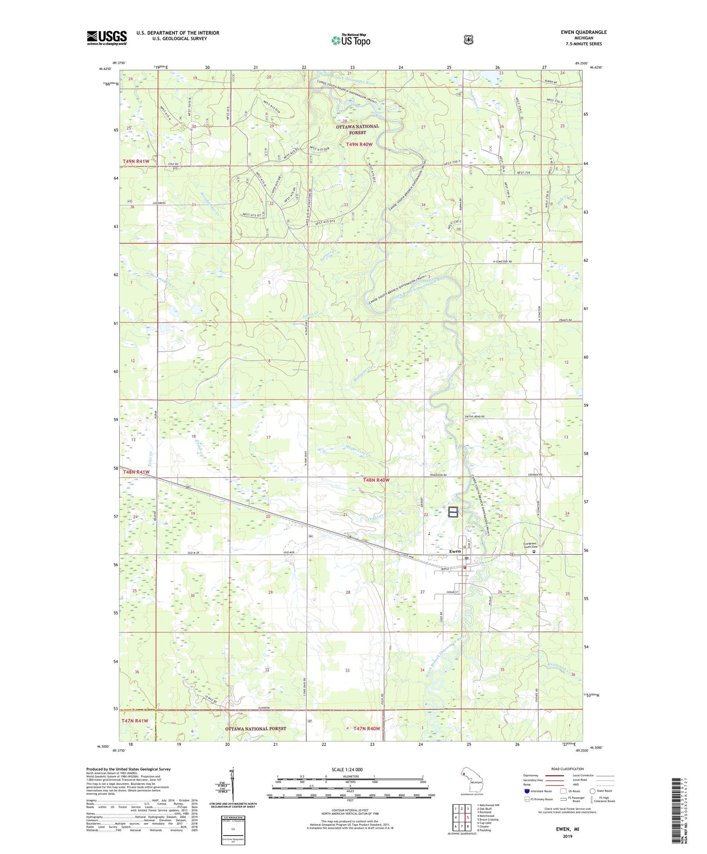
2019 topographic map quadrangle Ewen in the state of Michigan. Scale: 1:24000. Based on the newly updated USGS 7.5' US Topo map series, this map is in the following counties: Ontonagon, Gogebic. The map contains contour data, water features, and other items you are used to seeing on USGS maps, but also has updated roads and other features. This is the next generation of topographic maps. Printed on high-quality waterproof paper with UV fade-resistant inks.
Quads adjacent to this one:
West: Matchwood
Northwest: Matchwood NW
North: Oak Bluff
Northeast: Rockland
East: Bruce Crossing
Southeast: Paulding
South: Choate
Southwest: Cup Lake
Contains the following named places: Cedar Creek, Evergreen - Ewen Cemetery, Ewen, Ewen - Trout Creek Consolidated School, Ewen Census Designated Place, Ewen Pines Roadside Park, Ewen Post Office, Ewen Station, Farmer Creek, First Lutheran Church, Flannigan Rapids, Junco Creek, Kostlenick Creek, Maple Leaf Creek, McMillan Township Library, McMillan Township Volunteer Fire Department, Mulligan Creek, Sacred Heart Church, Township of McMillan, Wanagan Creek, ZIP Code: 49925