MyTopo
Ferry Michigan US Topo Map
Couldn't load pickup availability
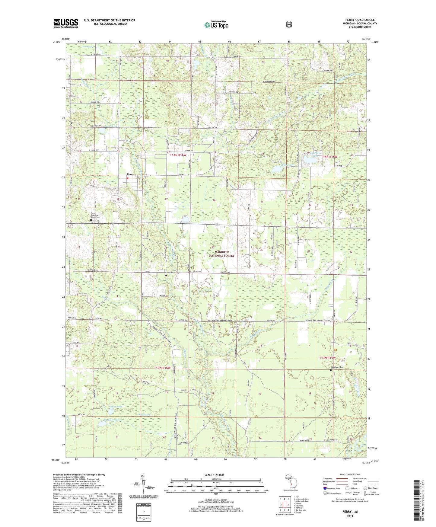
2019 topographic map quadrangle Ferry in the state of Michigan. Scale: 1:24000. Based on the newly updated USGS 7.5' US Topo map series, this map is in the following counties: Oceana. The map contains contour data, water features, and other items you are used to seeing on USGS maps, but also has updated roads and other features. This is the next generation of topographic maps. Printed on high-quality waterproof paper with UV fade-resistant inks.
Quads adjacent to this one:
West: Shelby
Northwest: Hart
North: Walkerville West
Northeast: Walkerville East
East: Hesperia
Southeast: Holton
South: Big Blue Lake
Southwest: Montague
Contains the following named places: Bear Creek, Blackmer Lake, Camp Keewana, Camp Manistee, Ferry, Ferry Elementary School, Ferry Lookout Tower, Ferry Post Office, Ferry Township Fire Department, Ferry Township South Cemetery, Ferry United Methodist Church, Ferry Wesleyan Church, Gillan Lake, Gillon Lake, Hansen Post Office, Hightower Lake, Knutson Creek, Landin Lake, Lidkey Swamp, Michigan Department of Natural Resources Oceana Field Office, Newman Chapel, Newman School, Osborn Creek, Otto Cemetery, Robinson Creek, Shelby Wesleyan Church, Swinton Creek, Township of Ferry, Township of Otto, Wager Post Office, Woodward Cemetery