
MyTopo
Glen Haven Michigan US Topo Map
Couldn't load pickup availability
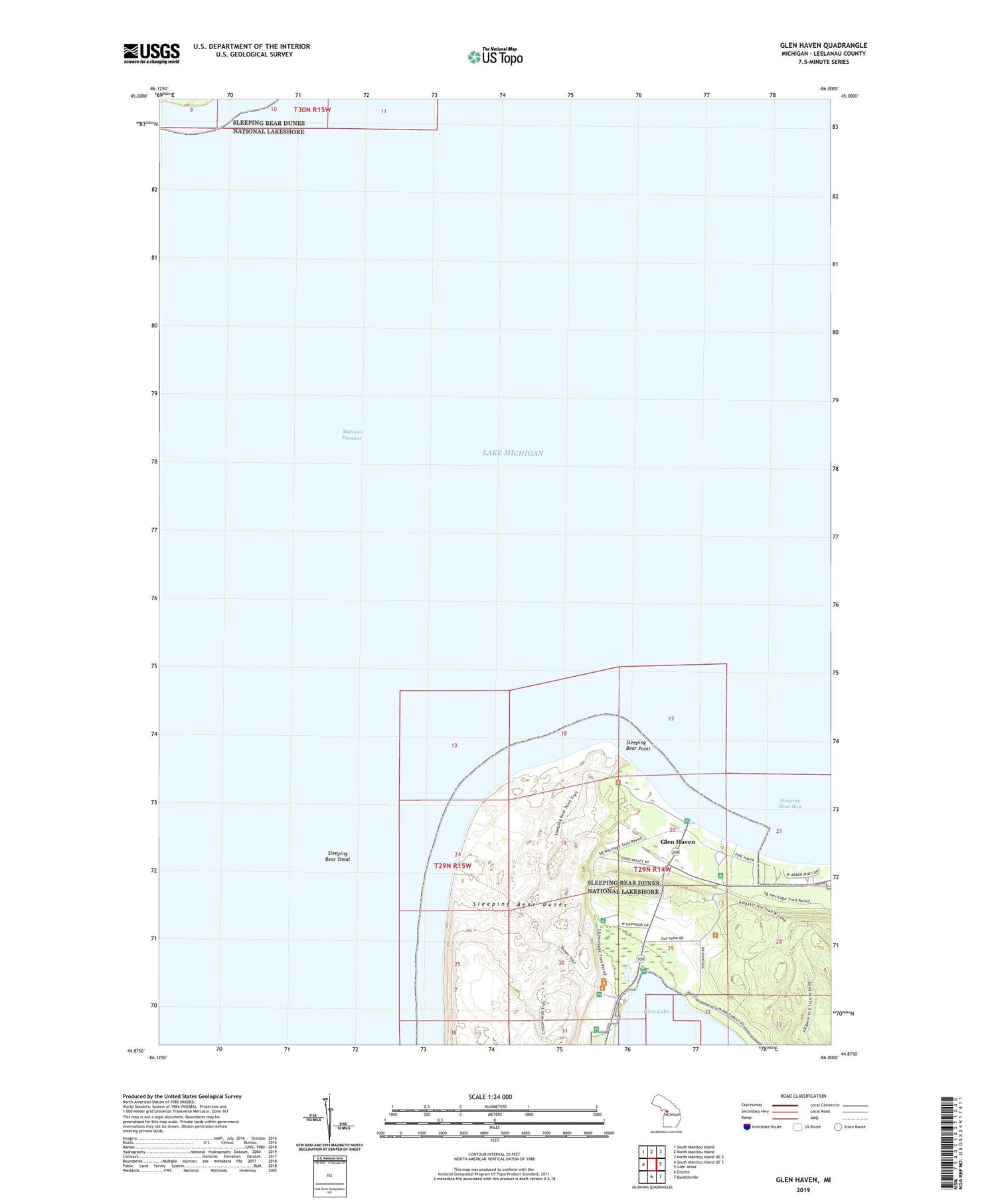
2019 topographic map quadrangle Glen Haven in the state of Michigan. Scale: 1:24000. Based on the newly updated USGS 7.5' US Topo map series, this map is in the following counties: Leelanau. The map contains contour data, water features, and other items you are used to seeing on USGS maps, but also has updated roads and other features. This is the next generation of topographic maps. Printed on high-quality waterproof paper with UV fade-resistant inks.
Quads adjacent to this one:
West: South Manitou Island OE S
Northwest: South Manitou Island
North: North Manitou Island
Northeast: North Manitou Island OE E
East: Glen Arbor
Southeast: Burdickville
South: Empire
Contains the following named places: D H Day State Park, Devils Hole, Early State Parks Historical Marker, Glen Haven, Glen Haven Post Office, Manitou Passage, Sleeping Bear Bay, Sleeping Bear Point, Sleeping Bear Shoal, South Manitou Island, Township of Glen Arbor, USDH Day Campground


