MyTopo
Green Timbers Michigan US Topo Map
Couldn't load pickup availability
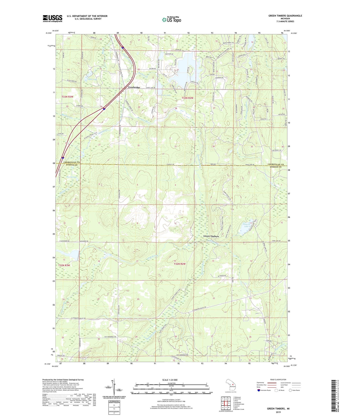
2019 topographic map quadrangle Green Timbers in the state of Michigan. Scale: 1:24000. Based on the newly updated USGS 7.5' US Topo map series, this map is in the following counties: Otsego, Cheboygan. The map contains contour data, water features, and other items you are used to seeing on USGS maps, but also has updated roads and other features. This is the next generation of topographic maps. Printed on high-quality waterproof paper with UV fade-resistant inks.
Quads adjacent to this one:
West: Vanderbilt
Northwest: Wildwood
North: Wolverine
Northeast: Afton
East: Hardwood Lake
Southeast: Saunders Creek
South: Sparr
Southwest: Gaylord
Contains the following named places: Blackjack Creek, Bradley Creek, Burrows Creek, Club Stream, Elkwood Campground, Fontinalis Club, Green Timbers, Lance Lake, Mud Creek, Mud Lake, Pickerel Creek, Pickerel Lake, Pickerel Lake State Forest Campground, Pigeon River State Forest, Stewart Creek, Storey Lake, Sturgeon River Campground, Township of Corwith, Trowbridge, Trowbridge Post Office, Trowbridge Station, Wildwood Lake, Wildwood Lake Golf Course, ZIP Code: 49795