MyTopo
Hangore Heights Michigan US Topo Map
Couldn't load pickup availability
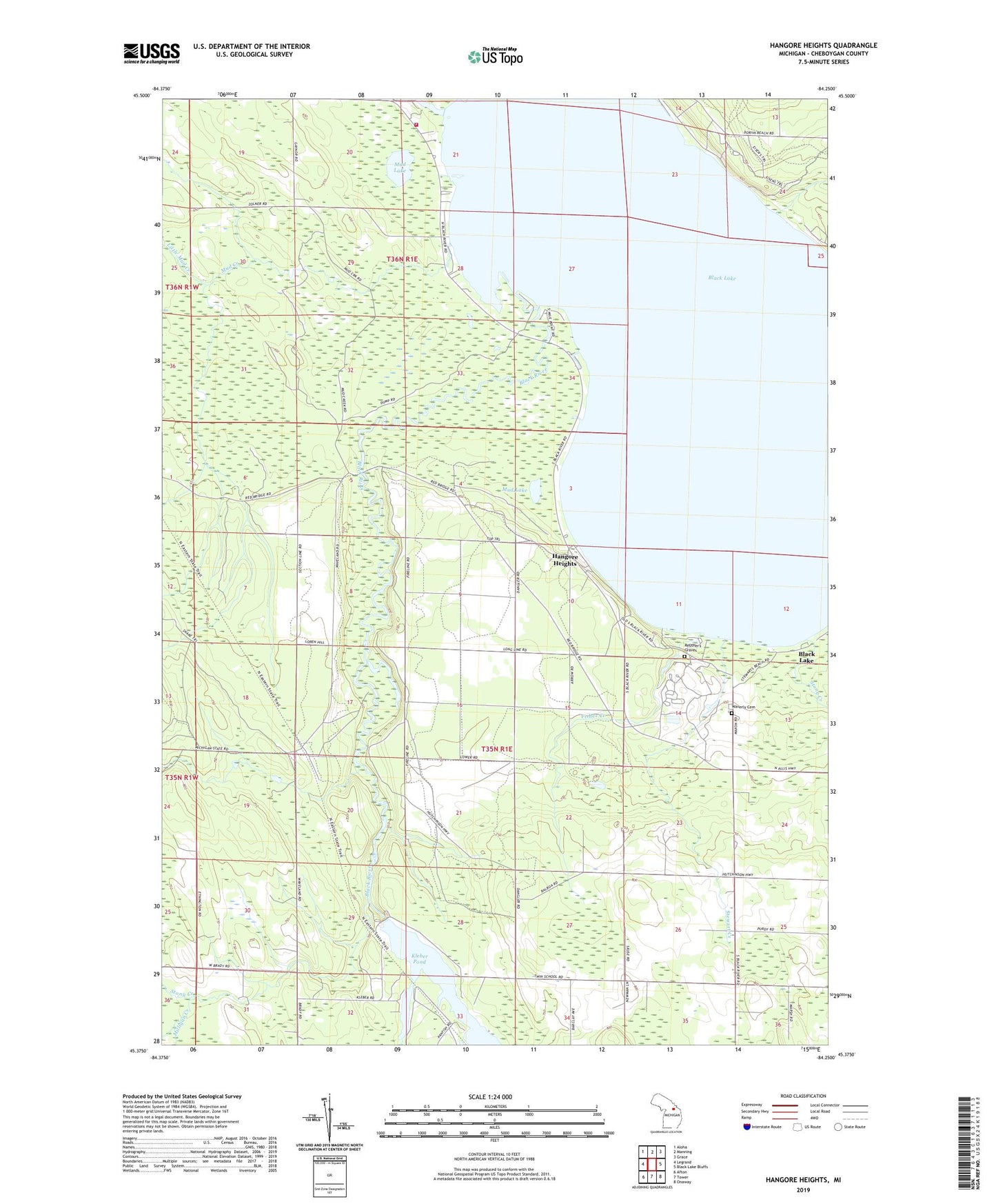
2019 topographic map quadrangle Hangore Heights in the state of Michigan. Scale: 1:24000. Based on the newly updated USGS 7.5' US Topo map series, this map is in the following counties: Cheboygan. The map contains contour data, water features, and other items you are used to seeing on USGS maps, but also has updated roads and other features. This is the next generation of topographic maps. Printed on high-quality waterproof paper with UV fade-resistant inks.
Quads adjacent to this one:
West: Legrand
Northwest: Aloha
North: Manning
Northeast: Grace
East: Black Lake Bluffs
Southeast: Onaway
South: Tower
Southwest: Afton
Contains the following named places: Alverno Fire Department Station 3, Black Lake, Black Lake Golf Course, Black Lake State Forest, Black Lake State Forest Campground, Fisher Creek, Hangore Heights, Kleber Dam, Kleber Pond, Little Mud Creek, Milligan Creek, Mud Creek, Mud Lake, Pine Grove Beach, Reuther's Graves, School 1, School 2, School 4, Stewart Creek, Stony Creek, Township of Waverly, United Auto Workers Family Education Center Fire Department, Waveland, Waverly Cemetery, Welch Creek