MyTopo
Hatton Michigan US Topo Map
Couldn't load pickup availability
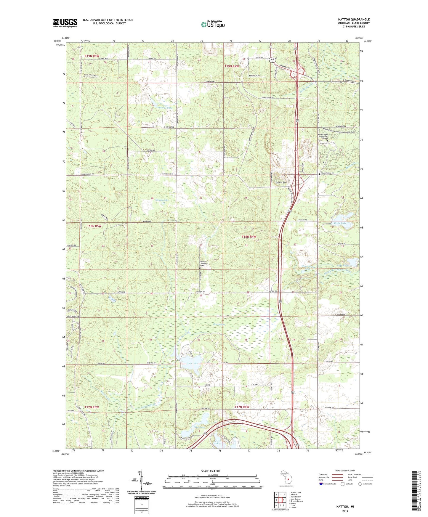
2019 topographic map quadrangle Hatton in the state of Michigan. Scale: 1:24000. Based on the newly updated USGS 7.5' US Topo map series, this map is in the following counties: Clare. The map contains contour data, water features, and other items you are used to seeing on USGS maps, but also has updated roads and other features. This is the next generation of topographic maps. Printed on high-quality waterproof paper with UV fade-resistant inks.
Quads adjacent to this one:
West: Lake George
Northwest: Prestle Creek
North: Harrison
Northeast: Meredith SW
East: Browns Corners
Southeast: Loomis
South: Clare
Southwest: Woods
Contains the following named places: Andersen Chapel, Bear Swamp, Beebe Lake, Brown Corners Church, Camp Rotary, Charles A Amble Library, Clare County, Clare-Gladwin School, Community Baptist Church, East Trout Lake, Firefly Golf Links, Gerrish Railroad Roadside Park, Gut Lake, Handy Lake, Hatton, Hatton Post Office, Hatton Station, Hatton Township Cemetery, Hidden Hill Family Campground, Lake Enola, Logging Railroads Historical Marker, Loon Lake, Loon Lake Creek, Mannsiding Pit, Mid-Michigan Community College, Pfannes Lake, Redner School, Snow Snake Golf Course, Snow Snake Mountain Ski Area, Township of Hatton, West Trout Lake, WKKM-FM (Harrison), WWKM-AM (Harrison)