MyTopo
Hog Island Point Michigan US Topo Map
Couldn't load pickup availability
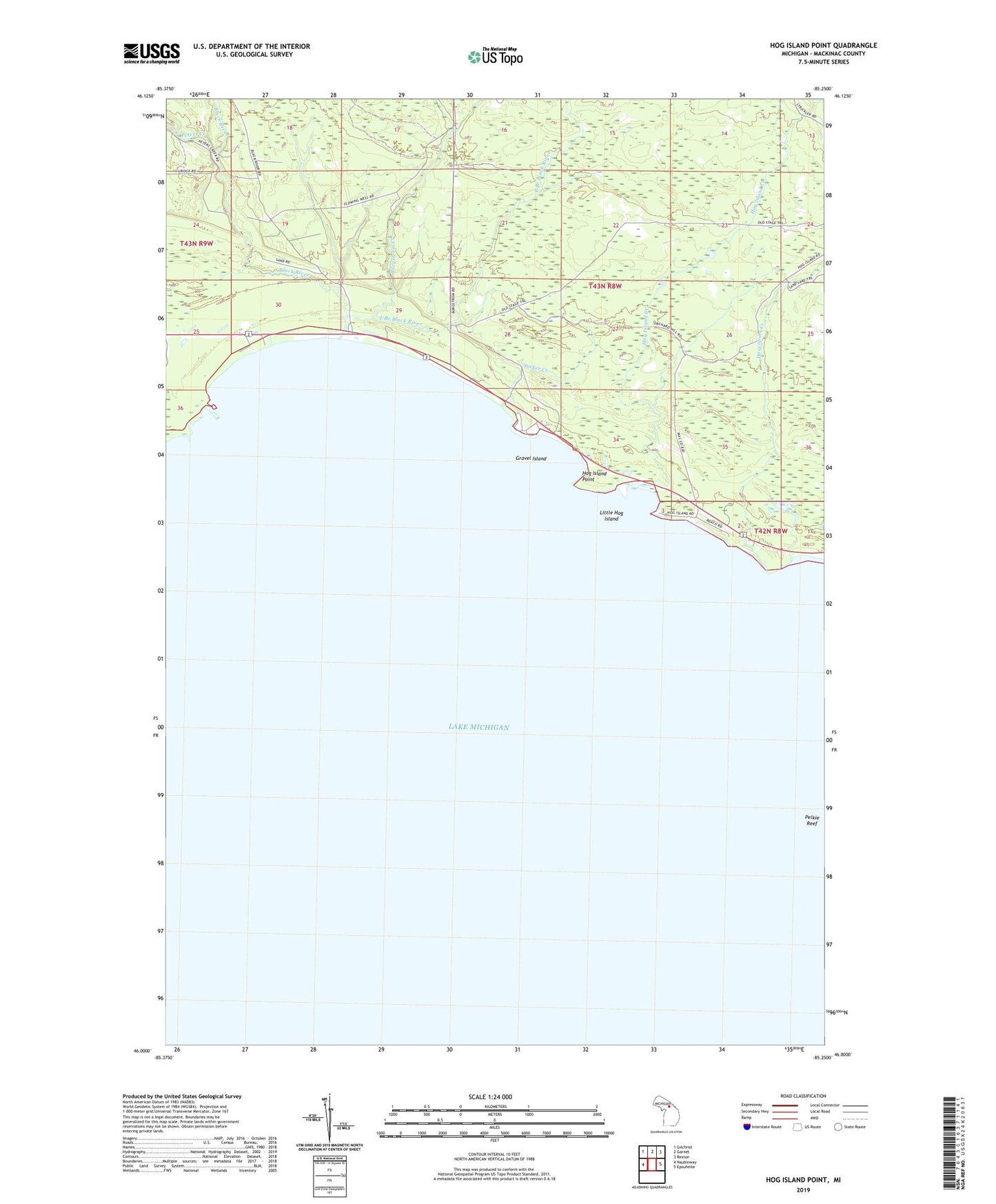
2019 topographic map quadrangle Hog Island Point in the state of Michigan. Scale: 1:24000. Based on the newly updated USGS 7.5' US Topo map series, this map is in the following counties: Mackinac. The map contains contour data, water features, and other items you are used to seeing on USGS maps, but also has updated roads and other features. This is the next generation of topographic maps. Printed on high-quality waterproof paper with UV fade-resistant inks.
Quads adjacent to this one:
West: Naubinway
Northwest: Gilchrist
North: Garnet
Northeast: Rexton
East: Epoufette
Contains the following named places: Black River, Black River State Forest Campground, Borgstrom Creek, Davenport Creek, East Branch Black River, Garlyn Zoological Park, Gravel Island, Harts RV Park, Hog Island Campground, Hog Island Creek, Hog Island Point, Little Hog Island, Mackinac State Forest, Peters Creek, Sucker Creek, ZIP Code: 49762