MyTopo
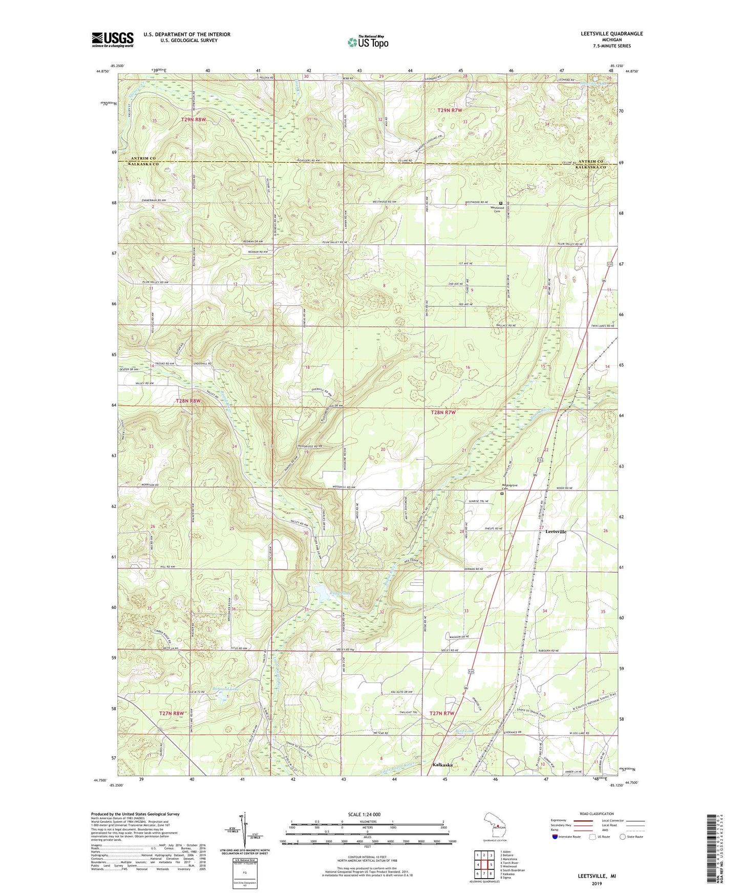
Leetsville Michigan US Topo Map
Couldn't load pickup availability
2019 topographic map quadrangle Leetsville in the state of Michigan. Scale: 1:24000. Based on the newly updated USGS 7.5' US Topo map series, this map is in the following counties: Kalkaska, Antrim. The map contains contour data, water features, and other items you are used to seeing on USGS maps, but also has updated roads and other features. This is the next generation of topographic maps. Printed on high-quality waterproof paper with UV fade-resistant inks.
Quads adjacent to this one:
West: Torch River
Northwest: Alden
North: Bellaire
Northeast: Mancelona
East: Westwood
Southeast: Sigma
South: Kalkaska
Southwest: South Boardman
Contains the following named places: Barber School, Barnard Lake, Bird Lake, Kalkaska United Methodist Church, Lannin School, Leetsville, Leetsville Post Office, Leetsville Station, Little Rapid River, Maplegrove Cemetery, Mayville Lake, Miller School, Rapid River Campground and Cabins, Rugg Pond, Rugg Pond Dam Historical Marker, Rugg Post Office, Township of Rapid River, Westwood Cemetery, WKLT-FM (Kalkaska), ZIP Code: 49612