MyTopo
Lewiston Michigan US Topo Map
Couldn't load pickup availability
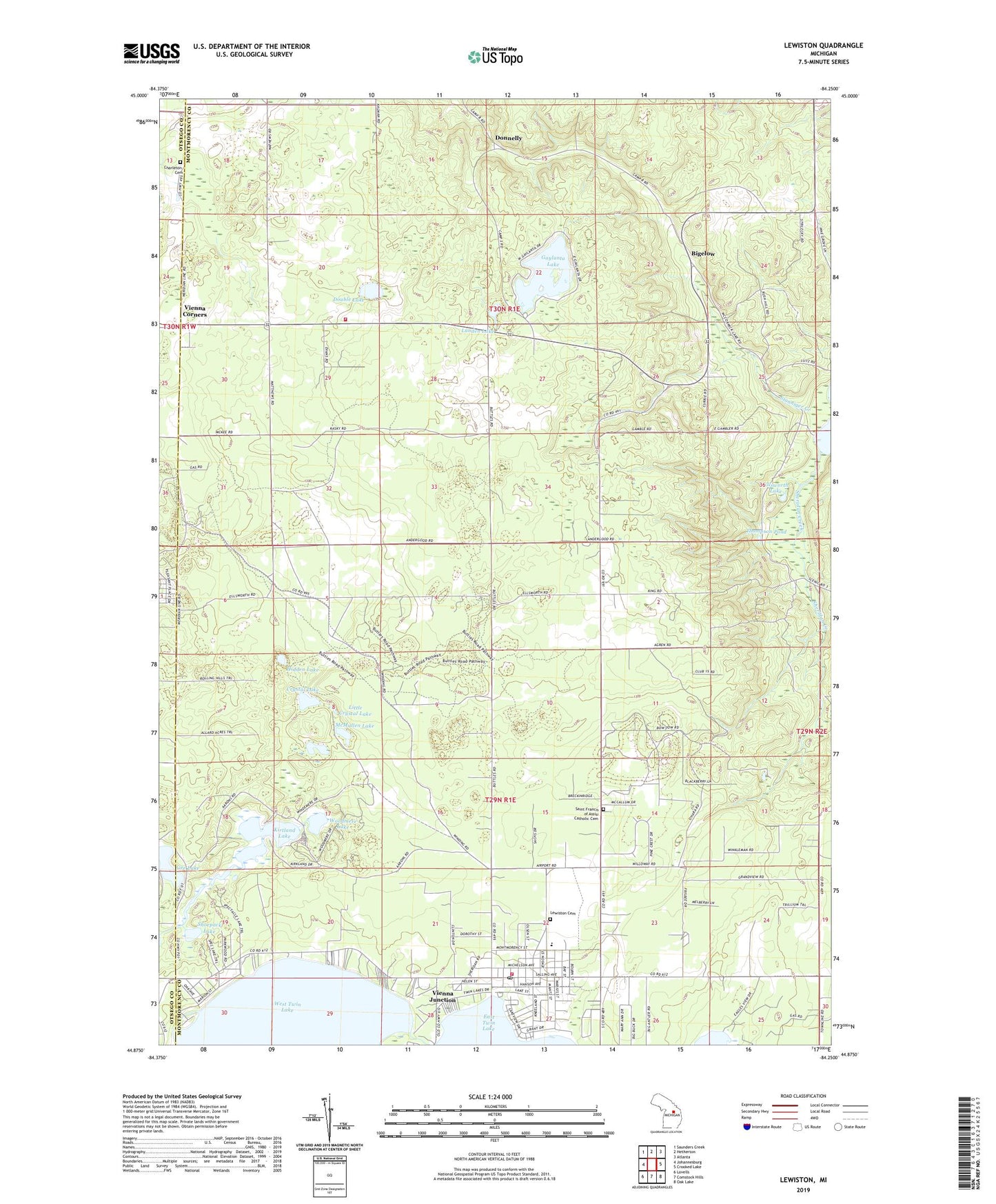
2019 topographic map quadrangle Lewiston in the state of Michigan. Scale: 1:24000. Based on the newly updated USGS 7.5' US Topo map series, this map is in the following counties: Montmorency, Otsego. The map contains contour data, water features, and other items you are used to seeing on USGS maps, but also has updated roads and other features. This is the next generation of topographic maps. Printed on high-quality waterproof paper with UV fade-resistant inks.
Quads adjacent to this one:
West: Johannesburg
Northwest: Saunders Creek
North: Hetherton
Northeast: Atlanta
East: Crooked Lake
Southeast: Oak Lake
South: Comstock Hills
Southwest: Lovells
Contains the following named places: Albert Township Hall, Albert Township School, Angusdale Stock Farm Historical Marker, Bethlehem Church, Bigelow, Bingham Park, Bourne Lake, Camp Nakomis, Charleton Cemetery, Congregational United Church of Christ Historical Marker, Crystal Lake, Donnelly, Double Lake, Doubles School, Ellsworth Lake, First Baptist Church, First Congregational Community Church, Gaylanta Lake, Gee Lake, Hidden Lake, Idlewild Post Office, Kirtland Lake, Lewiston, Lewiston Cemetery, Lewiston Census Designated Place, Lewiston Fire Department, Lewiston Post Office, Lewiston Public Library, Lewiston Station, Lighthouse Tabernacle, Little Crystal Lake, Lunden Lake, McCormick Lake Campground, McMullen Lake, Presque Isle State Forest, Saint Francis Church, Saint Francis of Assisi Catholic Cemetery, Sheridan Creek, Shoepack Lake, Silver Beach Lodge, Spectacle Lake, Spectacle Lakes, Stanniger Creek, Thompson Pond, Township of Albert, Twin Lakes Airport, Vienna Corners, Vienna Junction, Vienna Junction Station, Vienna Post Office, Vienna Township Fire Department, Vienna Township Hall, West Twin Lake, Woodmere Lake