MyTopo
Maywood Michigan US Topo Map
Couldn't load pickup availability
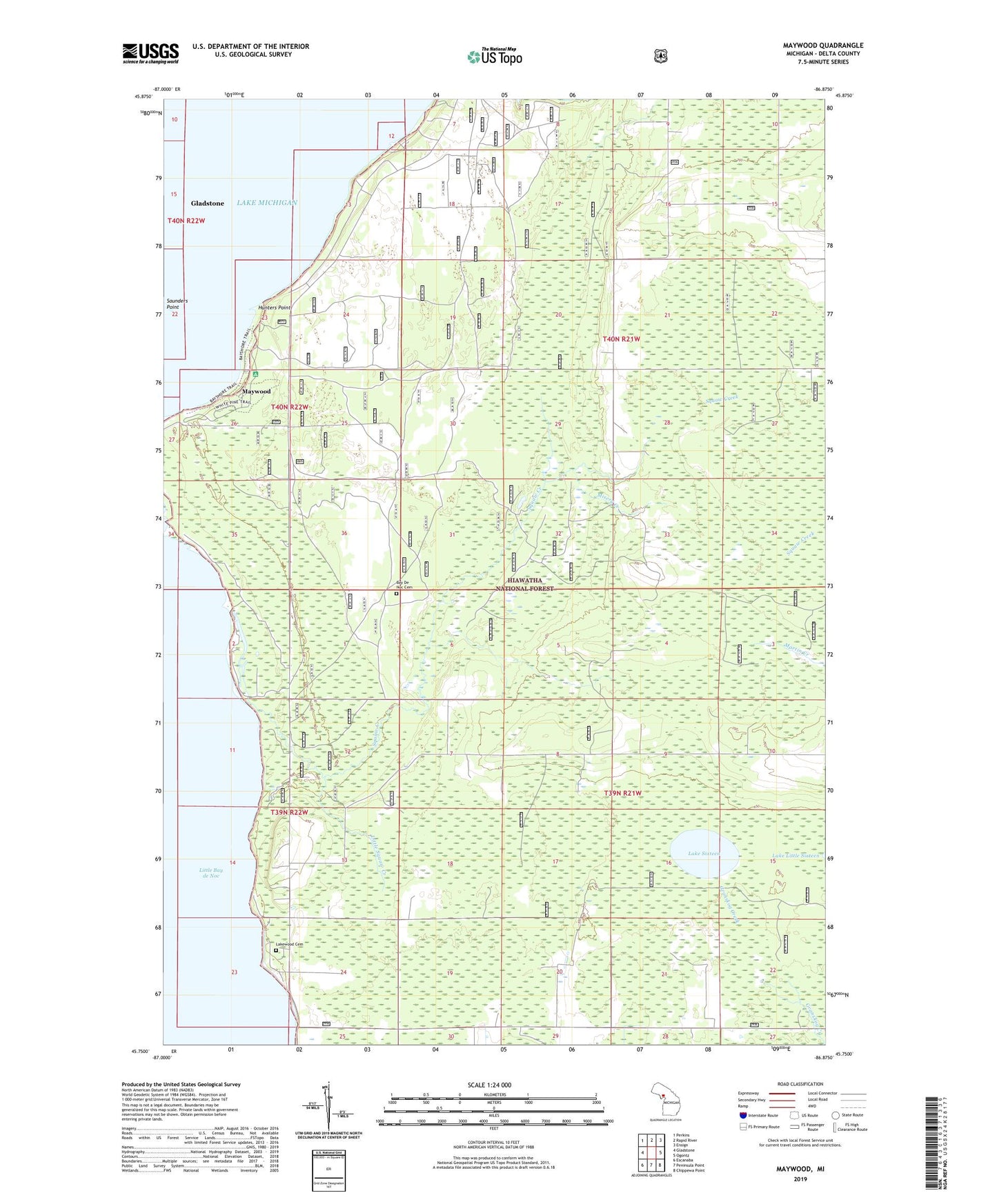
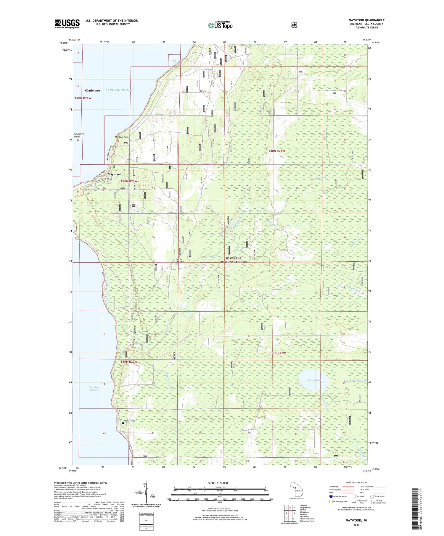
2019 topographic map quadrangle Maywood in the state of Michigan. Scale: 1:24000. Based on the newly updated USGS 7.5' US Topo map series, this map is in the following counties: Delta. The map contains contour data, water features, and other items you are used to seeing on USGS maps, but also has updated roads and other features. This is the next generation of topographic maps. Printed on high-quality waterproof paper with UV fade-resistant inks.
Quads adjacent to this one:
West: Gladstone
Northwest: Perkins
North: Rapid River
Northeast: Ensign
East: Ogontz
Southeast: Chippewa Point
South: Peninsula Point
Southwest: Escanaba
Contains the following named places: Bay De Noc Cemetery, Black George Creek, Hunters Point, Lake Sixteen, Lakewood Cemetery, Little Squaw Creek, Maywood, Maywood Campground, Misery Creek, Slab Dock Campground, Squaw Creek, Stonington Community Hall, Township of Bay de Noc, Township Park, Twin Springs Park