MyTopo
McKinley Michigan US Topo Map
Couldn't load pickup availability
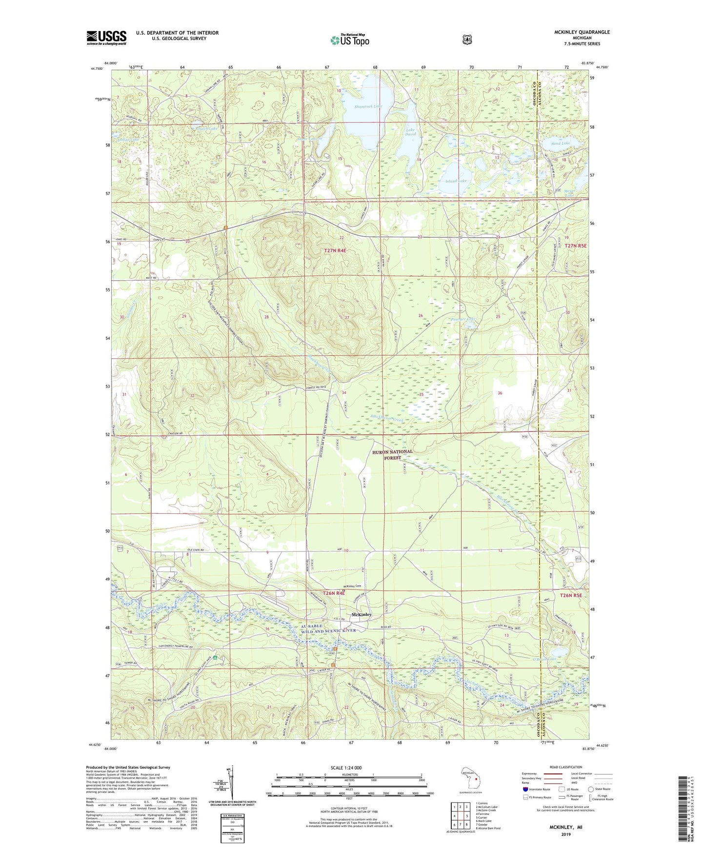
2019 topographic map quadrangle McKinley in the state of Michigan. Scale: 1:24000. Based on the newly updated USGS 7.5' US Topo map series, this map is in the following counties: Oscoda, Alcona. The map contains contour data, water features, and other items you are used to seeing on USGS maps, but also has updated roads and other features. This is the next generation of topographic maps. Printed on high-quality waterproof paper with UV fade-resistant inks.
Quads adjacent to this one:
West: Fairview
Northwest: Comins
North: McCollum Lake
Northeast: McGinn Creek
East: Curran
Southeast: Alcona Dam Pond
South: Goodar
Southwest: Mack Lake
Contains the following named places: Au Sable Wild and Scenic River, Camp Barakel, Dollar Lake, Dutch Lake, Hardy Post Office, Island Lake, Lake David, McKinley, McKinley Cemetery, McKinley Post Office, McKinley Station, McKinley Trail Camp, Mentor Township - McKinley Fire Department, Meyer Lake, Ninemile Creek, O'Brien Lake, Penoger Lake, Sand Lake, Shamrock Lake, Shear Lake